Category:Old maps of Yemen
Subcategories
This category has the following 9 subcategories, out of 9 total.
Media in category "Old maps of Yemen"
The following 18 files are in this category, out of 18 total.
-
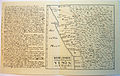
 Map of yemen 1763.jpeg 1,025 × 1,316; 160 KB
-
 Map of Yemen by Niebuhr.jpg 2,481 × 1,563; 3.37 MB
-
 457 Map of Yemen (1893).jpg 3,375 × 4,627; 6.36 MB
-
 Yemen1908.jpg 960 × 643; 284 KB
-

-
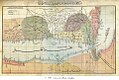
 Bellin - Plan de la Ville de Moka.png 1,400 × 1,822; 4.7 MB
-
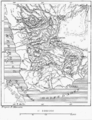 D125-Territoire du Yemen.-L2-Ch5.png 1,461 × 1,911; 493 KB
-
 EB9 Yemen.png 2,520 × 2,540; 2.05 MB
-
 Perim Island 1858 chart by Walker Lamb.jpg 1,500 × 1,124; 153 KB
-
 Territoire de Cheikh Saïd.jpg 1,569 × 1,342; 873 KB
-
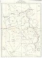
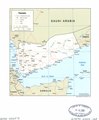
 Yemen administrative divisions. LOC 2005625554.jpg 2,466 × 3,016; 553 KB
-
 Yemen administrative divisions. LOC 2005625554.tif 2,466 × 3,016; 21.28 MB
-
 Yemen. LOC 2002622573.jpg 2,389 × 2,899; 542 KB
-
 Yemen. LOC 2002622573.tif 2,389 × 2,899; 19.81 MB
-
 Yemen. LOC 2002622574.jpg 2,532 × 3,271; 662 KB
-
 Yemen. LOC 2002622574.tif 2,532 × 3,271; 23.7 MB
-
 Yemen. LOC 2002627680.jpg 9,860 × 6,713; 7.75 MB
-
 Yemen. LOC 2002627680.tif 9,860 × 6,713; 189.37 MB


.jpg)

_(14801574093).jpg)


