Category:Old maps of the Qing Dynasty
Subcategories
This category has the following 6 subcategories, out of 6 total.
C
D
K
廣
Media in category "Old maps of the Qing Dynasty"
The following 81 files are in this category, out of 81 total.
-
 (General map of China). Zi-ka-wei, près Chang-Hai, Orphelinat de T'ou-sé-wé.png 26,246 × 33,572; 1.02 GB
-
 Map of Fengshan County, Taiwan Prefectural Gazetteer, 1696.jpg 765 × 609; 119 KB
-

-

-

-
 Anville Nouvel atlas de la Chine - Page15 Chine generale couleur.jpg 2,500 × 1,755; 2.87 MB
-
 Anville Nouvel atlas de la Chine - Page87 - thibet bhoutan generale.jpg 5,112 × 4,048; 8.6 MB
-

-
 CEM-44-La-Chine-la-Tartarie-Chinoise-et-le-Thibet-1734-2568.jpg 2,552 × 1,832; 2.5 MB
-

-

-

-

-

-
 1806 Cary Map of Tartary or Central Asia - Geographicus - Tartary-cary-1806.jpg 5,000 × 4,569; 8.57 MB
-
 Carte Generale de l'Empire Chinois et du Japon.png 6,245 × 4,612; 43.36 MB
-
 Carte generale de l'Empire Chinois et du Japon (1836).jpg 8,445 × 6,140; 12.87 MB
-
 Carte de la Chine et des Etats-Tributaires.png 1,161 × 866; 2.28 MB
-
 Empires chinois et japonais LOC 2006629415.jpg 6,400 × 4,822; 5.51 MB
-
-
-
 F.S.Weller - Map of china - 1898.jpg 2,912 × 2,987; 1.82 MB
-
 1912 China map from National Geographic.jpg 6,980 × 5,326; 10.65 MB
-
 A new universal atlas of the world.Asia.jpg 3,172 × 2,497; 1.59 MB
-
 An old map of Kaifeng Confucius Temple.jpg 955 × 647; 175 KB
-
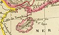
 Bay von Hocsieu.jpg 1,203 × 890; 487 KB
-

-

-
 CEM-36-Regno-di-Nivche-2429.jpg 1,600 × 1,186; 1.07 MB
-
 China and Japan, John Nicaragua Dower (1844).jpg 7,297 × 5,945; 15.07 MB
-
 China Map 1670 p0024.jpg 1,175 × 1,080; 339 KB
-
 China proper banner 1844 map.jpg 5,557 × 800; 1.79 MB
-
 Chinese empire and Japan. LOC 2006629414.jpg 5,783 × 4,879; 4.99 MB
-
 Chinese empire and Japan. LOC 2006629414.tif 5,783 × 4,879; 80.72 MB
-
 Dengzhou map in old time.jpg 1,384 × 1,070; 188 KB
-
 Dengzhou old city.jpg 454 × 490; 32 KB
-
 Empire Chinois, Japon (1832).jpg 9,174 × 6,811; 15.68 MB
-
 Empires chinois et japonais LOC 2006629415.tif 6,400 × 4,822; 88.29 MB
-
 Great China Embracing the Kingdoms under Heaven WDL6762.png 1,024 × 1,771; 3.82 MB
-
 Hangzhou 1864-1874.jpg 10,404 × 7,762; 7.79 MB
-
 Hangzhou Waterway 1864-1874.jpg 9,821 × 17,912; 16.6 MB
-
 Haï - Nan. L'Empire Chinois et du Japon (1833) (cropped).jpg 638 × 384; 100 KB
-
 Hedin-First expedition.jpg 1,598 × 1,479; 326 KB
-
 HefeiWallMap.jpg 820 × 661; 351 KB
-
 Huguenin1912 0201.png 2,170 × 2,496; 7.01 MB
-
 John-Tallis-1851-Tibet-Mongolia-and-Manchuria-33621.jpg 4,030 × 3,102; 12.64 MB
-
 John-Tallis-1851-Tibet-Mongolia-and-Manchuria-NE.jpg 2,100 × 1,400; 2.34 MB
-
 L'Empire Chinois et du Japon (1833) (cropped1).jpg 1,035 × 1,986; 614 KB
-
 L'Empire Chinois et du Japon (1833).jpg 4,977 × 3,681; 5.98 MB
-
 Liaoyang.gif 515 × 579; 44 KB
-
 Lienkianghien.JPG 683 × 619; 110 KB
-
 Map China c1798.jpg 940 × 894; 297 KB
-
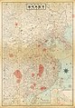
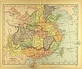 Map of the Qing Dynasty.jpg 3,530 × 2,935; 2.61 MB
-

-

-
 Map of Tibet in 1798, from- Map China c1798 (cropped).jpg 348 × 255; 40 KB
-
 Mongolie. L'Empire Chinois et du Japon (1833) (cropped).jpg 1,839 × 1,498; 1,020 KB
-
 Mukden.jpg 674 × 654; 70 KB
-
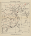
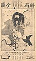 Political Map of 19th Century China(時局全圖).jpg 580 × 974; 259 KB
-
 Province of Chih-li, southern sheet.jpg 8,957 × 8,115; 15.21 MB
-
 Qing China 1844.png 903 × 685; 1.37 MB
-
 Qing china.jpg 888 × 725; 779 KB
-
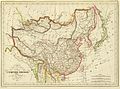
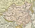
 Qing Dynasty 1760.jpg 2,702 × 2,400; 1.08 MB
-
 Qing Dynasty Map durnig Xinhai Revolution.JPG 6,400 × 9,200; 23.58 MB
-
 Schemes of Handan Counties in Qianlong Period of Qing Dynasty.jpg 3,264 × 2,448; 2.65 MB
-
 Stielers Handatlas 1891 62.jpg 5,150 × 4,250; 7.49 MB
-
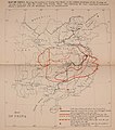 Taiping Rebellion map.jpg 1,825 × 2,059; 273 KB
-
 Taiwan map detail, from- Qing Dynasty Map durnig Xinhai Revolution (cropped).JPG 1,122 × 941; 416 KB
-
 The Ancient Huizhou Government Office in 1827.jpg 3,435 × 2,621; 1.4 MB
-
 Tibet, Political Map of 19th Century China(時局全圖) (cropped).jpg 149 × 108; 9 KB
-
 Yili-military-complex-ca-1809.jpg 1,620 × 1,088; 1.25 MB
-
 Zhejiang coastal defence map in 1900s.jpg 4,000 × 6,169; 3.18 MB
-
 Zunghar Khanate at 1760.jpg 495 × 553; 99 KB
-
 Манж улс.jpg 1,319 × 1,311; 703 KB
-
 מפת האימפריה של צינג.jpg 1,920 × 1,378; 1.18 MB
-
 乾隆京城全图护国寺.jpg 1,092 × 1,912; 573 KB
-
 古代光化县.jpg 857 × 618; 201 KB
-
 时局图.jpg 3,915 × 5,532; 4.27 MB
-
 杭州驻防图.jpg 6,076 × 1,969; 5.08 MB
-
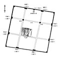
 祥符县学宫图.jpg 1,023 × 791; 558 KB
-
 邓州州治.jpg 899 × 685; 151 KB
._Zi-ka-wei,_pr%C3%A8s_Chang-Hai,_Orphelinat_de_T%27ou-s%C3%A9-w%C3%A9.png)


.jpg)

.jpg)


.jpg)


.jpg)


.jpg)


.jpg)


_(cropped).jpg)


_(cropped1).jpg)
.jpg)


_(cropped).jpg)
_by_(Tse_Tsan-tai,_1872-1939)_depicted_the_western_powers_encroaching_on_China,_%E6%97%B6%E5%B1%80%E5%9B%BE_(cropped).jpg)
.jpg)
_(cropped).jpg)


.JPG)

.jpg)


