Category:Old maps of the harbour of Genoa
Media in category "Old maps of the harbour of Genoa"
The following 15 files are in this category, out of 15 total.
-
 "Plan du Port de Genes" (22244677325).jpg 3,267 × 2,429; 1.73 MB
-

-

-
 Porto Genova 1886.png 904 × 1,386; 2.66 MB
-
 96 of '(Cook's Tourist's Handbook for Northern Italy.)' (11249816876).jpg 1,238 × 1,938; 558 KB
-
 A new chart of the Mediterranean Sea - The Port of Genoa (1797).jpg 1,979 × 2,006; 604 KB
-
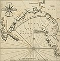
 Harbour of Genoa - Drummond Alexander - 1754.jpg 2,000 × 1,503; 1.16 MB
-
 Map of the port of Genova in Italy - Roux Joseph - 1804.jpg 1,500 × 1,024; 667 KB
-

-
 Plan du port de Gennes (sic), levé géométriquement - btv1b8440101x.jpg 8,832 × 6,798; 5.66 MB
-
 Plan du port de Gênes en Italie - par Jacques Ayrouard - btv1b530421511.jpg 6,037 × 4,725; 3.56 MB
-
 Plan du port de Gênes et environs jusqu'au château - btv1b53165233d.jpg 13,662 × 4,302; 6.6 MB
-
 Port de Gênes - btv1b53165234v.jpg 5,522 × 3,608; 2.18 MB
-
 Porto Genova 1906.png 904 × 1,386; 2.88 MB
-
 Portolano della Liguria - btv1b52511052z (37 of 65).jpg 10,063 × 7,179; 8.35 MB
.jpg)


%27_(11249816876).jpg)
.jpg)


,_lev%C3%A9_g%C3%A9om%C3%A9triquement_-_btv1b8440101x.jpg)


.jpg)