Category:Old maps of the history of Oceania

Media in category "Old maps of the history of Oceania"
The following 33 files are in this category, out of 33 total.
-

-
 1769 Cook Map of the Society Islands - Geographicus - SoecityIsland-cook-1769.jpg 4,000 × 2,708; 2.29 MB
-
 1780 Cook - Hogg Map of Tahiti ( Society Islands ) - Geographicus - Tahiti-hogg-1780.jpg 4,000 × 2,138; 912 KB
-
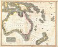
 1806 Cary Map of Asia, Polynesia, and Australia - Geographicus - Asia-cary-1806.jpg 4,000 × 3,546; 4.13 MB
-
-
 1852 Bocage Map of Australia and Polynesia - Geographicus - Oceanie-bocage-1852.jpg 3,000 × 2,210; 2.19 MB
-

-
 1862 Stieler Map o Australia and Polynesia - Geographicus - Polynesien-perthes-1862.jpg 3,236 × 2,551; 1.63 MB
-
 HARVEN(1883) p065 OCEANIA.jpg 3,644 × 2,780; 5.13 MB
-
 (1897) OZEANIA.jpg 3,097 × 2,425; 3.75 MB
-
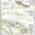
 1897 administrative map of the Marshall Islands, Pacific Ocean.jpg 1,254 × 1,412; 609 KB
-
 Übersicht Der Deutschen Besitzungen im Stillen Ozean.jpg 1,019 × 1,029; 391 KB
-
 Australia1848.jpg 5,589 × 4,512; 1.57 MB
-
 Bouillet - Atlas universel, Carte 88.png 3,425 × 2,674; 8.97 MB
-

-
 Die Gartenlaube (1887) b 460 1.jpg 1,696 × 980; 321 KB
-
 Expediciones Españolas.jpg 1,402 × 959; 1.48 MB
-
 Islas Marianas Palaos y Carolinas.JPG 902 × 489; 184 KB
-
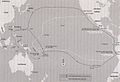
 Itinéraire du Caitaine Cook.JPG 813 × 824; 162 KB
-
 Kadavu-Fiji 1889.jpg 1,692 × 1,269; 368 KB
-
 Karte vom Amerikanischen Polynesien 1859.jpg 2,034 × 1,564; 546 KB
-
 Karte von Australien oder Polynesien (1795).jpg 10,000 × 8,104; 9.69 MB
-
 LA2-Blitz-0298p.png 762 × 282; 396 KB
-
-
 Meyers b12 s0582a.jpg 5,319 × 2,814; 2.64 MB
-
 Neukaledonien und Loyaltyinseln MKL1888.png 374 × 309; 25 KB
-
 New Caledonia.jpg 480 × 732; 52 KB
-
 NovaGuinea1600map.jpg 700 × 448; 73 KB
-
 Old Oceania map in german.jpg 1,456 × 961; 523 KB
-
 Stielers Handatlas 1891 76 Cook detail.png 309 × 359; 256 KB
-
 Stielers Handatlas 1891 76.jpg 5,000 × 4,200; 4.98 MB
-
 Tahiti 18th century map.jpg 500 × 306; 47 KB
-
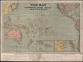 War map - Australia, China, Japan, and the South Pacific (1914).jpg 5,000 × 3,753; 13.05 MB


_-_Geographicus_-_Tahiti-hogg-1780.jpg)


_-_Geographicus_-_Oceanie-levasseur-1852.jpg)

_p065_OCEANIA.jpg)
_OZEANIA.jpg)


_b_460_1.jpg)


.jpg)


.jpg)