Category:Old maps of the provinces of Japan
日本語: 日本のかつての令制国(律令国)の古い地図
Subcategories
This category has the following 4 subcategories, out of 4 total.
D
K
Media in category "Old maps of the provinces of Japan"
The following 15 files are in this category, out of 15 total.
-
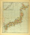
 1855 Colton Map of Japan - Geographicus - Japan-colton-1855.jpg 3,500 × 2,927; 2.86 MB
-
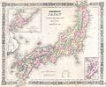
 1862 Johnson Map of Japan - Geographicus - Japan-johnson-1862.jpg 3,000 × 2,601; 2.2 MB
-
-
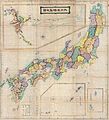
 1871 (Meiji 4) Woodblock Map of Japan - Geographicus - Japan-meiji4-1871.jpg 5,000 × 4,322; 3.53 MB
-
 1875 Meiji 8 Japanese Wall Map of Japan - Geographicus - Japan-meiji8-1875.jpg 6,000 × 6,601; 7.35 MB
-
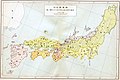
 1880s Meiji Japanese Folding Map of Japan - Geographicus - Japan-meiji-1880.jpg 3,580 × 5,000; 5.56 MB
-
 Ancient Japan provinces map in 701.jpg 2,740 × 1,820; 1.41 MB
-
 Ancient Japan provinces map in 721.jpg 2,730 × 1,820; 1.33 MB
-
 Ancient Japan provinces map in 824.jpg 2,730 × 1,830; 1.27 MB
-
 Colton's Japan - Nippon, Kiusiu, Sikok, Yesso and the Japanese Kuriles. LOC 2004629150.jpg 4,945 × 4,249; 4.23 MB
-
 Colton's Japan - Nippon, Kiusiu, Sikok, Yesso and the Japanese Kuriles. LOC 2004629150.tif 4,945 × 4,249; 60.11 MB
-
 Colton's Japan- Nippon, Kiusiu, Sikok, Yesso and the Japanese Kuriles WDL75.png 1,188 × 1,024; 2.33 MB
-
 Map of Japan in Provinces in time of Iyeyasu.jpg 4,448 × 3,062; 11.17 MB
-
 Map of Japan.jpg 2,942 × 3,453; 2.03 MB
-
 Shugos during the Kamakura period.jpg 2,710 × 1,800; 960 KB


_-_Geographicus_-_Japan-j-64.jpg)
_Woodblock_Map_of_Japan_-_Geographicus_-_Japan-meiji4-1871.jpg)


