Category:Ool
| Object location | | View all coordinates using: OpenStreetMap |
|---|
village in Roermond, Netherlands   | |||||
| Upload media | |||||
| Instance of | |||||
|---|---|---|---|---|---|
| Location | |||||
 | |||||
Subcategories
This category has the following 2 subcategories, out of 2 total.
H
N
- Nepomukkapel (Ool) (3 F)
Media in category "Ool"
The following 12 files are in this category, out of 12 total.
-
 Map - NL - Roermond - Wijk 07 Herten - Buurt 00 Ool.svg 375 × 375; 31 KB
-
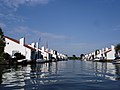 Roermond Marina Oolderhuuske.jpg 2,048 × 1,536; 664 KB
-
 Tussen Merum en Ool, de Oolderplas foto4 2017-05-10 11.51.jpg 4,302 × 1,947; 3.97 MB
-
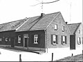
 Voor- en zijgevel - Ool - 20487622 - RCE.jpg 1,200 × 900; 149 KB
-
 Voorgevel - Ool - 20487628 - RCE.jpg 1,200 × 900; 181 KB
-
 Zij- en voorgevel - Ool - 20487620 - RCE.jpg 1,200 × 900; 132 KB
-
 Zij- en voorgevel - Ool - 20487621 - RCE.jpg 1,200 × 900; 141 KB
-
 Zij- en voorgevel - Ool - 20487624 - RCE.jpg 1,200 × 900; 200 KB
-
 Zij- en voorgevel - Ool - 20487625 - RCE.jpg 1,200 × 900; 145 KB
-
 Zij- en voorgevel - Ool - 20487627 - RCE.jpg 1,200 × 900; 196 KB
-
 Zijgevel - Ool - 20487626 - RCE.jpg 1,200 × 900; 184 KB
-
 Zijgevel - Ool - 20487629 - RCE.jpg 1,200 × 900; 190 KB


