Category:Oosterstraat 57 (Groningen)
| Object location | | View all coordinates using: OpenStreetMap |
|---|
 | |||||
| Upload media | |||||
| Instance of | |||||
|---|---|---|---|---|---|
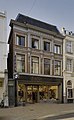
| Location | Groningen, Netherlands | ||||
| Street address |
| ||||
| Architectural style | |||||
| Heritage designation |
| ||||
 | |||||
Nederlands: 1885, pui 1937: Muller en Van Elmpt
|
This is a category about rijksmonument number 486014
|
| Address |
|
Media in category "Oosterstraat 57 (Groningen)"
The following 23 files are in this category, out of 23 total.
-
 Groningen Carolieweg 33.JPG 3,264 × 2,448; 3.84 MB
-
 Groningen Oosterstraat 57.JPG 2,448 × 3,264; 3.7 MB
-
-

-

-
 Interieur, begane grond, trappenhuis - Groningen - 20335502 - RCE.jpg 936 × 1,200; 171 KB
-

-
-
-

-

-

-
 Interieur, eerste verdieping, voorkamer, overzicht - Groningen - 20335511 - RCE.jpg 1,200 × 1,200; 196 KB
-
 Interieur, trappenhuis naar de tweede verdieping - Groningen - 20335501 - RCE.jpg 1,200 × 1,200; 203 KB
-

-

-
-
 Interieur, tweede verdieping, achterkamer, overzicht - Groningen - 20335495 - RCE.jpg 1,200 × 1,200; 206 KB
-
 Overzicht achtergevel - Groningen - 20335520 - RCE.jpg 956 × 1,200; 209 KB
-
 Overzicht pakhuis bij de achtergevel - Groningen - 20335521 - RCE.jpg 956 × 1,200; 192 KB
-
 Overzicht pakhuis bij de achtergevel - Groningen - 20335522 - RCE.jpg 983 × 1,200; 219 KB
-
 Overzicht voorgevel, woon-winkelpand - Groningen - 20335516 - RCE.jpg 738 × 1,200; 181 KB
-
 Overzicht voorgevel, woon-winkelpand - Groningen - 20335518 - RCE.jpg 956 × 1,200; 235 KB


,_overzicht_schouw_-_Groningen_-_20335514_-_RCE.jpg)


