Category:OpenStreetMap maps of Dębica
Media in category "OpenStreetMap maps of Dębica"
The following 14 files are in this category, out of 14 total.
-
 Dębica location map blank.svg 621 × 764; 345 KB
-
 Dębica location map.png 438 × 538; 226 KB
-
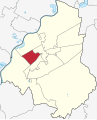
 Dębica subdiv Osiedle Centrum locator map.svg 621 × 764; 380 KB
-
 Dębica subdiv Osiedle Gawrzyłowa locator map.svg 621 × 764; 381 KB
-
 Dębica subdiv Osiedle Kawęczyn-Pana Tadeusza locator map.svg 621 × 764; 380 KB
-
 Dębica subdiv Osiedle Krakowska-Południe locator map.svg 621 × 764; 380 KB
-
 Dębica subdiv Osiedle Krakowska-Północ locator map.svg 621 × 764; 380 KB
-
 Dębica subdiv Osiedle Kępa-Wolica locator map.svg 621 × 764; 381 KB
-
 Dębica subdiv Osiedle Mickiewicza locator map.svg 621 × 764; 380 KB
-
 Dębica subdiv Osiedle Rzeszowska-Południe locator map.svg 621 × 764; 380 KB
-
 Dębica subdiv Osiedle Rzeszowska-Północ locator map.svg 621 × 764; 380 KB
-

-
 Dębica subdiv Osiedle Świętosława locator map.svg 621 × 764; 380 KB
-
 Dębica subdivision map.svg 621 × 764; 348 KB


