Category:OpenStreetMap maps of Paris 13e arrondissement
Media in category "OpenStreetMap maps of Paris 13e arrondissement"
The following 18 files are in this category, out of 18 total.
-
 13e Arrondissement, Paris, France - Open Street Map.png 2,058 × 1,868; 4.64 MB
-
 13th arrondissement of Paris & the Cité florale - OSM 2020.svg 512 × 469; 2.38 MB
-
 13th arrondissement of Paris & the Quartier asiatique - OSM 2020.svg 512 × 469; 2.41 MB
-
 13th arrondissement of Paris - OSM 2020.svg 1,795 × 1,645; 2.32 MB
-
 2014 collegiale Saint-Marcel emplacement.jpg 533 × 446; 235 KB
-
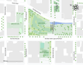
 Campus des Grands Moulins - OSM 2021.svg 1,461 × 1,078; 283 KB
-
 Campus des Grands Moulins - Plan 2021.svg 1,461 × 1,078; 279 KB
-
 Campus des Grands Moulins - Plan colored 2021.svg 1,461 × 1,078; 245 KB
-
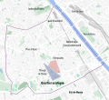
 Cité florale, Paris - OSM 2020.svg 512 × 360; 96 KB
-
 Jardins Abbé-Pierre - Grands-Moulins, Paris - OSM 2022.svg 1,170 × 920; 175 KB
-
 Map of the 13th arrondissement of Paris - OSM 2020.svg 1,795 × 1,645; 2.36 MB
-
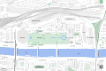
 Paris Rive Gauche - OSM 2022.svg 1,834 × 850; 736 KB
-
 Quarters of the 13th arrondissement of Paris - OSM 2020.svg 1,795 × 1,645; 2.33 MB
-
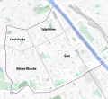
 Quartier de Bercy, Paris - OSM 2020.svg 1,428 × 951; 610 KB
-
 Secteurs de Paris Rive Gauche - OSM 2022.svg 1,834 × 850; 739 KB
-
 Triangle de Choisy & Olympiades, Paris - OSM 2020.svg 1,990 × 1,950; 446 KB
-
 Université Paris 7 - Paris Rive Gauche Campus.jpg 1,987 × 1,909; 1.08 MB
-
 Université Paris 7 - Paris Rive Gauche Campus.svg 744 × 1,052; 282 KB


