Category:OpenStreetMap maps of Toronto
Media in category "OpenStreetMap maps of Toronto"
The following 14 files are in this category, out of 14 total.
-
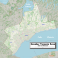 GreaterTorontoArea2022OSM.png 5,555 × 5,555; 21.65 MB
-
 Location map Toronto.png 2,054 × 1,806; 3.22 MB
-
 Map of Toronto's Little Jamaica.png 927 × 713; 457 KB
-
 OpenStreetMap 10 St. Mary Street Toronto as seen in 2020.jpg 1,100 × 723; 124 KB
-
 OSM-Toronto Islands with labels.png 685 × 498; 76 KB
-
 Ripleys Aquarium Toronto map.png 1,018 × 674; 809 KB
-
 Rockcliffe-Smythe-Toronto-Ontario-Canada.png 1,484 × 974; 392 KB
-
 OSM-Toronto Islands.png 685 × 498; 97 KB
-
 Toronto map.png 1,500 × 1,115; 703 KB
-
 Toronto Public Library locations.jpg 950 × 670; 149 KB
-
 Toronto region wards 1988.png 1,390 × 776; 541 KB
-
 Toronto Zoo map.png 1,009 × 666; 405 KB
-
 TorontoIslands2022OSM.png 2,927 × 2,062; 2.1 MB
-
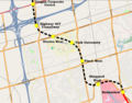 Yonge-University-Spadina extenstion map.png 1,083 × 847; 722 KB


