Category:Orotava (ship, 1958)
| Object location | | View all coordinates using: OpenStreetMap |
|---|
recent wreck offshore dive site in Smitswinkel Bay on the Cape Peninsula east coast   | |||||
| Upload media | |||||
| Instance of |
| ||||
|---|---|---|---|---|---|
| Part of | |||||
| Location | Table Mountain National Park Marine Protected Area, Western Cape, RSA | ||||
| Country of registry | |||||
 | |||||
Media in category "Orotava (ship, 1958)"
The following 18 files are in this category, out of 18 total.
-
 Diver at the propeller aperture on the Orotava P8281063.JPG 3,648 × 2,736; 2.09 MB
-
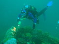
 Diver on starboard side of Orotava P8281051.JPG 3,648 × 2,736; 2.04 MB
-
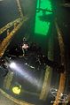
 Diver over the funnel on Orotava P8281106.JPG 3,648 × 2,736; 2.12 MB
-
 Diver using Inspiration rebreather at the wreck of the MV Orotava P6308040.JPG 3,648 × 2,736; 2.14 MB
-
 Diver using Inspiration rebreather at the wreck of the MV Orotava P6308043.jpg 3,648 × 2,736; 2 MB
-
 Diver using Inspiration rebreather at the wreck of the MV Orotava P6308046.JPG 3,648 × 2,736; 2.15 MB
-
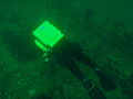
 Divers in wheelhouse 2.jpg 1,280 × 960; 59 KB
-
 Feather stars on MV Orotava DSC04835.JPG 2,048 × 1,536; 1.4 MB
-
 Frilled nudibranchs on the wreck of the Orotava P5050137.JPG 3,648 × 2,736; 2.13 MB
-
 Looking out from the forecastle space on MV Orotava wreck P5050122.jpg 3,648 × 2,736; 2.13 MB
-
 MFV Orotava banner 1.JPG 2,100 × 300; 483 KB
-
 MV Orotava general arrangement plan.png 3,563 × 1,700; 489 KB
-
 Oratava (1).jpg 398 × 600; 65 KB
-
 Oratava (2).jpg 398 × 600; 86 KB
-
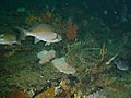
 Scorpion fish on MV Orotava DSC04881.JPG 2,048 × 1,536; 1.45 MB
-
 Twotone fingerfin on MV Orotava DSC04886.JPG 2,048 × 1,536; 1.4 MB
-
 Whelks and egg mass on Orotava P5050136.JPG 3,648 × 2,736; 2.02 MB
-
 White seacatfish inside Orotava wreck P5050108.JPG 3,648 × 2,736; 2.14 MB


.jpg)
.jpg)


