Category:Oude Delft 234, Delft
| Object location | | View all coordinates using: OpenStreetMap |
|---|
building in Delft, Netherlands  | |||||
| Upload media | |||||
| Instance of | |||||
|---|---|---|---|---|---|
| Location | Delft, South Holland, Netherlands | ||||
| Street address |
| ||||
| Located on street | |||||
| Heritage designation |
| ||||
 | |||||
|
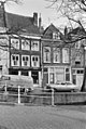
This is a category about rijksmonument number 12133
|
| Address |
|
Media in category "Oude Delft 234, Delft"
The following 2 files are in this category, out of 2 total.
-
 Delft - Oude Delft 234.jpg 1,944 × 2,592; 1.8 MB
-
 Gevel - Delft - 20052852 - RCE.jpg 805 × 1,200; 268 KB
