Category:Oude Singel 118, Leiden
| Object location | | View all coordinates using: OpenStreetMap |
|---|
building in Leiden, Netherlands  | |||||
| Upload media | |||||
| Instance of | |||||
|---|---|---|---|---|---|
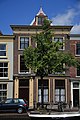
| Location | Leiden, South Holland, Netherlands | ||||
| Street address |
| ||||
| Heritage designation |
| ||||
 | |||||
|
This is a category about rijksmonument number 25366
|
| Address |
|
Media in category "Oude Singel 118, Leiden"
The following 20 files are in this category, out of 20 total.
-
 Gevels - Leiden - 20136839 - RCE.jpg 802 × 1,200; 153 KB
-
 INTERIEUR, GANG, PLAFOND, STUCWERK - Leiden - 20285023 - RCE.jpg 1,195 × 1,200; 223 KB
-
 INTERIEUR, GANG, PLAFOND, STUCWERK - Leiden - 20285024 - RCE.jpg 1,197 × 1,200; 312 KB
-
 INTERIEUR, GANG, PLAFOND, STUCWERK - Leiden - 20285029 - RCE.jpg 1,190 × 1,200; 244 KB
-
 INTERIEUR, GANG, PLAFOND, STUCWERK - Leiden - 20285031 - RCE.jpg 1,188 × 1,200; 291 KB
-
 INTERIEUR, GANG, STUCWERK - Leiden - 20285022 - RCE.jpg 1,188 × 1,200; 299 KB
-
 INTERIEUR, GANG, STUCWERK - Leiden - 20285027 - RCE.jpg 1,192 × 1,200; 282 KB
-
 INTERIEUR, GANG, STUCWERK - Leiden - 20285028 - RCE.jpg 1,191 × 1,200; 282 KB
-
 INTERIEUR, GANG, STUCWERK - Leiden - 20285030 - RCE.jpg 1,195 × 1,200; 232 KB
-
 INTERIEUR, GANG, STUCWERK BOVEN DEUR - Leiden - 20285025 - RCE.jpg 1,193 × 1,200; 220 KB
-
 INTERIEUR, GANG, STUCWERK BOVEN DEUR - Leiden - 20285026 - RCE.jpg 1,195 × 1,200; 316 KB
-
 INTERIEUR, TRAPPENHUIS, STUCWERK - Leiden - 20285017 - RCE.jpg 1,184 × 1,200; 308 KB
-
 INTERIEUR, TRAPPENHUIS, STUCWERK - Leiden - 20285018 - RCE.jpg 1,188 × 1,200; 246 KB
-
 INTERIEUR, TRAPPENHUIS, STUCWERK - Leiden - 20285019 - RCE.jpg 1,183 × 1,200; 319 KB
-
 INTERIEUR, TRAPPENHUIS, STUCWERK - Leiden - 20285020 - RCE.jpg 1,191 × 1,200; 374 KB
-
 INTERIEUR, TRAPPENHUIS, STUCWERK - Leiden - 20285021 - RCE.jpg 1,175 × 1,200; 310 KB
-
 Leiden - Oude Singel 118.JPG 2,736 × 3,648; 4.77 MB
-
 Oude singel 112, 114, 116, 118.JPG 4,272 × 2,848; 1.87 MB
-
 Oude Singel 118, Leiden.JPG 2,848 × 4,272; 2.37 MB
-
 Oude singel 118.JPG 2,783 × 4,175; 2.01 MB


