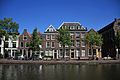
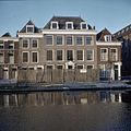
Category:Oude Singel 54, Leiden
| Object location | | View all coordinates using: OpenStreetMap |
|---|
 | |||||
| Upload media | |||||
| Instance of |
| ||||
|---|---|---|---|---|---|
| Location | Leiden, South Holland, Netherlands | ||||
| Street address |
| ||||
| Heritage designation |
| ||||
 | |||||
|
This is a category about rijksmonument number 25343
|
| Address |
|
Media in category "Oude Singel 54, Leiden"
The following 5 files are in this category, out of 5 total.
-
 Gevels - Leiden - 20136803 - RCE.jpg 1,200 × 802; 222 KB
-
 Oude singel 44, 46, 48, 50-52, 54.JPG 4,272 × 2,848; 2.25 MB
-
 Overzicht - Leiden - 20136784 - RCE.jpg 1,200 × 802; 253 KB
-
 Overzicht van de voorgevels tijdens restauratie - Leiden - 20382187 - RCE.jpg 1,200 × 1,198; 299 KB
-
 Voorgevels - Leiden - 20136804 - RCE.jpg 1,200 × 956; 270 KB


