Category:Overgrown footpaths
Media in category "Overgrown footpaths"
The following 33 files are in this category, out of 33 total.
-
 An overgrown section of Elland FP20 - geograph.org.uk - 4669095.jpg 2,048 × 1,536; 782 KB
-
 Blocked footpath at Mixenden Lodge - geograph.org.uk - 5439779.jpg 2,000 × 1,500; 1.08 MB
-
 Blocked footpath off Crow Hill Road, Sowerby - geograph.org.uk - 4877122.jpg 2,048 × 1,536; 1.03 MB
-
 Bridleway off Kennel Lane, Sowerby (2) - geograph.org.uk - 5000215.jpg 2,048 × 1,536; 781 KB
-
 Diverted footpath at Long Royd, Sowerby - geograph.org.uk - 4610838.jpg 2,048 × 1,536; 1.09 MB
-
 Elland FP17 passing a bramble patch - geograph.org.uk - 4693094.jpg 2,048 × 1,536; 736 KB
-
 Footpath blocked by trees near Spout Field Farm, Sowerby - geograph.org.uk - 4857352.jpg 2,048 × 1,536; 1.36 MB
-
 Footpath blocked by vegetation at Long Royd, Sowerby - geograph.org.uk - 4610820.jpg 2,048 × 1,536; 1.26 MB
-
 Footpath in an overgrown lane, Norland - geograph.org.uk - 4881253.jpg 2,048 × 1,536; 1.24 MB
-
 Footpath to Shaw's Lane via Lower Oaken Clough, Sowerby - geograph.org.uk - 5002761.jpg 2,048 × 1,536; 1.09 MB
-
 Former lane to Slead Sike Mill (Woollen), Brighouse - geograph.org.uk - 6347787.jpg 2,000 × 1,500; 1.38 MB
-
 Halifax FP336 at Cowling Lane, Northowram - geograph.org.uk - 5016423.jpg 2,000 × 1,500; 1.28 MB
-
 Halifax FP399 at Lee Lane, Northowram - geograph.org.uk - 5151387.jpg 1,500 × 2,000; 1.41 MB
-
 Halifax FP736 - geograph.org.uk - 5396699.jpg 2,048 × 1,536; 1.07 MB
-
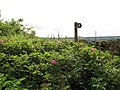
 Lamp post in a field, Brighouse - geograph.org.uk - 6348136.jpg 2,000 × 1,335; 1.47 MB
-
 Looking for Halifax FP229, Illingworth - geograph.org.uk - 5993485.jpg 2,000 × 1,500; 1.21 MB
-
 Nettles on Elland FP57, Stainland - geograph.org.uk - 4707470.jpg 1,536 × 2,048; 1.34 MB
-
 Obstructed path, Sowerby - geograph.org.uk - 5003377.jpg 2,048 × 1,536; 1.05 MB
-

-
 Overgrown footpath at Bilberry Hall Farm - geograph.org.uk - 4624580.jpg 1,024 × 768; 260 KB
-

-
 Overgrown footpath near Spout Field Farm, Sowerby - geograph.org.uk - 4857346.jpg 2,048 × 1,536; 1.23 MB
-
 Overgrown part of Shibden Fold Footpath, Halifax FP739 - geograph.org.uk - 5605828.jpg 2,000 × 1,500; 1.13 MB
-
 Overgrown path to Field Head Farm - geograph.org.uk - 5817860.jpg 640 × 480; 87 KB
-
 Overgrown path, Halifax - geograph.org.uk - 5107756.jpg 640 × 480; 85 KB
-
 Overgrown public footpath at Spring Hill - geograph.org.uk - 4624782.jpg 1,024 × 768; 231 KB
-

-
 Overgrown section of FP23, Elland - geograph.org.uk - 4653383.jpg 2,048 × 1,536; 787 KB
-
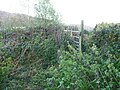
 Overgrown stile - geograph.org.uk - 5132431.jpg 1,024 × 768; 361 KB
-
 Pule Green Lane passing Nab End, Boothtown, Halifax - geograph.org.uk - 5956928.jpg 2,000 × 1,484; 1.03 MB
-
 Pule Green Lane, Boothtown, Halifax - geograph.org.uk - 5956919.jpg 2,000 × 1,500; 1.37 MB
-
 Sowerby Bridge FP140 (Green lane) Link D - geograph.org.uk - 4610807.jpg 2,048 × 1,536; 1.28 MB
-
 TPT Jungle^ - geograph.org.uk - 2468217.jpg 768 × 1,024; 862 KB


_-_geograph.org.uk_-_5000215.jpg)


,_Brighouse_-_geograph.org.uk_-_6347787.jpg)


_Link_D_-_geograph.org.uk_-_4610807.jpg)
