Category:Oxborough
village in Breckland, Norfolk, United Kingdom  | |||||
| Upload media | |||||
| Instance of | |||||
|---|---|---|---|---|---|
| Location | Breckland, Norfolk, East of England, England | ||||
| Area |
| ||||
 | |||||
Subcategories
This category has the following 6 subcategories, out of 6 total.
Media in category "Oxborough"
The following 200 files are in this category, out of 272 total.
(previous page) (next page)-
 A palette of spring colours - geograph.org.uk - 1857123.jpg 640 × 480; 135 KB
-
 Boundary wall to Oxburgh Hall - geograph.org.uk - 4441593.jpg 4,320 × 3,240; 4.77 MB
-
 Bridge over the Moat, Oxburgh Hall, Norfolk - geograph.org.uk - 3721361.jpg 1,024 × 683; 782 KB
-
 Bus stop and shelter, Oxborough - geograph.org.uk - 4555909.jpg 640 × 480; 55 KB
-
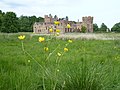 Buttercup at Oxburgh Hall - geograph.org.uk - 3996687.jpg 4,320 × 3,240; 5.39 MB
-
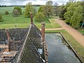
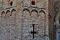
 Chimney, Oxburgh Hall, Norfolk - geograph.org.uk - 5377420.jpg 2,832 × 3,888; 2.71 MB
-
 Chimneys and rooftops at Oxburgh Hall - geograph.org.uk - 3996711.jpg 4,320 × 3,240; 5.95 MB
-
 Chimneys at Oxburgh Hall - geograph.org.uk - 4000020.jpg 4,320 × 3,240; 5.74 MB
-
 Conservation headland next to Oxborough Road - geograph.org.uk - 3996349.jpg 4,320 × 3,240; 5.87 MB
-
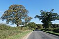 Contrasting trees on Oxborough Road - geograph.org.uk - 5984772.jpg 1,600 × 1,067; 1,014 KB
-
 Cottages on Oxborough Road - geograph.org.uk - 4555814.jpg 640 × 480; 65 KB
-
 Crop field beside Broom Covert - geograph.org.uk - 4555861.jpg 640 × 480; 65 KB
-
 Crop field north of Gooderstone - geograph.org.uk - 5391968.jpg 640 × 480; 73 KB
-
 Crop field north of Oxborough - geograph.org.uk - 5391952.jpg 640 × 480; 45 KB
-
 Crop field off Oxborough Road - geograph.org.uk - 4555870.jpg 640 × 480; 64 KB
-
 Crop field off Oxborough Road - geograph.org.uk - 4555875.jpg 640 × 480; 104 KB
-
 Crop field south of Oxborough Road - geograph.org.uk - 4555856.jpg 640 × 480; 62 KB
-
 Crop field towards woodland - geograph.org.uk - 4555805.jpg 640 × 480; 63 KB
-
 Eastmoor Road - geograph.org.uk - 5391950.jpg 640 × 480; 78 KB
-
 Eastmoor Road towards Oxborough - geograph.org.uk - 5391955.jpg 640 × 480; 38 KB
-
 Entering Oxborough - geograph.org.uk - 4555883.jpg 640 × 480; 70 KB
-
 Entering Oxborough - geograph.org.uk - 5391956.jpg 640 × 480; 72 KB
-
 Estate Cottage, Oxburgh Hall - geograph.org.uk - 949426.jpg 640 × 480; 85 KB
-
 Farm track (byway) off Swaffham Road - geograph.org.uk - 5391970.jpg 640 × 480; 81 KB
-
 Farm track beside Broom Covert - geograph.org.uk - 4555867.jpg 640 × 480; 58 KB
-
 Farm track east of Caldecote Farm - geograph.org.uk - 3443094.jpg 1,600 × 1,000; 351 KB
-
 Farm track near Caldecote East Farm - geograph.org.uk - 5391982.jpg 640 × 480; 41 KB
-
 Farm track off Swaffham Road - geograph.org.uk - 5391966.jpg 640 × 480; 57 KB
-
 Farm track south of Oxborough Wood - geograph.org.uk - 1857132.jpg 640 × 480; 117 KB
-
 Farm track to Lodge Farm and Woodland Lodge - geograph.org.uk - 5984769.jpg 1,600 × 1,200; 1.03 MB
-
 Farmland near Oxborough - geograph.org.uk - 3749157.jpg 2,592 × 1,944; 1.56 MB
-
 Farmland near Oxborough - geograph.org.uk - 6269322.jpg 6,000 × 4,000; 6.93 MB
-
 Farmland near The Golts - geograph.org.uk - 6269326.jpg 5,715 × 3,813; 5.1 MB
-
 Field near Caldecote East Farm - geograph.org.uk - 5391980.jpg 640 × 480; 48 KB
-
 Field north east of Oxborough - geograph.org.uk - 5391959.jpg 640 × 480; 51 KB
-
 Fields south of Oxborough Wood - geograph.org.uk - 1857138.jpg 640 × 480; 90 KB
-

-
 Football playing field in Oxborough - geograph.org.uk - 1857247.jpg 640 × 480; 111 KB
-
 Footpath cut through a sugarbeet crop - geograph.org.uk - 5603283.jpg 3,456 × 2,592; 3.85 MB
-
 Footpath in Home Covert - geograph.org.uk - 6269327.jpg 6,000 × 4,000; 6.53 MB
-
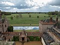
 Garden at Oxburgh Hall in Norfolk - geograph.org.uk - 6265005.jpg 4,032 × 3,024; 5.47 MB
-
 Garden wall at Oxburgh Hall - geograph.org.uk - 3996492.jpg 4,320 × 3,240; 6.27 MB
-
 Garden, Oxburgh Hall, Norfolk - geograph.org.uk - 5377075.jpg 4,000 × 3,000; 2.17 MB
-
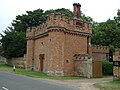 Gatehouse, Oxburgh Hall - geograph.org.uk - 4555898.jpg 640 × 480; 83 KB
-
 Gateway to Oxburgh Hall - geograph.org.uk - 4555890.jpg 640 × 480; 71 KB
-
 Great War Memorial - geograph.org.uk - 3611951.jpg 2,592 × 1,944; 1.29 MB
-
 Greenhouse at Oxburgh Hall - geograph.org.uk - 3205523.jpg 2,000 × 1,500; 503 KB
-
 Heading north east into Oxborough - geograph.org.uk - 4555880.jpg 640 × 480; 75 KB
-
 Inside the walled garden at Oxburgh Hall, Norfolk - geograph.org.uk - 6265017.jpg 4,032 × 3,024; 6.98 MB
-
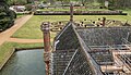
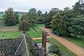
 Looking down from Oxburgh Hall, Norfolk - geograph.org.uk - 5377410.jpg 4,000 × 3,000; 2.63 MB
-
 Looking down from Oxburgh Hall, Norfolk - geograph.org.uk - 5377412.jpg 4,000 × 3,000; 2.89 MB
-
 Looking down from Oxburgh Hall, Norfolk - geograph.org.uk - 5377414.jpg 4,000 × 3,000; 2.37 MB
-
 Looking down from Oxburgh Hall, Norfolk - geograph.org.uk - 5377416.jpg 4,000 × 3,000; 2.33 MB
-
 Looking down from Oxburgh Hall, Norfolk - geograph.org.uk - 5377418.jpg 4,000 × 2,285; 2.93 MB
-
 Looking down from Oxburgh Hall, Norfolk - geograph.org.uk - 5377423.jpg 4,000 × 3,000; 2.37 MB
-
 Looking down from Oxburgh Hall, Norfolk - geograph.org.uk - 5377424.jpg 3,815 × 2,403; 2.77 MB
-
 Looking out from Oxburgh Hall, Norfolk - geograph.org.uk - 5377407.jpg 4,000 × 3,000; 2.87 MB
-
 Looking south-east from Oxburgh Hall - geograph.org.uk - 5984779.jpg 1,600 × 1,200; 973 KB
-
 Mannequin in the grounds of the Bedingfeld Arms - geograph.org.uk - 5603285.jpg 3,456 × 2,592; 3.85 MB
-
 Moat, Oxburgh Hall, Norfolk - geograph.org.uk - 3721362.jpg 683 × 1,024; 755 KB
-
 Moat, Oxburgh Hall, Norfolk - geograph.org.uk - 3721364.jpg 683 × 1,024; 777 KB
-
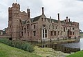
 Moat, Oxburgh Hall, Norfolk - geograph.org.uk - 5377425.jpg 4,000 × 3,000; 2.77 MB
-
 Moat, Oxburgh Hall, Norfolk - geograph.org.uk - 5377427.jpg 4,000 × 3,000; 2.49 MB
-
 National Trust chairs - geograph.org.uk - 4616507.jpg 800 × 531; 159 KB
-
 Newly planted potato field - geograph.org.uk - 397803.jpg 640 × 480; 89 KB
-
 On the roof of Oxburgh Hall - geograph.org.uk - 3611943.jpg 2,592 × 1,944; 1.28 MB
-
 Oxborough Church - geograph.org.uk - 4555903.jpg 640 × 480; 57 KB
-
 Oxborough houses (2) (geograph 6711617).jpg 4,320 × 3,240; 3.16 MB
-
 Oxborough houses (3) (geograph 6711629).jpg 3,704 × 2,777; 2.61 MB
-
 Oxborough Hythe, ruin of the church of St. Mary Magdalene (geograph 4353781).jpg 1,024 × 768; 561 KB
-
 Oxborough Road - geograph.org.uk - 4555807.jpg 640 × 480; 75 KB
-
 Oxborough Road - geograph.org.uk - 4555812.jpg 640 × 480; 79 KB
-
 Oxborough Road - geograph.org.uk - 4555858.jpg 640 × 480; 77 KB
-
 Oxborough Road - geograph.org.uk - 4555863.jpg 640 × 480; 77 KB
-
 Oxborough Road - geograph.org.uk - 4555878.jpg 640 × 480; 86 KB
-
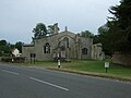
 Oxborough St. John the Evangelist's church - geograph.org.uk - 4353789.jpg 1,024 × 768; 305 KB
-
 Oxborough village sign - geograph.org.uk - 3611952.jpg 2,592 × 1,944; 1.31 MB
-
 Oxborough village sign - geograph.org.uk - 6269328.jpg 6,000 × 4,000; 7.7 MB
-
 Oxborough War Memorial - geograph.org.uk - 5603086.jpg 2,592 × 3,456; 3.16 MB
-
 Oxborough, The Church of St John the Evangelist - geograph.org.uk - 4487440.jpg 3,874 × 2,597; 4.95 MB
-

-

-

-

-

-

-

-

-
 Oxborough, The Church of St John the Evangelist, The Nave - geograph.org.uk - 4487465.jpg 5,520 × 3,680; 7.76 MB
-
 Oxborough, The Church of St John the Evangelist, The Nave - geograph.org.uk - 4487470.jpg 3,672 × 2,827; 3.63 MB
-
 Oxborough, The Church of St John the Evangelist, The Nave - geograph.org.uk - 4487478.jpg 5,416 × 3,516; 6.62 MB
-
 Oxborough, The Church of St John the Evangelist, The Nave - geograph.org.uk - 4487503.jpg 2,814 × 3,167; 3.35 MB
-
 Oxborough, The Church of St John the Evangelist, The Nave - geograph.org.uk - 4487514.jpg 5,478 × 3,614; 6.88 MB
-
 Oxborough, The Church of St John the Evangelist, The Pulpit - geograph.org.uk - 4487508.jpg 4,369 × 3,021; 5.12 MB
-
 Oxburgh Hall (1) - geograph.org.uk - 5176154.jpg 2,555 × 1,917; 819 KB
-
 Oxburgh Hall (2) - geograph.org.uk - 5176155.jpg 1,915 × 2,555; 1.73 MB
-
 Oxburgh Hall (3) - geograph.org.uk - 5176156.jpg 2,549 × 1,692; 1.48 MB
-
 Oxburgh Hall (4) - geograph.org.uk - 5176157.jpg 2,547 × 1,911; 1.14 MB
-
 Oxburgh Hall (5) - geograph.org.uk - 5176158.jpg 1,853 × 2,469; 1.1 MB
-
 Oxburgh Hall - geograph.org.uk - 3205490.jpg 2,000 × 1,350; 475 KB
-
 Oxburgh Hall - geograph.org.uk - 3205509.jpg 2,000 × 1,376; 489 KB
-
 Oxburgh Hall - geograph.org.uk - 3562979.jpg 1,350 × 898; 172 KB
-
 Oxburgh Hall - geograph.org.uk - 4473064.jpg 4,246 × 2,967; 7.4 MB
-
 Oxburgh Hall - geograph.org.uk - 4487226.jpg 4,498 × 2,819; 7.33 MB
-
 Oxburgh Hall - geograph.org.uk - 4616478.jpg 1,024 × 680; 241 KB
-
 Oxburgh Hall - geograph.org.uk - 5294707.jpg 1,024 × 683; 225 KB
-
 Oxburgh Hall - geograph.org.uk - 5294797.jpg 1,024 × 670; 256 KB
-
 Oxburgh Hall - geograph.org.uk - 5294804.jpg 1,024 × 683; 300 KB
-
 Oxburgh Hall - geograph.org.uk - 5294813.jpg 1,024 × 683; 166 KB
-
 Oxburgh Hall - geograph.org.uk - 5410634.jpg 640 × 480; 84 KB
-
 Oxburgh Hall - geograph.org.uk - 5984775.jpg 1,600 × 1,200; 1.07 MB
-
 Oxburgh Hall - geograph.org.uk - 6268238.jpg 6,000 × 4,000; 4.42 MB
-
 Oxburgh Hall - geograph.org.uk - 6269317.jpg 6,000 × 4,000; 5.82 MB
-
 Oxburgh Hall and gardens - geograph.org.uk - 3611936.jpg 2,522 × 1,848; 802 KB
-
 Oxburgh Hall Boundary Wall - geograph.org.uk - 4524899.jpg 1,259 × 699; 149 KB
-
 Oxburgh Hall Estate (1) - geograph.org.uk - 5176167.jpg 2,560 × 1,920; 1.9 MB
-
 Oxburgh Hall Estate (12) (geograph 6710777).jpg 4,320 × 3,240; 3.87 MB
-
 Oxburgh Hall Estate (13) (geograph 6710779).jpg 3,155 × 4,207; 3.18 MB
-
 Oxburgh Hall Estate (14) (geograph 6710783).jpg 4,320 × 3,240; 4.33 MB
-
 Oxburgh Hall Estate (17) (geograph 6710814).jpg 4,067 × 3,050; 2.67 MB
-
 Oxburgh Hall Estate (18) (geograph 6710821).jpg 4,320 × 3,240; 3.97 MB
-
 Oxburgh Hall Estate (2) - geograph.org.uk - 5176169.jpg 2,489 × 1,867; 855 KB
-
 Oxburgh Hall Estate (3) - geograph.org.uk - 5176172.jpg 2,553 × 1,915; 1.24 MB
-
 Oxburgh Hall Estate (4) - geograph.org.uk - 5176175.jpg 2,407 × 1,805; 1.68 MB
-
 Oxburgh Hall Estate (5) - geograph.org.uk - 5176177.jpg 2,454 × 1,536; 1.39 MB
-
 Oxburgh Hall Estate (6) - geograph.org.uk - 5176180.jpg 2,560 × 1,920; 1.65 MB
-
 Oxburgh Hall Estate (7) - geograph.org.uk - 5176182.jpg 3,123 × 4,165; 3.08 MB
-
 Oxburgh Hall viewed through a gateway - geograph.org.uk - 3153664.jpg 425 × 640; 103 KB
-
 Oxburgh Hall, Detail of the base of the tower - geograph.org.uk - 4473070.jpg 3,678 × 2,456; 6.22 MB
-

-
 Oxburgh Hall, Detail of the east tower turret - geograph.org.uk - 4487427.jpg 3,678 × 2,456; 4.87 MB
-

-
 Oxburgh Hall, near Oxborough, Norfolk - geograph.org.uk - 3721355.jpg 683 × 1,024; 773 KB
-
 Oxburgh Hall, Norfolk - geograph.org.uk - 3721365.jpg 1,024 × 683; 816 KB
-
 Oxburgh Hall, Norfolk - geograph.org.uk - 3721366.jpg 683 × 1,024; 761 KB
-
 Oxburgh Hall, Norfolk - geograph.org.uk - 3721367.jpg 1,024 × 683; 914 KB
-
 Oxburgh Hall, Norfolk - geograph.org.uk - 3721369.jpg 1,024 × 683; 888 KB
-
 Oxburgh Hall, Norfolk - geograph.org.uk - 3721371.jpg 683 × 1,024; 822 KB
-
 Oxburgh Hall, Norfolk - geograph.org.uk - 3721372.jpg 683 × 1,024; 677 KB
-
 Oxburgh Hall, Norfolk - geograph.org.uk - 3721373.jpg 683 × 1,024; 697 KB
-
 Oxburgh Hall, Norfolk - geograph.org.uk - 3721374.jpg 683 × 1,024; 1.03 MB
-
 Oxburgh Hall, Norfolk - geograph.org.uk - 3721376.jpg 534 × 800; 168 KB
-
 Oxburgh Hall, Norfolk - geograph.org.uk - 3721377.jpg 700 × 1,024; 958 KB
-
 Oxburgh Hall, Norfolk - geograph.org.uk - 3721378.jpg 683 × 1,024; 986 KB
-
 Oxburgh Hall, Norfolk - geograph.org.uk - 3721381.jpg 683 × 1,024; 810 KB
-
 Oxburgh Hall, Norfolk - geograph.org.uk - 3721382.jpg 683 × 1,024; 829 KB
-
 Oxburgh Hall, Norfolk - geograph.org.uk - 3721385.jpg 534 × 800; 140 KB
-
 Oxburgh Hall, Norfolk - geograph.org.uk - 3721387.jpg 683 × 1,024; 741 KB
-
 Oxburgh Hall, Norfolk - geograph.org.uk - 3721389.jpg 667 × 1,024; 662 KB
-
 Oxburgh Hall, Norfolk - geograph.org.uk - 3721391.jpg 683 × 1,024; 609 KB
-
 Oxburgh Hall, Norfolk - geograph.org.uk - 3721393.jpg 683 × 1,024; 967 KB
-
 Oxburgh Hall, Norfolk - geograph.org.uk - 3721395.jpg 1,024 × 683; 822 KB
-
 Oxburgh Hall, Norfolk - geograph.org.uk - 3721398.jpg 1,024 × 683; 935 KB
-
 Oxburgh Hall, Norfolk - geograph.org.uk - 3721400.jpg 683 × 1,024; 788 KB
-
 Oxburgh Hall, Norfolk - geograph.org.uk - 3721402.jpg 1,024 × 683; 850 KB
-
 Oxburgh Hall, Norfolk - geograph.org.uk - 3721405.jpg 683 × 1,024; 828 KB
-
 Oxburgh Hall, Norfolk - geograph.org.uk - 3721406.jpg 1,024 × 683; 860 KB
-
 Oxburgh Hall, Norfolk - geograph.org.uk - 3721407.jpg 683 × 1,024; 739 KB
-
 Oxburgh Hall, Norfolk - geograph.org.uk - 3721410.jpg 683 × 1,024; 682 KB
-
 Oxburgh Hall, Norfolk - geograph.org.uk - 3721411.jpg 1,024 × 711; 834 KB
-
 Oxburgh Hall, Norfolk - geograph.org.uk - 3721601.jpg 679 × 1,024; 687 KB
-
 Oxburgh Hall, Norfolk - geograph.org.uk - 5377079.jpg 4,000 × 3,000; 2.47 MB
-
 Oxburgh Hall, Norfolk - geograph.org.uk - 5377081.jpg 4,000 × 3,000; 2.51 MB
-
 Oxburgh Hall, Oxborough, Norfolk - geograph.org.uk - 2054010.jpg 640 × 481; 68 KB
-
 Oxburgh Hall, Stained glass in a first floor corridor window - geograph.org.uk - 4487323.jpg 2,749 × 1,907; 2.67 MB
-

-
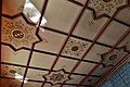
 Oxburgh Hall, The ceiling in the Gatehouse carriageway - geograph.org.uk - 4487398.jpg 3,678 × 2,456; 5.3 MB
-
 Oxburgh Hall, The Dining Room - geograph.org.uk - 4487306.jpg 4,102 × 2,836; 6.62 MB
-
 Oxburgh Hall, The Dining Room - geograph.org.uk - 4487316.jpg 4,924 × 2,349; 5.57 MB
-
 Oxburgh Hall, The Library - geograph.org.uk - 4487287.jpg 3,678 × 2,456; 5.99 MB
-
 Oxburgh Hall, The Library - geograph.org.uk - 4487293.jpg 3,678 × 2,456; 4.93 MB
-
 Oxburgh Hall, The main entrance tower - geograph.org.uk - 4487238.jpg 4,102 × 2,744; 5.19 MB
-
 Oxburgh Hall, The main entrance tower from the courtyard - geograph.org.uk - 4487242.jpg 3,676 × 3,455; 6.9 MB
-
 Oxburgh Hall, The main entrance tower from the courtyard - geograph.org.uk - 4487252.jpg 3,678 × 2,414; 7.58 MB
-
 Oxburgh Hall, The painted ceiling in the West Drawing Room - geograph.org.uk - 4487266.jpg 3,678 × 2,456; 4.52 MB
-
 Oxburgh Hall, The parterre - geograph.org.uk - 4473066.jpg 3,814 × 2,467; 4.6 MB
-
 Oxburgh Hall, The Queen's Room - geograph.org.uk - 4487331.jpg 3,834 × 2,608; 5.62 MB
-
 Oxburgh Hall, The Queen's Room - geograph.org.uk - 4487336.jpg 2,638 × 1,593; 2.38 MB
-
 Oxburgh Hall, The Queen's Room - geograph.org.uk - 4487340.jpg 5,488 × 3,630; 7.58 MB
-
-
 Oxburgh Hall, The two Tower Turrets - geograph.org.uk - 4487344.jpg 4,428 × 3,032; 7.42 MB
-
 Oxburgh Hall, The West Drawing Room - geograph.org.uk - 4487275.jpg 3,678 × 2,455; 5.09 MB
-
 Oxburgh Hall, View from the roof - geograph.org.uk - 4487360.jpg 3,678 × 2,455; 6.02 MB
-
 Oxburgh Hall, View from the roof - geograph.org.uk - 4487365.jpg 3,678 × 2,456; 4.53 MB
-
 Oxburgh Hall, View from the tower - geograph.org.uk - 4487351.jpg 3,678 × 2,456; 4.88 MB
-
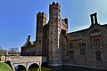
 Oxburgh Hall, Western aspect - geograph.org.uk - 4487234.jpg 5,334 × 3,378; 7.71 MB
-
 Parkland at Oxburgh Hall - geograph.org.uk - 6269323.jpg 6,000 × 4,000; 6.72 MB
-
 Parkland near Oxburgh Hall - geograph.org.uk - 6264846.jpg 4,032 × 3,024; 1.52 MB
-
 Pond at roadside - geograph.org.uk - 1219190.jpg 640 × 480; 88 KB
-
 Poppy in rapeseed - geograph.org.uk - 3996438.jpg 4,320 × 3,240; 5.65 MB
-
 Reflection in the moat - Oxburgh Hall, Norfolk - geograph.org.uk - 3998671.jpg 4,608 × 3,456; 6.31 MB
-
 Road junction - geograph.org.uk - 853263.jpg 640 × 480; 68 KB
-

-

-
 Roof and garden of Oxburgh Hall - geograph.org.uk - 4616561.jpg 800 × 531; 165 KB
-
 Ruined chapel at Oxborough Hythe - geograph.org.uk - 1854256.jpg 640 × 480; 110 KB
-
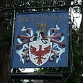 Sign for the Bedingfeld Arms, Oxborough - geograph.org.uk - 4555926.jpg 640 × 633; 129 KB
-

-
 St John the Evangelist church, Oxborough - geograph.org.uk - 3749152.jpg 2,592 × 1,944; 1.55 MB
-


_off_Swaffham_Road_-_geograph.org.uk_-_5391970.jpg)


_(geograph_6711617).jpg)
_(geograph_6711629).jpg)
.jpg)


_-_geograph.org.uk_-_5176154.jpg)
_-_geograph.org.uk_-_5176155.jpg)
_-_geograph.org.uk_-_5176156.jpg)
_-_geograph.org.uk_-_5176157.jpg)
_-_geograph.org.uk_-_5176158.jpg)


_-_geograph.org.uk_-_5176167.jpg)
_(geograph_6710777).jpg)
_(geograph_6710779).jpg)
_(geograph_6710783).jpg)
_(geograph_6710814).jpg)
_(geograph_6710821).jpg)
_-_geograph.org.uk_-_5176169.jpg)
_-_geograph.org.uk_-_5176172.jpg)
_-_geograph.org.uk_-_5176175.jpg)
_-_geograph.org.uk_-_5176177.jpg)
_-_geograph.org.uk_-_5176180.jpg)
_-_geograph.org.uk_-_5176182.jpg)


