Category:PEF Map of Western Palestine (details)
Media in category "PEF Map of Western Palestine (details)"
The following 10 files are in this category, out of 10 total.
-
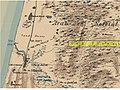
 Jericho and Tell es Sultan in the Survey of Western Palestine 1880.18 (cropped).jpg 2,480 × 1,404; 1.15 MB
-

-
 Tell Arad in the Survey of Western Palestine 1880.25 (cropped).jpg 1,240 × 695; 273 KB
-
 אזור ואדי חנין בסביבות 1880.jpg 960 × 720; 116 KB
-
 יער השרון במפת ה PEF (סביבות 1880).jpg 960 × 720; 118 KB
-
 יער השרון מפת ה PEF.jpg 960 × 720; 121 KB
-
 מפת ה PEF (סביבות 1880) קווי הטלגרף הוליכים ליפו מדרום.png 960 × 720; 1.09 MB
-
 מפת חורבת זנוח.jpg 971 × 492; 120 KB
-
 נחל אחיה PEF.jpg 960 × 720; 89 KB
-
 עמק גלילות מפת PEF.jpg 960 × 720; 112 KB
.jpg)
.jpg)
.jpg)

.jpg)

_%D7%A7%D7%95%D7%95%D7%99_%D7%94%D7%98%D7%9C%D7%92%D7%A8%D7%A3_%D7%94%D7%95%D7%9C%D7%99%D7%9B%D7%99%D7%9D_%D7%9C%D7%99%D7%A4%D7%95_%D7%9E%D7%93%D7%A8%D7%95%D7%9D.png)


