Category:Paga, Ghana
| Object location | | View all coordinates using: OpenStreetMap |
|---|
town and district capital in Upper East Region of Ghana | |||||
| Upload media | |||||
| Instance of | |||||
|---|---|---|---|---|---|
| Location | Kassena-Nankana West District, Upper East Region, Ghana | ||||
| Elevation above sea level |
| ||||
 | |||||
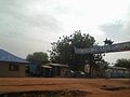
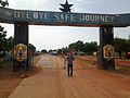
English: Paga is a small town in northern Ghana, lying where north Ghana's main north-south road reaches the Burkina Faso border, north of Bolgatanga. It's the administrative capital of the Kassena Nankana West District, a district in the Upper East region of north Ghana. There are plans to extend the Kumasi-Takoradi railway to Paga.
Polski: Paga – małe miasteczko w północnej Ghanie, leży w miejscu gdzie główna droga krajowa północ-południe dochodzi do granicy z Burkina Faso, 40km na północ od Bolgatanga i 12km od Navrongo. Znane ze swoich świętych stawów krokodyli.
Media in category "Paga, Ghana"
The following 5 files are in this category, out of 5 total.
-
 Ghana - Burkina Faso Border.jpg 2,048 × 1,536; 490 KB
-
 Ghana - Victory Pump.jpg 2,048 × 1,536; 1.26 MB
-
 Ghana to Burkina Faso border.jpg 2,048 × 1,536; 378 KB
-
 Ghana-Burkina Fasa border.jpg 2,048 × 1,536; 464 KB
-
 Ghana-Burkina Faso Border.jpg 2,048 × 1,536; 460 KB


