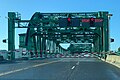
Category:Park Street bridge, Alameda, California
| Object location | | View all coordinates using: OpenStreetMap |
|---|
bridge connecting Alameda and Oakland  | |||||
| Upload media | |||||
| Instance of | |||||
|---|---|---|---|---|---|
| Location | California, Pacific States Region | ||||
| Date of official opening |
| ||||
 | |||||
Media in category "Park Street bridge, Alameda, California"
The following 10 files are in this category, out of 10 total.
-
-
 Park Street Bridge 2008-12.jpg 3,627 × 2,591; 2 MB
-
 Park Street Bridge from east in 2011.jpg 1,681 × 1,025; 160 KB
-
 SF Call 03 Aug 1901 Estuary Bridges.png 2,419 × 2,382; 4.64 MB
-
-
 USA-Alameda-Part Street Bridge-1.jpg 3,008 × 2,000; 3.31 MB
-
 USA-Alameda-Part Street Bridge-2.jpg 3,008 × 2,000; 3.22 MB
-
 USA-Alameda-Part Street Bridge-3.jpg 2,000 × 3,008; 2.72 MB
-
 USA-Alameda-Part Street Bridge-4.jpg 3,008 × 2,000; 2.36 MB
-
 USA-Alameda-Part Street Bridge-5.jpg 3,008 × 2,000; 2.5 MB


