Category:Pembridge
village in Herefordshire, UK  | |||||
| Upload media | |||||
| Instance of | |||||
|---|---|---|---|---|---|
| Location | Herefordshire, West Midlands, England | ||||
| official website | |||||
 | |||||
English: Pembridge is a village and civil parish located just south of the River Arrow on the A44 between Leominster and Kington in Herefordshire, England. Pembridge is believed to have originally been called Pen y Bont (Welsh origin) before it was anglicised to the current spelling.
Nederlands: Pembridge is een plaats en civil parish in het bestuurlijke gebied Herefordshire, in het Engelse graafschap Herefordshire met 1000 inwoners.
Polski: Pembridge – wieś w Anglii, w hrabstwie Herefordshire. Leży 22 km na północny zachód od miasta Hereford i 206 km na północny zachód od Londynu. Miejscowość liczy 1000 mieszkańców.

Subcategories
This category has the following 18 subcategories, out of 18 total.
B
- Bearwood, Herefordshire (5 F)
C
- Clear Brook, Herefordshire (2 F)
- Court of Noke (10 F)
K
- King's House, Pembridge (4 F)
L
- Lower Bearwood (9 F)
- Lower Broxwood (3 F)
M
- Marston, Herefordshire (7 F)
- Moorcourt, Herefordshire (2 F)
N
- New Inn, Pembridge (17 F)
O
- Old Oak House, Pembridge (3 F)
P
- Pembridge Market Hall (15 F)
- Pembridge Parish Hall (4 F)
- Pembridge War Memorial (2 F)
R
- The Red Lion, Pembridge (4 F)
W
- West End Farm, Pembridge (4 F)
- Weston, Herefordshire (1 F)
Media in category "Pembridge"
The following 200 files are in this category, out of 603 total.
(previous page) (next page)-

-
 2 Bridge Street, Pembridge - geograph.org.uk - 1105508.jpg 640 × 559; 79 KB
-
 A Brand New Orchard - geograph.org.uk - 4048319.jpg 1,600 × 1,199; 508 KB
-
 A house down a lane - geograph.org.uk - 4048362.jpg 1,600 × 1,200; 423 KB
-
 A Medieval House in Pembridge - geograph.org.uk - 4474585.jpg 1,980 × 1,320; 1.28 MB
-
 A Potato Field - geograph.org.uk - 4048299.jpg 1,600 × 1,200; 768 KB
-

-
 A reminder of Empire - geograph.org.uk - 6025406.jpg 2,121 × 3,461; 2.92 MB
-

-
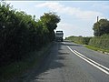 A44 at the access for Moseley Farm - geograph.org.uk - 2587956.jpg 640 × 480; 63 KB
-
 A44 at the access for Pitfield Farm - geograph.org.uk - 2587953.jpg 640 × 480; 63 KB
-
 A44 at the access to Westonbury Farm - geograph.org.uk - 2587959.jpg 640 × 480; 70 KB
-
 A44 at the entrance to Moor Court - geograph.org.uk - 2587994.jpg 640 × 480; 63 KB
-
 A44 between Kington and Pembridge - geograph.org.uk - 6076238.jpg 1,024 × 768; 385 KB
-
 A44 entering Pembridge from the east - geograph.org.uk - 2587944.jpg 640 × 480; 71 KB
-
 A44 in Pembridge - geograph.org.uk - 2587947.jpg 640 × 480; 76 KB
-
 A44 near Weston - geograph.org.uk - 2587964.jpg 640 × 480; 44 KB
-
 A44 south of Marston - geograph.org.uk - 2587960.jpg 640 × 480; 52 KB
-
 A44 through Pembridge - geograph.org.uk - 2144916.jpg 600 × 800; 75 KB
-
 A44 west of Pembridge - geograph.org.uk - 2587951.jpg 640 × 480; 67 KB
-
 AA Sign at Pembridge - geograph.org.uk - 5853062.jpg 2,048 × 1,536; 1.48 MB
-
 An ancient lane - geograph.org.uk - 5674226.jpg 1,024 × 768; 333 KB
-
 An ancient motte - geograph.org.uk - 2366885.jpg 2,048 × 1,536; 641 KB
-
 An RAF navigator's grave, Pembridge - geograph.org.uk - 6020841.jpg 2,209 × 3,323; 3.31 MB
-
 Anaerobic Digester plant, Shobdon - geograph.org.uk - 4256720.jpg 854 × 640; 345 KB
-
 Anaerobic digester, The Leven - geograph.org.uk - 6076373.jpg 1,024 × 768; 278 KB
-
 Ancient and modern - geograph.org.uk - 2935212.jpg 1,024 × 612; 297 KB
-
 Another tight bend on the A44 - geograph.org.uk - 2587958.jpg 640 × 480; 46 KB
-
 Approaching Lower Green - geograph.org.uk - 4995439.jpg 1,600 × 901; 725 KB
-
 Approaching Meer Common - geograph.org.uk - 4995423.jpg 1,600 × 901; 664 KB
-
 Approaching The Forge - geograph.org.uk - 2621484.jpg 640 × 480; 87 KB
-
 Approaching the turning to Cabal - geograph.org.uk - 2620732.jpg 2,592 × 1,944; 2.89 MB
-
 Armorial Bearings of the BRACE family of Noke Court, Pembridge, Herefordshire.png 1,200 × 1,200; 479 KB
-
 Armorial Bearings of the TYLER family of Pembridge, Herefordshire.png 1,200 × 1,200; 819 KB
-
 Arrow Bridge, Pembridge - geograph.org.uk - 1105477.jpg 640 × 365; 83 KB
-
 Arrow flood plain - geograph.org.uk - 388745.jpg 640 × 480; 75 KB
-
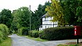
 Assorted styles of black and white houses, Pembridge - geograph.org.uk - 5891761.jpg 1,600 × 1,203; 707 KB
-
 Award on the tower - geograph.org.uk - 2144946.jpg 1,024 × 768; 303 KB
-
 Back to the main road - geograph.org.uk - 2152375.jpg 600 × 800; 95 KB
-
 Bank House, Pembridge (geograph 7328962).jpg 1,024 × 768; 165 KB
-
 Barn Conversions, Weston Court Farm - geograph.org.uk - 4060386.jpg 3,904 × 2,744; 2.24 MB
-
 Bearwood black-and-white - geograph.org.uk - 4995445.jpg 1,600 × 901; 715 KB
-
 Bearwood Cottage - geograph.org.uk - 1971321.jpg 1,024 × 768; 198 KB
-
 Bearwood Cross - geograph.org.uk - 1971286.jpg 1,024 × 768; 230 KB
-
 Bearwood Cross - geograph.org.uk - 3855258.jpg 640 × 480; 321 KB
-
 Behind the Parish Hall - geograph.org.uk - 4060212.jpg 4,000 × 3,000; 2.93 MB
-
 Bell tower, Church of St Mary, Pembridge - geograph.org.uk - 4935442.jpg 966 × 1,280; 338 KB
-
 Bell Tower, Pembridge - geograph.org.uk - 5670093.jpg 768 × 1,024; 234 KB
-
 Bench mark on the porch - geograph.org.uk - 2146173.jpg 600 × 800; 197 KB
-
 Bench mark, St Mary's Church, Pembridge - geograph.org.uk - 4935444.jpg 960 × 1,280; 492 KB
-
 Bench, Pembridge - geograph.org.uk - 6073045.jpg 640 × 480; 119 KB
-
 Bend into Pembridge - geograph.org.uk - 1354439.jpg 640 × 480; 70 KB
-
 Beside the Curl Brook, Marsden - geograph.org.uk - 6076230.jpg 1,024 × 768; 349 KB
-
 Black and white and cream house, Pembridge - geograph.org.uk - 5891764.jpg 1,600 × 891; 664 KB
-
 Black and white by Bridge Street, Pembridge - geograph.org.uk - 2935195.jpg 1,024 × 768; 411 KB
-

-
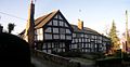
 Black and White House, Pembridge, Herefordshire - geograph.org.uk - 4093061.jpg 1,024 × 768; 912 KB
-
 Black and White Houses Pembridge, Herefordshire - geograph.org.uk - 4093074.jpg 1,024 × 768; 950 KB
-

-
 Black and White Houses, Pembridge, Herefordshire - geograph.org.uk - 4093105.jpg 1,024 × 768; 897 KB
-
 Black and White Houses, Pembridge, Herefordshire - geograph.org.uk - 4093107.jpg 1,024 × 768; 812 KB
-
 Black and White in Pembridge - geograph.org.uk - 4091400.jpg 1,912 × 1,494; 629 KB
-
 Black ^ White Pembridge - geograph.org.uk - 2587945.jpg 640 × 480; 73 KB
-
 Boardwalk, Pembridge - geograph.org.uk - 6073043.jpg 1,024 × 768; 520 KB
-
 Brick House and West End Farm, Pembridge - geograph.org.uk - 5631754.jpg 1,600 × 1,044; 340 KB
-
 Brick house, Pembridge - geograph.org.uk - 3096438.jpg 640 × 512; 82 KB
-
 Bridge Cottage, Pembridge - geograph.org.uk - 1105517.jpg 640 × 332; 47 KB
-
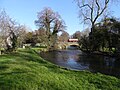
 Bridge crossing the River Arrow - geograph.org.uk - 5671039.jpg 1,024 × 683; 262 KB
-
 Bridge House - geograph.org.uk - 5671044.jpg 1,024 × 683; 235 KB
-
 Bridge over the Arrow - geograph.org.uk - 4060169.jpg 4,000 × 3,000; 2.99 MB
-
 Bridge over the Arrow, Pembridge - geograph.org.uk - 6073030.jpg 1,024 × 768; 386 KB
-
 Bridge, Pembridge - geograph.org.uk - 6059236.jpg 1,024 × 768; 173 KB
-
 Broadstone House (Pembridge) - geograph.org.uk - 5853209.jpg 2,048 × 1,360; 1.32 MB
-
 Broadstone, West Street, Pembridge - geograph.org.uk - 4935435.jpg 1,280 × 960; 344 KB
-
 Brockaly ^ The Riddox - geograph.org.uk - 4048389.jpg 1,600 × 1,200; 433 KB
-
 Brook beside Noke Lane - geograph.org.uk - 6076352.jpg 1,024 × 768; 571 KB
-
 Broxwood Road - geograph.org.uk - 4995434.jpg 1,600 × 901; 695 KB
-
 Broxwood Road - geograph.org.uk - 4995437.jpg 1,600 × 901; 688 KB
-
 Bug hotel - geograph.org.uk - 6073071.jpg 1,024 × 768; 565 KB
-
 Bull in the Orchard - geograph.org.uk - 4048329.jpg 1,600 × 1,118; 522 KB
-
 Burcher to Staunton road - geograph.org.uk - 5515224.jpg 1,024 × 683; 420 KB
-
 Butter, eggs and oatmeal - geograph.org.uk - 2152301.jpg 1,024 × 768; 141 KB
-
 Byletts - geograph.org.uk - 6073053.jpg 1,024 × 768; 418 KB
-
 Byway, leading to Bearwood - geograph.org.uk - 1971303.jpg 1,024 × 768; 267 KB
-
 Cabal Lane - geograph.org.uk - 5674259.jpg 1,024 × 768; 336 KB
-
 Cabal Lane - geograph.org.uk - 6076294.jpg 1,024 × 768; 453 KB
-
 Carpenter's Wood - geograph.org.uk - 3855233.jpg 640 × 480; 360 KB
-
 Carpenter's Wood - geograph.org.uk - 3855239.jpg 640 × 480; 374 KB
-
 Castle Site of Pembridge - geograph.org.uk - 6025807.jpg 3,323 × 2,209; 3.85 MB
-
 Cat at Pembridge Primary School - geograph.org.uk - 5853194.jpg 2,048 × 1,360; 1.36 MB
-
 Ceiling at St. Mary's Church (Chancel ^ Pembridge) - geograph.org.uk - 5853131.jpg 2,048 × 1,360; 1.04 MB
-
 Ceiling of St. Mary's Church (Porch ^ Pembridge) - geograph.org.uk - 5853119.jpg 2,048 × 1,360; 1.35 MB
-
 Chapel gallery - geograph.org.uk - 2144924.jpg 600 × 800; 123 KB
-
 Cherry Tree Cottage (Pembridge) - geograph.org.uk - 5853180.jpg 3,648 × 2,736; 4.34 MB
-
 Cherry Tree Cottage, Pembridge - geograph.org.uk - 3096602.jpg 640 × 523; 73 KB
-
 Church Cottage, Pembridge - geograph.org.uk - 6023713.jpg 3,290 × 2,231; 2.02 MB
-

-
 Church House, Pembridge (geograph 7328970).jpg 1,024 × 757; 124 KB
-
 Church of St Mary, Pembridge - geograph.org.uk - 4935441.jpg 1,280 × 909; 322 KB
-
 Cider orchard at Lower Green - geograph.org.uk - 4995438.jpg 1,600 × 901; 769 KB
-
 Civil War damage on Pembridge church - geograph.org.uk - 5857647.jpg 768 × 1,024; 310 KB
-
 Classic MGA passing through Pembridge - geograph.org.uk - 872189.jpg 640 × 480; 87 KB
-
 Clock on St. Mary's Church (Bell Tower ^ Pembridge) - geograph.org.uk - 5853104.jpg 2,048 × 1,360; 1.03 MB
-
 Commemoration on the houses - geograph.org.uk - 2144859.jpg 1,024 × 768; 154 KB
-
 Cort of Noke - estate buildings - geograph.org.uk - 4475475.jpg 640 × 427; 69 KB
-
 Cotmore - geograph.org.uk - 6076267.jpg 1,024 × 768; 287 KB
-
 Cottages, East Street, Pembridge (geograph 7327762).jpg 1,024 × 768; 143 KB
-
 Cottages, Pembridge (geograph 7327753).jpg 1,024 × 751; 130 KB
-
 Cottages, West Street, Pembridge (geograph 7328994).jpg 1,024 × 768; 149 KB
-
 Country lane at Nutfield - geograph.org.uk - 440541.jpg 640 × 426; 113 KB
-
 Country road approaching Sherrington Manor - geograph.org.uk - 5695524.jpg 680 × 1,024; 292 KB
-
 Country road at Broxwood - geograph.org.uk - 5695402.jpg 680 × 1,024; 314 KB
-
 Court House Farmhouse, Pembridge - geograph.org.uk - 6020175.jpg 3,513 × 2,089; 1.84 MB
-
 Court House farmhouse, Pembridge - geograph.org.uk - 6020176.jpg 3,205 × 2,290; 2.09 MB
-
 Court Meadow, Pembridge - geograph.org.uk - 5670759.jpg 1,024 × 768; 307 KB
-
 Court of Noke - estate buildings - geograph.org.uk - 4475484.jpg 640 × 427; 104 KB
-
 Court of Noke - geograph.org.uk - 5692328.jpg 1,024 × 680; 321 KB
-

-
 Court of Noke - waterwheel - geograph.org.uk - 4475493.jpg 427 × 640; 97 KB
-
 Court of Noke water mill - geograph.org.uk - 4474286.jpg 640 × 417; 115 KB
-
 Crates by the gate - geograph.org.uk - 4057085.jpg 1,600 × 1,200; 322 KB
-
 Dam, Curl Brook - geograph.org.uk - 6075508.jpg 1,024 × 768; 453 KB
-
 Decommissioned gate - geograph.org.uk - 3855229.jpg 640 × 480; 312 KB
-

-
 Detail of the Bell Tower in Pembridge - geograph.org.uk - 5670096.jpg 768 × 1,024; 166 KB
-
 Disused machinery - geograph.org.uk - 914519.jpg 640 × 480; 62 KB
-
 Diverging lanes near Bearwood - geograph.org.uk - 4995446.jpg 1,600 × 901; 718 KB
-
 Do not re-use says John Harvey - geograph.org.uk - 4056381.jpg 3,724 × 2,836; 3.68 MB
-
 Doctor's surgery on East Street, Pembridge - geograph.org.uk - 6153450.jpg 1,848 × 1,162; 1.73 MB
-
 Dovecot and water tower, Westonbury Mill - geograph.org.uk - 3607979.jpg 2,592 × 3,456; 7.91 MB
-
 Dunkerton's Apple Trees - geograph.org.uk - 4053549.jpg 1,024 × 768; 303 KB
-
 Dunkertons cider mill - geograph.org.uk - 171474.jpg 640 × 480; 76 KB
-
 Dunkertons Cider Mill - geograph.org.uk - 5670804.jpg 1,024 × 768; 199 KB
-
 Duppa Almshouses (former), Pembridge - geograph.org.uk - 1105397.jpg 640 × 369; 50 KB
-
 Duppa's Almshouses (Pembridge) - geograph.org.uk - 5853082.jpg 3,648 × 2,736; 4.71 MB
-
 Duppa's Almshouses - geograph.org.uk - 5857130.jpg 1,024 × 768; 250 KB
-
 Duppa's Almshouses pembridge.jpg 4,928 × 3,264; 10.45 MB
-
 Dutch barn at Court of Noke - geograph.org.uk - 5674232.jpg 1,024 × 768; 201 KB
-
 East St. Pembridge (1294514).jpg 1,000 × 711; 91 KB
-

-
 East Street, Pembridge - geograph.org.uk - 1972348.jpg 1,600 × 1,200; 278 KB
-
 East Street, Pembridge - geograph.org.uk - 6158024.jpg 1,844 × 1,154; 1.33 MB
-
 Engineers code, Cabal Lane - geograph.org.uk - 6076295.jpg 1,024 × 768; 395 KB
-
 Entering Pembridge - geograph.org.uk - 6210896.jpg 1,024 × 683; 188 KB
-
 Fallen oak, Upper Marston - geograph.org.uk - 6059258.jpg 1,024 × 1,024; 424 KB
-
 Farm bridge crossing the River Arrow - geograph.org.uk - 5692142.jpg 1,024 × 680; 327 KB
-
 Farm outbuildings, Luntley Court Farm - geograph.org.uk - 1969561.jpg 1,024 × 768; 202 KB
-
 Farm shop on edge of Pembridge - geograph.org.uk - 5891749.jpg 1,600 × 958; 668 KB
-
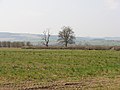
 Farmland above the River Arrow - geograph.org.uk - 5673137.jpg 1,024 × 683; 256 KB
-
 Farmland at Pembridge - geograph.org.uk - 5670417.jpg 1,024 × 768; 295 KB
-
 Farmland at Staunton-on-Arrow - geograph.org.uk - 5671075.jpg 1,024 × 683; 209 KB
-
 Farmland near Lower Green - geograph.org.uk - 5695520.jpg 1,024 × 680; 234 KB
-
 Farmland near Luntley - geograph.org.uk - 5670808.jpg 1,024 × 768; 243 KB
-
 Farmland near Upper Marston - geograph.org.uk - 5674253.jpg 1,024 × 768; 271 KB
-
 Farmland north of Pembridge - geograph.org.uk - 5671066.jpg 1,024 × 683; 221 KB
-
 Farmland track beside the River Arrow - geograph.org.uk - 5692129.jpg 1,024 × 680; 244 KB
-
 Farmyard, at Luntley - geograph.org.uk - 1969588.jpg 1,600 × 1,200; 592 KB
-
 Fence and field boundary - geograph.org.uk - 5674812.jpg 1,024 × 768; 308 KB
-
 Field access, The Forge - geograph.org.uk - 6076316.jpg 1,024 × 768; 417 KB
-
 Field beside a dismantled railway - geograph.org.uk - 5671071.jpg 1,024 × 683; 270 KB
-
 Field boundaries - geograph.org.uk - 4995443.jpg 1,600 × 901; 744 KB
-
 Field entrance on the A44, Weston - geograph.org.uk - 6158019.jpg 1,920 × 1,280; 1.4 MB
-
 Field entrance, Upper Marston - geograph.org.uk - 6076293.jpg 1,024 × 768; 477 KB
-
 Field near Little Sherrington - geograph.org.uk - 5695566.jpg 1,024 × 680; 307 KB
-
 Field of golden wheat, near Luntley - geograph.org.uk - 1969617.jpg 1,600 × 1,200; 626 KB
-
 Field, Bearwood Cross - geograph.org.uk - 3855263.jpg 640 × 480; 253 KB
-
 Field, Sherrington - geograph.org.uk - 6076387.jpg 1,024 × 768; 291 KB
-
 Field, Tibhall - geograph.org.uk - 3853939.jpg 640 × 480; 244 KB
-
 Fields near Luntley - geograph.org.uk - 4053501.jpg 1,600 × 1,067; 452 KB
-

-
 Fingerpost, Lower Broxwood - geograph.org.uk - 3854929.jpg 640 × 480; 364 KB
-
 Footpath off the road to Shobdon - geograph.org.uk - 2621865.jpg 626 × 450; 187 KB
-
 Ford at The Forge - geograph.org.uk - 4294424.jpg 3,872 × 2,592; 4.8 MB
-
 Former Chapel at Pembridge - geograph.org.uk - 4328136.jpg 544 × 672; 260 KB
-
 Former Market Hall, Pembridge - geograph.org.uk - 4935440.jpg 1,280 × 919; 373 KB
-
 Gatehouse, Moor Court Farm - geograph.org.uk - 3220886.jpg 3,456 × 2,592; 1.85 MB
-
 Gateway and farm track - geograph.org.uk - 5692140.jpg 1,024 × 680; 275 KB
-
 Glacial deposition terrain - geograph.org.uk - 6076331.jpg 1,024 × 768; 290 KB
-

-
 Glan Arrow, Bridge Street, Pembridge - geograph.org.uk - 1105500.jpg 640 × 365; 66 KB
-
 Gorsty to Weston lane - geograph.org.uk - 4995444.jpg 1,600 × 901; 745 KB
-
 Grave of Corporal A Hyde - geograph.org.uk - 5670099.jpg 683 × 1,024; 284 KB
-
 Grave of Private PRR Matthews - geograph.org.uk - 5670100.jpg 683 × 1,024; 196 KB
-
 Greenhouses at Noke Court - geograph.org.uk - 2953155.jpg 640 × 480; 93 KB
-
 Grove Wood - geograph.org.uk - 6076348.jpg 1,024 × 768; 570 KB
-
 Gunnera manicata - geograph.org.uk - 4995508.jpg 1,600 × 1,200; 1,014 KB
-

-
 Gunnera manicata, detail - geograph.org.uk - 4995512.jpg 1,600 × 1,200; 1.13 MB
-
 Herefordshire grassland - geograph.org.uk - 4995442.jpg 1,600 × 901; 665 KB
-
 Highways, Pembridge (geograph 7329010).jpg 1,024 × 768; 145 KB
-
 Highways, West Street, Pembridge - geograph.org.uk - 4935438.jpg 1,280 × 947; 400 KB
-
 Holmcroft - geograph.org.uk - 6059265.jpg 1,024 × 626; 140 KB
-
 House at Meer Common - geograph.org.uk - 4995420.jpg 1,600 × 901; 718 KB
-
 House entrance on West Street, Pembridge - geograph.org.uk - 6158021.jpg 1,920 × 1,280; 1.1 MB
-
 House in Marston - geograph.org.uk - 5674382.jpg 1,024 × 768; 254 KB
-
 House in Nokelane Head - geograph.org.uk - 2621489.jpg 640 × 480; 105 KB
-
 House on East Street - geograph.org.uk - 4669657.jpg 1,024 × 768; 155 KB
-
 House on East Street, Pembridge - geograph.org.uk - 6153449.jpg 1,920 × 1,280; 1.68 MB
-
 House on East Street, Pembridge - geograph.org.uk - 6158023.jpg 1,884 × 1,224; 1.91 MB
-
 House on the A44 past Weston - geograph.org.uk - 6158020.jpg 1,852 × 1,170; 1.3 MB


.jpg)


_-_geograph.org.uk_-_5853209.jpg)


_-_geograph.org.uk_-_5853131.jpg)
_-_geograph.org.uk_-_5853119.jpg)

_-_geograph.org.uk_-_5853180.jpg)


.jpg)


_-_geograph.org.uk_-_5853104.jpg)


.jpg)
.jpg)
.jpg)


,_Pembridge_-_geograph.org.uk_-_1105397.jpg)
_-_geograph.org.uk_-_5853082.jpg)


.jpg)


.jpg)


