Category:Pensax
village in the United Kingdom  | |||||
| Upload media | |||||
| Instance of | |||||
|---|---|---|---|---|---|
| Location | Malvern Hills, Worcestershire, West Midlands, England | ||||
| Population |
| ||||
 | |||||
Media in category "Pensax"
The following 53 files are in this category, out of 53 total.
-
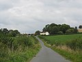
 Approaching the School - geograph.org.uk - 3276827.jpg 640 × 447; 69 KB
-
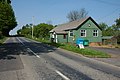
 B4202 at Pensax Village Hall - geograph.org.uk - 3276832.jpg 640 × 335; 64 KB
-
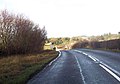
 B4202 At Snead Common - geograph.org.uk - 1490173.jpg 640 × 480; 160 KB
-
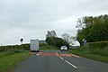
 B4202 At The Bell Pub - geograph.org.uk - 1490170.jpg 640 × 480; 165 KB
-

-
 Blackthorn, Menithwood - geograph.org.uk - 6135324.jpg 1,024 × 577; 333 KB
-
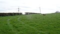
 Cattle, Pensax - geograph.org.uk - 6135302.jpg 1,024 × 577; 239 KB
-
 Clenchall Cottages - geograph.org.uk - 1490152.jpg 640 × 480; 142 KB
-
 Crag. Pensax - geograph.org.uk - 6135308.jpg 1,024 × 577; 341 KB
-
 Cross Keys - geograph.org.uk - 1901019.jpg 1,024 × 752; 196 KB
-
 Cross Keys pub sign - geograph.org.uk - 1901038.jpg 600 × 800; 181 KB
-
 Entering Pensax from the south - geograph.org.uk - 3276250.jpg 640 × 434; 48 KB
-
 Ewes and lambs, Stockton - geograph.org.uk - 6135300.jpg 1,024 × 577; 195 KB
-
 Former Primary School, Pensax - geograph.org.uk - 1490179.jpg 640 × 480; 298 KB
-
 Hawkley Farm - geograph.org.uk - 510499.jpg 640 × 480; 97 KB
-
 Hay Rolls Near Worles Common - geograph.org.uk - 1490157.jpg 640 × 480; 161 KB
-
 Hillside At Fartown Farm - geograph.org.uk - 1490164.jpg 640 × 480; 195 KB
-
 Hillside At Penn Hall - geograph.org.uk - 1490200.jpg 640 × 480; 246 KB
-
 Junction in Snead Common - geograph.org.uk - 3488857.jpg 1,024 × 767; 123 KB
-
 Junction of minor roads - geograph.org.uk - 1901069.jpg 800 × 600; 107 KB
-
 Lane To Pensax - geograph.org.uk - 1490178.jpg 640 × 480; 105 KB
-
 Lane To Pensax At Penn Hall - geograph.org.uk - 1490203.jpg 640 × 480; 216 KB
-
-
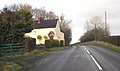 Lilac Cottage on B4202 - geograph.org.uk - 3276244.jpg 640 × 380; 58 KB
-
 Menithwood - Cross Keys Public House - geograph.org.uk - 1490228.jpg 640 × 480; 203 KB
-

-
 Menithwood - Lane To Heath Farm - geograph.org.uk - 1490185.jpg 480 × 640; 207 KB
-
 Menithwood Grassland - geograph.org.uk - 1490234.jpg 640 × 480; 184 KB
-
 New Inn Farm in the snow 2016 - geograph.org.uk - 6353964.jpg 960 × 720; 138 KB
-

-
 No through road - geograph.org.uk - 1901050.jpg 800 × 588; 164 KB
-
 Parish Hall, Pensax - geograph.org.uk - 4980799.jpg 3,264 × 2,448; 2.6 MB
-
 Penn Hall triangulation pillar - geograph.org.uk - 6093339.jpg 1,024 × 768; 156 KB
-
 Penn Hall trig point - geograph.org.uk - 6093334.jpg 1,024 × 768; 181 KB
-
 Pensax Parish Hall - geograph.org.uk - 417554.jpg 640 × 426; 114 KB
-

-
 Post box, Pensax - geograph.org.uk - 6135305.jpg 577 × 1,024; 297 KB
-
 Remains of an orchard, Pensax - geograph.org.uk - 6135311.jpg 1,024 × 577; 349 KB
-
 Road in Menithwood - geograph.org.uk - 6135318.jpg 1,024 × 577; 228 KB
-
 Running into Snead Common on B4202 - geograph.org.uk - 3276818.jpg 640 × 446; 69 KB
-
 Snead Common - geograph.org.uk - 3488849.jpg 767 × 1,024; 139 KB
-
 St James, Pensax - geograph.org.uk - 4735537.jpg 2,526 × 1,680; 2.04 MB
-
 St James, Pensax - geograph.org.uk - 4738304.jpg 1,772 × 2,664; 1.78 MB
-
 St James, Pensax - geograph.org.uk - 4738319.jpg 2,602 × 1,730; 1.36 MB
-
 St James, Pensax - geograph.org.uk - 4738338.jpg 2,628 × 1,747; 1.36 MB
-
 St James, Pensax - geograph.org.uk - 4738398.jpg 2,136 × 2,082; 1.48 MB
-
 Stubble Field Near Pensax - geograph.org.uk - 1490176.jpg 640 × 480; 219 KB
-
 The Bell at Pensax (1982) - geograph.org.uk - 1087713.jpg 640 × 427; 82 KB
-
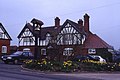
 The Bell Inn at Pensax - geograph.org.uk - 419535.jpg 640 × 426; 112 KB
-
 View to Abberley Hill - geograph.org.uk - 4293859.jpg 800 × 531; 97 KB
-
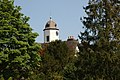 Cupola on Pensax Court - geograph.org.uk - 421675.jpg 640 × 426; 140 KB
-
 Lane at Snead Common - geograph.org.uk - 417543.jpg 640 × 426; 124 KB
-
 The Bell Inn, Pensax - geograph.org.uk - 76926.jpg 640 × 480; 149 KB


_-_geograph.org.uk_-_1087713.jpg)


