Category:Penwortham
town in South Ribble, Lancashire, England  | |||||
| Upload media | |||||
| Instance of | |||||
|---|---|---|---|---|---|
| Location | South Ribble, Lancashire, North West England, England | ||||
| Located in or next to body of water | |||||
| official website | |||||
 | |||||
English: Penwortham is a town and civil parish on the south bank of the River Ribble facing the city of Preston, England. The town is at the most westerly crossing point of the River Ribble, with major road and rail links crossing here. (→Penwortham)
Italiano: Penwortham è una cittadina di 23.436 abitanti del Lancashire, in Inghilterra. (→Penwortham)
Nederlands: Penwortham is een plaats en civil parish in het bestuurlijke gebied South Ribble, in het Engelse graafschap Lancashire met 23.436 inwoners. (→Penwortham)
Polski: Penwortham – miasto w Anglii, w hrabstwie Lancashire, w dystrykcie South Ribble. Leży 45 km na północny zachód od miasta Manchester i 304 km na północny zachód od Londynu. Miasto liczy 23 436 mieszkańców. (→Penwortham)
Subcategories
This category has the following 5 subcategories, out of 5 total.
Media in category "Penwortham"
The following 200 files are in this category, out of 259 total.
(previous page) (next page)-
 133-365 Pendolino at Penwortham Junction (51177479390).jpg 5,838 × 3,891; 3.45 MB
-
 A curious leveret - geograph.org.uk - 3939143.jpg 2,798 × 2,493; 7.27 MB
-

-

-
 A kayaker stood at the bus stop - geograph.org.uk - 225693.jpg 640 × 480; 56 KB
-
 A line of Trees - geograph.org.uk - 6153930.jpg 600 × 800; 1,020 KB
-
 A path through Blashaw Wood - geograph.org.uk - 3949789.jpg 4,592 × 3,056; 7.57 MB
-
 A power boat on the River Ribble - geograph.org.uk - 3939118.jpg 4,582 × 3,056; 6.84 MB
-
 A profusion of bluebells - geograph.org.uk - 3949878.jpg 4,592 × 3,056; 6.64 MB
-

-
 A small holding off The Cawsey - geograph.org.uk - 3641602.jpg 4,592 × 2,728; 7.89 MB
-
 A small tortoiseshell - geograph.org.uk - 3943270.jpg 3,244 × 1,749; 3.9 MB
-
 A stile on the footpath to Balshaw Farm - geograph.org.uk - 3642842.jpg 3,056 × 4,143; 7.75 MB
-
 A582 at Penwortham boundary - geograph.org.uk - 3809473.jpg 640 × 480; 45 KB
-
 A582 Golden Way roundabout - geograph.org.uk - 3813126.jpg 640 × 480; 45 KB
-
 A582 Penwortham Way - geograph.org.uk - 3809474.jpg 640 × 482; 50 KB
-

-

-
 A59, Liverpool Road - geograph.org.uk - 2974210.jpg 800 × 557; 88 KB
-
 Access road to tall electricity pylons - geograph.org.uk - 3981358.jpg 4,263 × 2,655; 4.61 MB
-
 AJ Busfield Ltd, Penwortham.JPG 4,608 × 3,456; 3.52 MB
-
 Allotments north of Liverpool Road - geograph.org.uk - 4257307.jpg 640 × 480; 87 KB
-

-
 Autumn leaves on the park - geograph.org.uk - 2133584.jpg 1,600 × 1,200; 474 KB
-
 Behind Studholme Crescent - geograph.org.uk - 3764615.jpg 640 × 480; 105 KB
-
 Beside The Pylons - geograph.org.uk - 6067942.jpg 640 × 430; 84 KB
-
 Bluebells - geograph.org.uk - 3949830.jpg 2,837 × 2,837; 5.34 MB
-
 Bridge on Former Railway Route - geograph.org.uk - 4337396.jpg 640 × 480; 405 KB
-
 Bridge over the A59 - geograph.org.uk - 4257306.jpg 640 × 480; 53 KB
-
 Building, Penwortham Golf Course - geograph.org.uk - 2173774.jpg 640 × 480; 126 KB
-
 Bus Stops on Hill Road South - geograph.org.uk - 4337310.jpg 640 × 480; 355 KB
-
 Businesses in Higher Penwortham - geograph.org.uk - 6068042.jpg 640 × 422; 70 KB
-
 By The River Ribble - geograph.org.uk - 6067932.jpg 640 × 384; 56 KB
-
 Cardinal Newman College sports fields - geograph.org.uk - 5471269.jpg 640 × 305; 109 KB
-
 Cardinal Newman College sports fields - geograph.org.uk - 5471271.jpg 640 × 339; 129 KB
-

-

-
 Carlisle Avenue - geograph.org.uk - 3949770.jpg 3,695 × 2,786; 7.71 MB
-
 Castle hill motte.jpg 1,534 × 1,024; 1.09 MB
-
 Clovelly Drive - Newlands Avenue - Penwortham - geograph.org.uk - 3981343.jpg 4,097 × 2,513; 3.99 MB
-
 Cobbles on Penwortham Bridge - geograph.org.uk - 3978535.jpg 3,648 × 2,736; 4.72 MB
-
 Coote Lane from Hern Avenue - geograph.org.uk - 3440379.jpg 800 × 600; 84 KB
-
 Cop Lane ^ Liverpool Road Junction - geograph.org.uk - 1951722.jpg 4,224 × 3,168; 5.73 MB
-
 Cop Lane, Higher Penwortham - geograph.org.uk - 4257302.jpg 640 × 480; 90 KB
-
 Cowslips - geograph.org.uk - 773325 (cropped).jpg 640 × 420; 129 KB
-
 Cowslips - geograph.org.uk - 773325.jpg 640 × 428; 132 KB
-
 Crooking Lane joins the A59 at Penwortham - geograph.org.uk - 3077069.jpg 1,600 × 1,198; 307 KB
-
 Crossing the River Ribble by train - geograph.org.uk - 5471251.jpg 640 × 202; 64 KB
-
 Crossing the River Ribble by train - geograph.org.uk - 5471254.jpg 640 × 317; 102 KB
-

-
 Cycle route signs on the B5254 - geograph.org.uk - 5841459.jpg 1,024 × 768; 295 KB
-
 Cycle track beside the A59 - geograph.org.uk - 4257266.jpg 640 × 480; 80 KB
-
 Dandelions on the park - geograph.org.uk - 1286643.jpg 640 × 426; 125 KB
-
 Dragonfly Carving, Higher Penwortham - geograph.org.uk - 4337205.jpg 640 × 640; 459 KB
-

-
 Electricity sub station - geograph.org.uk - 4257276.jpg 640 × 480; 59 KB
-
 Electricity sub station - geograph.org.uk - 4257282.jpg 640 × 480; 58 KB
-

-
 Entrance to Hurst Grange Park - geograph.org.uk - 4337268.jpg 640 × 480; 372 KB
-
 Entrance to Penwortham Golf Club - geograph.org.uk - 4337238.jpg 640 × 480; 301 KB
-
 Erysiphe fischeri on Broad Leaved Ragwort Senecio fluviatilis (25269505448).jpg 2,048 × 1,536; 381 KB
-
 Factory Lane - geograph.org.uk - 5471283.jpg 640 × 559; 168 KB
-
 Farington Curve Junction. (Bee Lane) - geograph.org.uk - 1105447.jpg 640 × 480; 110 KB
-
 Fish House Bridge - geograph.org.uk - 3978526.jpg 3,648 × 2,736; 4.27 MB
-
 Fishing is very relaxing - geograph.org.uk - 3939096.jpg 4,175 × 2,313; 7.95 MB
-
 Football at Penwortham Holme - geograph.org.uk - 2815151.jpg 3,872 × 2,592; 4.65 MB
-
 Footpath along the Ribble - geograph.org.uk - 3904162.jpg 3,303 × 2,442; 2.96 MB
-
 Footpath into the nature reserve - geograph.org.uk - 3939011.jpg 4,592 × 3,056; 7.75 MB
-
 Footpath to Howick Hall Farm - geograph.org.uk - 3938053.jpg 4,428 × 2,947; 7.88 MB
-
 Footpath towards the river - geograph.org.uk - 3949855.jpg 4,592 × 3,056; 7.52 MB
-
 Former bank building, Penwortham.JPG 4,608 × 3,456; 3.49 MB
-

-
 G-NWAA at Penwortham Road crash.jpg 800 × 600; 82 KB
-
 Ghost sign - geograph.org.uk - 2369941.jpg 1,536 × 2,048; 1.23 MB
-
 Ghost sign on the Bridge Inn - geograph.org.uk - 2369957.jpg 2,048 × 1,536; 1.23 MB
-
 Golden Way from Cop Lane Bridge - geograph.org.uk - 1951717.jpg 4,224 × 2,816; 5.4 MB
-
 Golden Way near Kingsfold - geograph.org.uk - 5950024.jpg 2,700 × 2,025; 372 KB
-
 Golden Way near Kingsfold - geograph.org.uk - 5950039.jpg 2,700 × 1,990; 457 KB
-
 Golden Way near Preston (geograph 5949981).jpg 2,700 × 1,982; 496 KB
-
 Golden Way near Preston - geograph.org.uk - 5949970.jpg 2,700 × 2,015; 570 KB
-
 Golden Way near Preston - geograph.org.uk - 5950018.jpg 2,700 × 1,991; 458 KB
-
 Golden Way-Penwortham Way - geograph.org.uk - 6153651.jpg 800 × 533; 552 KB
-
 Grazing, Middleforth Green - geograph.org.uk - 3381848.jpg 640 × 544; 104 KB
-
 Higher Penwortham - geograph.org.uk - 4337248.jpg 640 × 480; 267 KB
-
 Higher Penwortham Businesses - geograph.org.uk - 6068045.jpg 640 × 446; 93 KB
-
 Higher Penwortham, Blundell Lane - geograph.org.uk - 4337253.jpg 640 × 480; 260 KB
-
 Higher Penwortham, Liverpool Road - geograph.org.uk - 4337256.jpg 640 × 480; 357 KB
-
 Higher Penwortham, Marshalls Brow - geograph.org.uk - 4337312.jpg 640 × 480; 303 KB
-
 Hill Road Cemetery, Higher Penwortham - geograph.org.uk - 4337269.jpg 640 × 480; 367 KB
-
 House on Howick Cross Lane - geograph.org.uk - 4257269.jpg 640 × 480; 66 KB
-

-

-
 Houses on Liverpool Road (A59) - geograph.org.uk - 4257283.jpg 640 × 480; 56 KB
-
 Houses on Liverpool Road (A59) - geograph.org.uk - 4257286.jpg 640 × 480; 59 KB
-
 Howick C E School - geograph.org.uk - 4257258.jpg 640 × 406; 112 KB
-
 Howick Cross Lane - geograph.org.uk - 2173778.jpg 640 × 478; 99 KB
-
 Howick Cross Lane - geograph.org.uk - 2173779.jpg 640 × 480; 100 KB
-
 Howick Cross Lane - geograph.org.uk - 4257274.jpg 640 × 480; 52 KB
-
 Howick Cross Lane - geograph.org.uk - 4257277.jpg 640 × 480; 94 KB
-
 Howick Cross Lane - geograph.org.uk - 6153823.jpg 800 × 533; 802 KB
-
 Howick Cross Lane at the Sub Station - geograph.org.uk - 3981369.jpg 4,151 × 2,353; 4.74 MB
-
 Howick Cross Lane under power lines - geograph.org.uk - 4968780.jpg 640 × 480; 66 KB
-
 Howick Cross Lane, Penwortham - geograph.org.uk - 6153941.jpg 800 × 533; 790 KB
-
 Howick Hall Farm - geograph.org.uk - 6153933.jpg 800 × 601; 997 KB
-
 Howick Hall Wood - geograph.org.uk - 3912640.jpg 2,560 × 1,920; 3.59 MB
-
 Howick Hall Wood - geograph.org.uk - 4257273.jpg 640 × 480; 88 KB
-
 Howick Moor Lane, Penwortham (1).JPG 4,608 × 3,456; 3.42 MB
-
 Howick Moor Lane, Penwortham (2).JPG 4,608 × 3,456; 3.44 MB
-
 Howick Moor Lane, Penwortham (3).JPG 4,608 × 3,456; 3.41 MB
-
 Hurst Grange Park deserted in the rain - geograph.org.uk - 3950067.jpg 4,396 × 2,924; 6.16 MB
-

-
 Junction of A59 and Central Drive, Hutton, Lancashire - geograph.org.uk - 2641994.jpg 1,600 × 1,200; 515 KB
-

-
 Leyland Road - geograph.org.uk - 6153609.jpg 800 × 533; 579 KB
-
 Leyland Road heading to Preston - geograph.org.uk - 5990945.jpg 2,700 × 2,012; 467 KB
-
 Leyland Road heading to Preston - geograph.org.uk - 5990947.jpg 2,700 × 2,025; 373 KB
-
 Leyland Road heading to Preston - geograph.org.uk - 5990948.jpg 2,700 × 2,025; 382 KB
-
 Leyland Road heading to Preston - geograph.org.uk - 5990950.jpg 2,700 × 2,025; 539 KB
-
 Leyland Road heading to Preston - geograph.org.uk - 5990951.jpg 2,700 × 2,025; 602 KB
-
 Leyland Road heading to Preston - geograph.org.uk - 5990952.jpg 2,700 × 2,025; 406 KB
-
 Leyland Road heading to Preston - geograph.org.uk - 5990953.jpg 2,700 × 2,010; 369 KB
-
 Leyland Road heading to Preston - geograph.org.uk - 5990954.jpg 2,700 × 2,021; 646 KB
-
 Leyland Road passing the Sumpter Horse - geograph.org.uk - 5990949.jpg 2,700 × 2,025; 410 KB
-

-

-
 Liverpool Road (A59) - geograph.org.uk - 4257267.jpg 640 × 480; 66 KB
-
 Liverpool Road (A59) - geograph.org.uk - 4257285.jpg 640 × 480; 71 KB
-
 Liverpool Road (A59) - geograph.org.uk - 4257310.jpg 640 × 480; 101 KB
-

-
 Liverpool Road - Penwortham - geograph.org.uk - 3981348.jpg 4,590 × 2,769; 6.04 MB
-
 Liverpool Road, Higher Penwortham - geograph.org.uk - 2173762.jpg 640 × 480; 99 KB
-
 Liverpool Road, Penwortham.JPG 4,608 × 3,456; 3.25 MB
-
 Lostock Hall, Houses on Leyland Road - geograph.org.uk - 6153606.jpg 800 × 533; 534 KB
-
 Marsh Farm from Howick Cross Lane - geograph.org.uk - 4968786.jpg 640 × 480; 92 KB
-
 May blossom on Cop Lane - geograph.org.uk - 3950031.jpg 3,889 × 2,713; 6.17 MB
-
 Middleforth Hall, Penwortham.jpg 4,608 × 3,456; 5.47 MB
-
 Mill Brook Enters The Ribble - geograph.org.uk - 6067948.jpg 640 × 422; 68 KB
-
 Motte in St Mary's churchyard, Penwortham - geograph.org.uk - 2815231.jpg 3,872 × 2,592; 6.11 MB
-
 Newt Carving, Higher Penwortham - geograph.org.uk - 4337200.jpg 640 × 640; 472 KB
-
 Old Penwortham Bridge - geograph.org.uk - 1005262.jpg 640 × 480; 108 KB
-

-
 On The Ribble Way - geograph.org.uk - 6067899.jpg 640 × 455; 159 KB
-
 Otter Carving, Higher Penwortham - geograph.org.uk - 4337183.jpg 640 × 640; 464 KB
-
 Our "non-existent" road ^^ - geograph.org.uk - 524122.jpg 640 × 427; 135 KB
-
 Owl Carving, Higher Penwortham - geograph.org.uk - 4337176.jpg 640 × 480; 432 KB
-
 Path from Hollinhurst Avenue to Church Avenue - geograph.org.uk - 2815215.jpg 3,872 × 2,592; 4.79 MB
-
 Pathway from Bee Lane to Sumpter Croft - geograph.org.uk - 1385975.jpg 640 × 480; 144 KB
-
 Pear Tree Garage - geograph.org.uk - 1377753.jpg 640 × 480; 70 KB
-
 Pear Tree pub on the B5254 - geograph.org.uk - 3440409.jpg 640 × 480; 60 KB
-
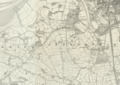 Penwortham 1840.png 4,493 × 3,178; 27.97 MB
-
 Penwortham 1888.png 4,493 × 3,178; 19.95 MB
-
 Penwortham 1949.png 4,493 × 3,178; 22.78 MB
-
 Penwortham 400kV Substation - geograph.org.uk - 6153939.jpg 800 × 533; 722 KB
-

-
 Penwortham Bridge - geograph.org.uk - 3904032.jpg 3,648 × 2,736; 4.78 MB
-
 Penwortham Bridge - geograph.org.uk - 5378581.jpg 3,456 × 2,304; 6.23 MB
-
 Penwortham Bridge - geograph.org.uk - 5378586.jpg 3,456 × 2,304; 6.18 MB
-
 Penwortham Bridge - geograph.org.uk - 5488710.jpg 1,024 × 768; 187 KB
-
 Penwortham Bridge, Preston - geograph.org.uk - 4315467.jpg 640 × 480; 323 KB
-
 Penwortham Bridge, Preston - geograph.org.uk - 5141189.jpg 640 × 420; 149 KB
-
 Penwortham Bridge.jpg 5,232 × 2,037; 5.27 MB
-
 Penwortham Brow - geograph.org.uk - 4337259.jpg 640 × 480; 356 KB
-
 Penwortham Cricket Club - Ground - geograph.org.uk - 3294447.jpg 1,600 × 1,200; 281 KB
-
 Penwortham Cricket Club - Pavilion - geograph.org.uk - 3294457.jpg 1,600 × 1,200; 466 KB
-
 Penwortham Fire Station - geograph.org.uk - 2087265.jpg 1,200 × 832; 213 KB
-
 Penwortham Golf Course - geograph.org.uk - 2815185.jpg 3,872 × 2,592; 5.7 MB
-
 Penwortham Library.JPG 4,608 × 3,456; 3.35 MB
-
 Penwortham Mill (geograph 4781246).jpg 2,816 × 2,112; 2.65 MB
-
 Penwortham Mill - geograph.org.uk - 4781245.jpg 2,816 × 2,112; 2.91 MB
-
 Penwortham Mill - geograph.org.uk - 962961.jpg 640 × 423; 115 KB
-
 Penwortham Mill - geograph.org.uk - 964479.jpg 640 × 427; 94 KB
-
 Penwortham Mill - geograph.org.uk - 964488.jpg 640 × 427; 100 KB
-
 Penwortham Tower 1.jpg 1,956 × 2,184; 2.36 MB
-
 Penwortham Tower 2.jpg 1,874 × 2,250; 2.39 MB
-
 Penwortham Tower 3.jpg 2,020 × 2,571; 2.72 MB
-
 Penwortham War Memorial - geograph.org.uk - 6067903.jpg 640 × 480; 176 KB
-
 Penwortham water tower - geograph.org.uk - 1530635.jpg 640 × 498; 70 KB
-
 Penwortham Water Tower - geograph.org.uk - 2040220.jpg 426 × 640; 51 KB
-
 Penwortham waterboard.jpg 1,600 × 1,200; 384 KB
-

-
 Penwortham Way near White Stake - geograph.org.uk - 5950047.jpg 2,700 × 1,966; 574 KB
-
 Penwortham West Allotments - geograph.org.uk - 2815160.jpg 3,872 × 2,592; 5.96 MB
-
 Penwortham, Blackthorn Drive - geograph.org.uk - 6153653.jpg 800 × 533; 655 KB
-
 Pipeline across the Ribble - geograph.org.uk - 3978543.jpg 3,648 × 2,736; 4.85 MB
-
 Playing Fields, Cardinal Newman College - geograph.org.uk - 5323517.jpg 1,600 × 793; 178 KB
-
 Pope Lane - Kingsfold - geograph.org.uk - 1951711.jpg 4,224 × 2,816; 5.45 MB
-

-
 Pumping Station, Penwortham Golf Course - geograph.org.uk - 2173769.jpg 640 × 480; 132 KB
-
 Pylon at Penwortham Electricity Sub Station - geograph.org.uk - 3981366.jpg 2,790 × 4,608; 5.8 MB
-
 Queensway View - geograph.org.uk - 6068044.jpg 640 × 414; 98 KB
-
 Railway Bridge - geograph.org.uk - 5460396.jpg 1,280 × 960; 1.17 MB
-
 Railway viaduct, Miller Park, Preston - geograph.org.uk - 5110190.jpg 640 × 637; 219 KB
-
 Reclaimed green space - geograph.org.uk - 2815198.jpg 3,872 × 2,592; 5.16 MB
-
 Reed Rains Estate Agent, Penwortham - geograph.org.uk - 5068725.jpg 682 × 1,024; 131 KB
-
 Ribble GSP Electricity Substation - geograph.org.uk - 4337227.jpg 640 × 481; 336 KB
-
 Ribble GSP substation - geograph.org.uk - 2815192.jpg 3,872 × 2,592; 4.36 MB
-
 Ribble Viaduct - geograph.org.uk - 6402421.jpg 4,000 × 3,000; 3.05 MB
-
 Ribble Viaduct from Riverside Road - geograph.org.uk - 5488716.jpg 1,024 × 768; 206 KB
-
 Ribble Way View - geograph.org.uk - 6067924.jpg 640 × 424; 104 KB
-
 Ribble Way, Higher Penwortham - geograph.org.uk - 4337159.jpg 640 × 480; 316 KB
.jpg)


.jpg)


_-_geograph.org.uk_-_4315135.jpg)


.jpg)

_-_geograph.org.uk_-_1105447.jpg)


.jpg)


_-_geograph.org.uk_-_4257283.jpg)
_-_geograph.org.uk_-_4257286.jpg)


.JPG)
.JPG)
.JPG)

,_Higher_Penwortham_-_geograph.org.uk_-_4257293.jpg)


_-_geograph.org.uk_-_4257267.jpg)
_-_geograph.org.uk_-_4257285.jpg)
_-_geograph.org.uk_-_4257310.jpg)
,_Higher_Penwortham_-_geograph.org.uk_-_4257289.jpg)


.jpg)


_towards_Preston_-_geograph.org.uk_-_5955018.jpg)


,_Higher_Penwortham_-_geograph.org.uk_-_4257292.jpg)


