Category:Perris & Browne maps of Manhattan published in 1857
Maps from: Perris, William. Maps of the City of New-York (New York: Perris & Browne) in seven volumes, each composed of section maps and title page with volume index (all double-page plates except Plate 66½).
- Volume 1 Third Edition (1857), 18 section maps (Plate 1–18).
- Volume 2 Third Edition (1857), 12 section maps (Plate 19–30).
This category includes TIF versions of both volume keys and Plate 18.
Source: The New York Public Library Digital Collections website, Maps of the city of New York [1857–1862].
Media in category "Perris & Browne maps of Manhattan published in 1857"
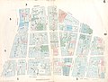
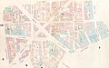
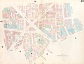
The following 40 files are in this category, out of 40 total.
-
 Volume 1 Index Map.) NYPL1268409.tiff 6,299 × 4,880; 87.97 MB
-
 Perris Manhattan V. 1 title page and volume key publ. 1857.jpg 5,991 × 4,356; 7.84 MB
-
 Perris Manhattan V. 1 title page and volume key (small) publ. 1857.jpg 2,442 × 1,754; 1.24 MB
-
 Volume 2 Index Map.) NYPL1268410.tiff 6,299 × 4,880; 87.97 MB
-
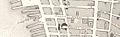 Jersey City Ferry1857 (cropped).jpg 1,095 × 336; 163 KB
-
 Perris Manhattan V. 2 title page and volume key publ. 1857.jpg 6,038 × 4,386; 6.95 MB
-
 Perris Manhattan V. 1 Plate 001 publ. 1857.jpg 5,948 × 4,229; 4.52 MB
-
 Perris Manhattan V. 1 Plate 002 publ. 1857.jpg 5,965 × 4,501; 4.68 MB
-
 Perris Manhattan V. 1 Plate 003 publ. 1857 (cropped).jpg 1,503 × 1,456; 411 KB
-
 Perris Manhattan V. 1 Plate 003 publ. 1857.jpg 5,907 × 4,525; 4.99 MB
-
 Perris Manhattan V. 1 Plate 004 publ. 1857.jpg 6,057 × 4,341; 4.72 MB
-
 Perris Manhattan V. 1 Plate 005 publ. 1857.jpg 6,048 × 4,488; 5.05 MB
-
 Perris Manhattan V. 1 Plate 006 publ. 1857.jpg 5,983 × 4,516; 4.97 MB
-
 Perris Manhattan V. 1 Plate 007 publ. 1857.jpg 6,074 × 4,360; 4.69 MB
-
 Perris Manhattan V. 1 Plate 008 publ. 1857.jpg 5,783 × 4,335; 4.42 MB
-
 Perris Manhattan V. 1 Plate 009 publ. 1857.jpg 6,032 × 4,086; 4.86 MB
-
 Perris Manhattan V. 1 Plate 010 publ. 1857 (cropped).jpg 5,807 × 3,613; 3.96 MB
-
 Perris Manhattan V. 1 Plate 010 publ. 1857.jpg 5,939 × 4,530; 4.94 MB
-
 Perris Manhattan V. 1 Plate 011 publ. 1857.jpg 6,057 × 4,445; 5.11 MB
-
 Perris Manhattan V. 1 Plate 012 publ. 1857.jpg 5,969 × 4,382; 4.63 MB
-
 Perris Manhattan V. 1 Plate 013 publ. 1857.jpg 5,737 × 4,529; 4.33 MB
-
 Perris Manhattan V. 1 Plate 014 publ. 1857 (crop 1).jpg 3,939 × 3,490; 11.11 MB
-
 Perris Manhattan V. 1 Plate 014 publ. 1857.jpg 5,707 × 4,479; 4.84 MB
-
 Perris Manhattan V. 1 Plate 015 publ. 1857.jpg 5,870 × 3,997; 4.21 MB
-
 Perris Manhattan V. 1 Plate 016 publ. 1857.jpg 6,083 × 3,944; 3.71 MB
-
 Perris Manhattan V. 1 Plate 017 publ. 1857.jpg 5,649 × 4,503; 4.82 MB
-
 Perris Manhattan V. 1 Plate 018 publ. 1857.tif 6,299 × 4,880; 87.97 MB
-
 Perris Manhattan V. 1 Plate 18 publ. 1857.jpg 5,758 × 4,508; 6.35 MB
-
 Perris Manhattan V. 2 Plate 019 publ. 1857.jpg 5,641 × 3,900; 3.98 MB
-
 Perris Manhattan V. 2 Plate 020 publ. 1857.jpg 5,874 × 4,264; 4.45 MB
-
 Perris Manhattan V. 2 Plate 021 publ. 1857.jpg 6,075 × 4,538; 5.31 MB
-
 Perris Manhattan V. 2 Plate 022 publ. 1857.jpg 5,536 × 4,453; 4.78 MB
-
 Perris Manhattan V. 2 Plate 023 publ. 1857.jpg 6,125 × 4,528; 5.72 MB
-
 Perris Manhattan V. 2 Plate 024 publ. 1857.jpg 5,855 × 4,535; 5.28 MB
-
 Perris Manhattan V. 2 Plate 025 publ. 1857.jpg 6,050 × 4,528; 5.99 MB
-
 Perris Manhattan V. 2 Plate 026 publ. 1857.jpg 6,101 × 4,527; 5.31 MB
-
 Perris Manhattan V. 2 Plate 027 publ. 1857.jpg 5,606 × 4,538; 4.58 MB
-
 Perris Manhattan V. 2 Plate 028 publ. 1857.jpg 6,104 × 4,538; 5.52 MB
-
 Perris Manhattan V. 2 Plate 029 publ. 1857.jpg 6,089 × 4,539; 5.13 MB
-
 Perris Manhattan V. 2 Plate 030 publ. 1857.jpg 5,718 × 4,428; 4.6 MB

_publ._1857.jpg)


.jpg)


.jpg)


.jpg)


.jpg)