Category:Pfarrhaus Aarau
| Object location | | View all coordinates using: OpenStreetMap |
|---|
building in Aarau in the canton of Aargau, Switzerland  | |||||
| Upload media | |||||
| Instance of | |||||
|---|---|---|---|---|---|
| Part of | |||||
| Location | Aarau, Aarau District, Aargau, Switzerland | ||||
| Street address |
| ||||
| Located on street |
| ||||
| Architectural style | |||||
| Architect | |||||
| Heritage designation | |||||
| Inception |
| ||||
 | |||||
Media in category "Pfarrhaus Aarau"
The following 6 files are in this category, out of 6 total.
-
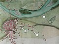 Aarau mit Telliring 1809.jpg 720 × 540; 117 KB
-
 Hieronymus Meyer 2004.10.14.S015.tif 998 × 1,497, 2 pages; 4.33 MB
-
 Johann Rudolf Meyer Sohn 2004.11.12.S003.tif 980 × 1,471, 2 pages; 4.18 MB
-
 Meyerhaus Neujahrsblätter 1939.jpg 2,174 × 1,320; 2.71 MB
-
 Meyersche-Stollen C012597.jpg 4,032 × 3,024; 7.83 MB
-
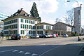 RömkatPfarrhaus-Kirche-Aarau01.jpg 3,045 × 2,030; 1.14 MB


