Category:Pfarrhof Perwang am Grabensee
| Object location | | View all coordinates using: OpenStreetMap |
|---|
building in Perwang am Grabensee, Upper Austrian, Austria _-_Gesamtanlage.jpg) | |||||
| Upload media | |||||
| Instance of | |||||
|---|---|---|---|---|---|
| Location | Perwang am Grabensee, Braunau District, Upper Austria, Austria | ||||
| Street address |
| ||||
| Heritage designation | |||||
 | |||||
Media in category "Pfarrhof Perwang am Grabensee"
The following 10 files are in this category, out of 10 total.
-
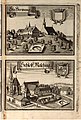 Historico-Topographica Descriptio. 2. Das Renntambt Burgkhausen 374.jpg 4,979 × 7,396; 4.13 MB
-
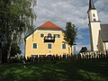
 Perwang - Ort - Pfarrhof - 2019 08 06 - 1.jpg 5,184 × 3,456; 3.86 MB
-
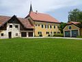
 Perwang - Ort - Pfarrhof - 2019 08 06 - 2.jpg 5,184 × 3,456; 4.41 MB
-
 Perwang - Ort - Pfarrhof - 2019 08 06 - 3.jpg 3,456 × 5,184; 3.94 MB
-
 Perwang-neu.jpg 640 × 475; 72 KB
-
 Pfarrhof Perwang Eingang.JPG 2,272 × 1,704; 1.77 MB
-
 Pfarrhof Perwang.JPG 2,272 × 1,704; 1.83 MB
-
 Schloss Perwang (Perwang am Grabensee) - Gesamtanlage.jpg 640 × 480; 58 KB
-
 Schloss Perwang (Perwang am Grabensee) - Pfarrhof.jpg 640 × 480; 62 KB
-
 Schloss Perwang (Perwang am Grabensee) - Wirtschaftsgebäude.jpg 640 × 480; 78 KB


_-_Pfarrhof.jpg)
_-_Wirtschaftsgeb%C3%A4ude.jpg)