Category:Pfarrkirche Brunn am Gebirge
| Object location | | View all coordinates using: OpenStreetMap |
|---|
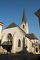
parish church and cemetery in Brunn am Gebirge, Austria   | |||||
| Upload media | |||||
| Instance of | |||||
|---|---|---|---|---|---|
| Location | Brunn am Gebirge, Mödling District, Lower Austria, Austria | ||||
| Street address |
| ||||
| Diocese | |||||
| Heritage designation | |||||
 | |||||
Deutsch: Diese Kategorie enthält Fotos der Pfarrkirche Brunn am Gebirge in Brunn am Gebirge in Niederösterreich
Subcategories
This category has the following 3 subcategories, out of 3 total.
I
Media in category "Pfarrkirche Brunn am Gebirge"
The following 6 files are in this category, out of 6 total.
-
 Brunn am Gebirge - Kirche.JPG 3,363 × 3,180; 8.29 MB
-
 Brunn am Gebirge 6991.jpg 3,888 × 2,592; 837 KB
-
 Brunn am Gebirge 6996.jpg 2,592 × 3,888; 1.69 MB
-
 Brunn am Gebirge 7010.jpg 2,592 × 3,888; 783 KB
-
 Brunn Pfarrkirche - Westfassade 1.jpg 3,000 × 4,000; 6.25 MB
-
 Brunn Pfarrkirche - Westfassade 2 Fensterrose.jpg 3,160 × 2,980; 6.65 MB


