Category:Pfarrkirche Dietwil
| Object location | | View all coordinates using: OpenStreetMap |
|---|
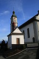
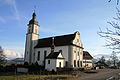
church building in Dietwil in the canton of Aargau, Switzerland .jpg) | |||||
| Upload media | |||||
| Instance of | |||||
|---|---|---|---|---|---|
| Part of | |||||
| Named after | |||||
| Location | Dietwil, Muri District, Aargau, Switzerland | ||||
| Street address |
| ||||
| Architectural style | |||||
| Has part(s) | |||||
| Heritage designation | |||||
 | |||||
Media in category "Pfarrkirche Dietwil"
The following 41 files are in this category, out of 41 total.
-
 2013-01-12 Dietwil Beinhaus Kirche.jpg 2,592 × 3,888; 2.98 MB
-
 2013-01-12 Dietwil Kirche (2).jpg 3,888 × 2,592; 2.41 MB
-
 2013-01-12 Dietwil Kirche (3).jpg 3,888 × 2,592; 3 MB
-
 2013-01-12 Dietwil Kirche (4).jpg 3,888 × 2,592; 2.89 MB
-
 2013-01-12 Dietwil Kirche (5).jpg 3,888 × 2,592; 2.87 MB
-
 2013-01-12 Dietwil Kirche Beinhaus (2).jpg 3,888 × 2,592; 3.19 MB
-
 2013-01-12 Dietwil Kirche Beinhaus (3).jpg 3,888 × 2,592; 3.11 MB
-
 2013-01-12 Dietwil Kirche Beinhaus (4).jpg 2,592 × 3,888; 3.12 MB
-
 2013-01-12 Dietwil Kirche Beinhaus.jpg 3,888 × 2,592; 3.2 MB
-
 2013-01-12 Dietwil Kirche innen (2).jpg 2,592 × 3,888; 3.6 MB
-
 2013-01-12 Dietwil Kirche innen (3).jpg 3,888 × 2,592; 3.28 MB
-
 2013-01-12 Dietwil Kirche innen (4).jpg 3,888 × 2,592; 4.32 MB
-
 2013-01-12 Dietwil Kirche innen (5).jpg 3,888 × 2,592; 3.1 MB
-
 2013-01-12 Dietwil Kirche innen (6).jpg 2,592 × 3,888; 3.2 MB
-
 2013-01-12 Dietwil Kirche innen (7).jpg 3,888 × 2,592; 3.87 MB
-
 2013-01-12 Dietwil Kirche innen (8).jpg 3,888 × 2,592; 3.72 MB
-
 2013-01-12 Dietwil Kirche innen (9).jpg 2,592 × 3,888; 3.9 MB
-
 2013-01-12 Dietwil Kirche innen Detail Kanzel.jpg 3,888 × 2,592; 4.04 MB
-
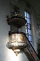 2013-01-12 Dietwil Kirche innen Kanzel.jpg 2,592 × 3,888; 2.73 MB
-
 2013-01-12 Dietwil Kirche innen Krippe.jpg 2,592 × 3,888; 4.1 MB
-
 2013-01-12 Dietwil Kirche innen Kruzifix (2).jpg 3,888 × 2,592; 3.48 MB
-
 2013-01-12 Dietwil Kirche innen Kruzifix.jpg 2,592 × 3,888; 3.67 MB
-
 2013-01-12 Dietwil Kirche innen Seitenaltar rechts.jpg 2,592 × 3,888; 4.3 MB
-
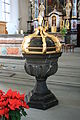 2013-01-12 Dietwil Kirche innen Taufstein.jpg 2,592 × 3,888; 3.83 MB
-
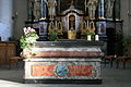 2013-01-12 Dietwil Kirche innen Volksaltar.jpg 3,888 × 2,592; 3.87 MB
-
 2013-01-12 Dietwil Kirche innen Wappen Bern.jpg 3,888 × 2,592; 3.64 MB
-
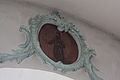 2013-01-12 Dietwil Kirche innen Wappen Glarus.jpg 3,888 × 2,592; 3.43 MB
-
 2013-01-12 Dietwil Kirche innen Wappen Luzern.jpg 3,888 × 2,592; 3.73 MB
-
 2013-01-12 Dietwil Kirche innen Wappen Schwyz.jpg 3,888 × 2,592; 3.51 MB
-
 2013-01-12 Dietwil Kirche innen Wappen Unterwalden.jpg 3,888 × 2,592; 3.48 MB
-
 2013-01-12 Dietwil Kirche innen Wappen Uri.jpg 3,888 × 2,592; 3.47 MB
-
 2013-01-12 Dietwil Kirche innen Wappen Zug.jpg 3,888 × 2,592; 3.58 MB
-
 2013-01-12 Dietwil Kirche innen Wappen Zürich.jpg 3,888 × 2,592; 3.23 MB
-
 2013-01-12 Dietwil Kirche innen.jpg 3,888 × 2,592; 4.48 MB
-
 2013-01-12 Dietwil Kirche.jpg 3,888 × 2,592; 3.58 MB
-
 2013-01-12 Dietwil Kirchturm.jpg 2,592 × 3,888; 2.62 MB
-
 2013-01-12 Dietwil Kirchturmuhr.jpg 3,888 × 2,592; 3.19 MB
-
 2013-01-12 Dietwil Pfarrhaus (2).jpg 3,888 × 2,592; 3.33 MB
-
 2013-01-12 Dietwil Pfarrhaus Kirche.jpg 3,888 × 2,592; 3.4 MB
-
 2013-01-12 Dietwil.jpg 3,888 × 2,592; 2.74 MB
-
 Dietwil-Preghejo 250.jpg 3,872 × 2,592; 4.36 MB

.jpg)
.jpg)
.jpg)
.jpg)
.jpg)
.jpg)

.jpg)
.jpg)
.jpg)
.jpg)
.jpg)
.jpg)
.jpg)
.jpg)


.jpg)


.jpg)


