Category:Pill and Easton-in-Gordano
English: Pill and Easton-in-Gordano is a civil parish in the North Somerset district, in the county of Somerset, England.
civil parish in North Somerset, Somerset, England | |||||
| Upload media | |||||
| Instance of | |||||
|---|---|---|---|---|---|
| Location | North Somerset, Somerset, South West England, England | ||||
 | |||||
Subcategories
This category has the following 2 subcategories, out of 2 total.
E
P
Media in category "Pill and Easton-in-Gordano"
The following 187 files are in this category, out of 187 total.
-
 A geological unconformity in Summer House Wood - geograph.org.uk - 5197172.jpg 3,648 × 2,048; 2.3 MB
-
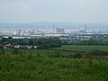 A haze of industry - geograph.org.uk - 6146583.jpg 3,296 × 2,472; 3.25 MB
-
 A muddy rhyne draining the salt marsh at Sheepway - geograph.org.uk - 2374727.jpg 3,072 × 2,304; 3.45 MB
-
 Access track to the Rock Cottages sewage pumping station - geograph.org.uk - 3521178.jpg 3,648 × 2,736; 4.09 MB
-

-

-

-
 Approaching Junction 19 on the M5 - geograph.org.uk - 1526574.jpg 640 × 480; 50 KB
-
 Avonmouth - Container Port - geograph.org.uk - 5266999.jpg 2,560 × 1,920; 1.97 MB
-
 Avonmouth and the Bristol Channel - geograph.org.uk - 5961873.jpg 2,304 × 1,704; 1.18 MB
-
 Avonmouth, Portbury Docks - geograph.org.uk - 6129635.jpg 800 × 600; 551 KB
-
 Barns at Happerton Farm - geograph.org.uk - 2474761.jpg 640 × 480; 84 KB
-
 Bridleway by Royal Portbury Dock Road - geograph.org.uk - 4517820.jpg 1,920 × 1,440; 981 KB
-
 Bridleway crossing Marsh Lane - geograph.org.uk - 4514679.jpg 1,920 × 1,434; 483 KB
-
 Bristol , Avonmouth View - geograph.org.uk - 2793922.jpg 3,605 × 2,393; 3.12 MB
-
 Bristol , Avonmouth View - geograph.org.uk - 2793925.jpg 4,288 × 2,848; 4.09 MB
-
 Bristol , The Royal Portberry Dock - geograph.org.uk - 4616034.jpg 4,225 × 2,806; 6.47 MB
-
 Bristol to Portishead road near Easton - geograph.org.uk - 2395175.jpg 3,685 × 2,769; 4.34 MB
-
 Broken Gate - geograph.org.uk - 2475113.jpg 640 × 455; 84 KB
-
 Bungalows in Lodway - geograph.org.uk - 5683693.jpg 640 × 427; 205 KB
-
 Car access to Gordano service area - geograph.org.uk - 2080953.jpg 640 × 480; 74 KB
-
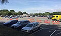 Car park, M5 Gordano Services, west of Bristol - geograph.org.uk - 5855224.jpg 1,024 × 614; 779 KB
-
 Car parking, Gordano services - geograph.org.uk - 2080962.jpg 640 × 480; 59 KB
-
 Chapel Pill inlet at low tide - River Avon - geograph.org.uk - 2399511.jpg 4,000 × 3,000; 4.19 MB
-

-
 Coal handling facility at Portbury Dock - geograph.org.uk - 5302027.jpg 1,024 × 683; 143 KB
-
 Coal transporting facility at Portbury Docks - geograph.org.uk - 5302049.jpg 1,024 × 685; 119 KB
-
 Coal unloading drill and ship in Royal Portbury Dock - geograph.org.uk - 2640056.jpg 3,072 × 2,304; 3.73 MB
-
 Cold store, Sheepway - geograph.org.uk - 4517777.jpg 1,920 × 2,560; 684 KB
-
 Countryside near Easton - geograph.org.uk - 2475116.jpg 640 × 480; 95 KB
-
 Crockerne Pill - geograph.org.uk - 6080212.jpg 1,024 × 683; 200 KB
-
 Crockerne Pill and the River Avon - geograph.org.uk - 6080211.jpg 1,024 × 683; 186 KB
-

-
 Cycle path number 26 from Bristol to Portishead - geograph.org.uk - 3521084.jpg 3,648 × 2,736; 3.03 MB
-
 Cycle way under road bridge - geograph.org.uk - 2482290.jpg 640 × 480; 89 KB
-
 Designated dog-walking area at Gordano Services - geograph.org.uk - 5439617.jpg 5,820 × 3,880; 6.87 MB
-

-
 Easton In Gordano - geograph.org.uk - 4057214.jpg 1,024 × 768; 201 KB
-
 Easton in Gordano Cricket Club pavilion - geograph.org.uk - 5572056.jpg 3,264 × 2,448; 1.9 MB
-

-
 Eden Office Park - geograph.org.uk - 4514076.jpg 1,920 × 1,097; 435 KB
-
 Eirene Terrace, Pill - geograph.org.uk - 4514370.jpg 1,920 × 1,440; 593 KB
-
 Empty car park by Gordano Way - geograph.org.uk - 4514772.jpg 3,930 × 2,664; 1.11 MB
-
 Empty storage area in Royal Portbury Docks - geograph.org.uk - 3521063.jpg 1,824 × 1,368; 695 KB
-

-

-
 Farm Track - geograph.org.uk - 2085897.jpg 3,072 × 2,304; 3.74 MB
-
 Field and footpath adjacent to Summer House Wood - geograph.org.uk - 5197240.jpg 3,648 × 2,048; 1.44 MB
-
 Field edge boundary adjacent to Summer House Wood - geograph.org.uk - 5197222.jpg 3,648 × 2,048; 2.74 MB
-
 Field, Easton-in-Gordano - geograph.org.uk - 4514460.jpg 1,920 × 1,269; 623 KB
-
 Former railtrack of the Bristol to Portishead Railway - geograph.org.uk - 3521072.jpg 3,648 × 2,736; 4.55 MB
-
 Former railway line near Easton-in-Gordano - geograph.org.uk - 4514664.jpg 1,920 × 1,367; 610 KB
-
 Former railway track runs under a bridge in Marsh Lane - geograph.org.uk - 3521100.jpg 1,824 × 1,368; 729 KB
-
 Gate into Pill Paddock - geograph.org.uk - 4196792.jpg 1,920 × 1,380; 1.06 MB
-

-
 Gordano Services - geograph.org.uk - 5439868.jpg 6,000 × 4,000; 4.17 MB
-
 Gordano Services - geograph.org.uk - 5439881.jpg 6,000 × 4,000; 3.58 MB
-
 Gordano Services - geograph.org.uk - 6258405.jpg 4,608 × 2,184; 2.73 MB
-
 Gordano services car park - geograph.org.uk - 3093589.jpg 1,024 × 768; 152 KB
-
 Gordano Services car park - geograph.org.uk - 5439632.jpg 6,000 × 4,000; 6.38 MB
-
 Gordano Services carpark - geograph.org.uk - 3801956.jpg 1,306 × 979; 365 KB
-
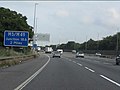
 Gordano Services on the M5 - geograph.org.uk - 3089301.jpg 1,024 × 768; 138 KB
-
 Gordano Services, M5 Junction 19 - geograph.org.uk - 6206589.jpg 1,024 × 768; 179 KB
-
 Grass area above Crockerne Pill - geograph.org.uk - 6080234.jpg 1,024 × 683; 187 KB
-
 Grotesque, St George's church, Easton-in-Gordano - geograph.org.uk - 4196803.jpg 1,920 × 2,265; 842 KB
-
 Ham Green freshwater fishing lake - geograph.org.uk - 3521136.jpg 3,648 × 2,736; 4.21 MB
-
 Happerton Farm (geograph 7125610).jpg 1,481 × 1,103; 212 KB
-

-
 Horse Chestnut, Ham Green - geograph.org.uk - 4514063.jpg 1,920 × 2,560; 1.35 MB
-
 Houses at Ham Green - geograph.org.uk - 5683666.jpg 640 × 427; 247 KB
-
 Houses in Lodway - geograph.org.uk - 5683674.jpg 640 × 480; 190 KB
-
 Houses in Lodway - geograph.org.uk - 5683731.jpg 640 × 444; 217 KB
-
 Houses in Lodway - geograph.org.uk - 5683743.jpg 640 × 427; 169 KB
-
 Houses in Pill - geograph.org.uk - 5683653.jpg 640 × 480; 223 KB
-
 Imported cars and ship at Royal Portbury Dock - geograph.org.uk - 5302273.jpg 1,024 × 683; 157 KB
-
 Imported cars stored under M5 - geograph.org.uk - 5301997.jpg 1,024 × 683; 156 KB
-
 Landing stage at Pill harbour - geograph.org.uk - 3339376.jpg 4,752 × 3,168; 3.84 MB
-
 Looking down onto the railway at Pill - geograph.org.uk - 6080238.jpg 1,024 × 683; 192 KB
-
 Looking downstream over the Markham Brook - geograph.org.uk - 4777813.jpg 2,048 × 3,648; 2.53 MB
-
 Looking upstream over the Markham Brook - geograph.org.uk - 4777817.jpg 2,048 × 3,648; 2.38 MB
-
 M5 at Easton-in-Gordano - geograph.org.uk - 4514629.jpg 1,920 × 1,343; 452 KB
-
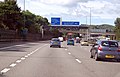
 M5 at junction 19 - geograph.org.uk - 2104024.jpg 640 × 480; 76 KB
-
 M5 Avonmouth bridge - south of the Avon - geograph.org.uk - 6080230.jpg 1,024 × 683; 135 KB
-
 M5 Gordano Services – the view from the edge of the woodland - geograph.org.uk - 5855249.jpg 1,024 × 1,024; 1.87 MB
-
 M5 Motorway - 1 mile to junction 18 - geograph.org.uk - 2081097.jpg 640 × 480; 69 KB
-
 M5 Motorway - 2 miles to the M49 - geograph.org.uk - 2081088.jpg 640 × 480; 59 KB
-
 M5 Motorway - exiting at junction 19 - geograph.org.uk - 2080937.jpg 640 × 480; 64 KB
-

-

-

-

-
 M5 Motorway from Gordano Services - geograph.org.uk - 2690270.jpg 640 × 480; 61 KB
-
 M5 Motorway Northbound - Sign for A4 - geograph.org.uk - 2625703.jpg 640 × 480; 86 KB
-
 M5 near Easton-in-Gordano - geograph.org.uk - 2305315.jpg 2,327 × 1,523; 2.64 MB
-
 M5 near Easton-in-Gordano - geograph.org.uk - 3753752.jpg 2,729 × 1,762; 2.62 MB
-
 M5 Northbound - geograph.org.uk - 3093599.jpg 1,024 × 768; 165 KB
-
 M5 southbound approaching Jn 19 - geograph.org.uk - 2937640.jpg 1,024 × 690; 85 KB
-
 M5 southbound near Lodway - geograph.org.uk - 5812519.jpg 1,024 × 769; 94 KB
-
 M5 towards Gordano services - geograph.org.uk - 3753720.jpg 2,692 × 1,698; 2.01 MB
-
 Marsh Lane - geograph.org.uk - 1459342.jpg 640 × 480; 243 KB
-
 Marsh Lane - geograph.org.uk - 3521033.jpg 1,824 × 1,368; 776 KB
-
 Marsh Lane - geograph.org.uk - 4514632.jpg 1,920 × 2,386; 1.35 MB
-
 Marsh Lane Industrial Estate - geograph.org.uk - 3521024.jpg 1,824 × 1,368; 547 KB
-
 Marsh Lane, Easton-in-Gordano - geograph.org.uk - 4514547.jpg 1,920 × 1,328; 476 KB
-

-
 MG cars stored at the Portbury Coal Terminal - geograph.org.uk - 5302322.jpg 1,024 × 683; 118 KB
-

-
 Mucking about at Pill - geograph.org.uk - 1813352.jpg 581 × 387; 57 KB
-
 NCN 26 near Sheepway - geograph.org.uk - 4517762.jpg 1,920 × 2,344; 1.29 MB
-
 North Somerset , Avonmouth Scenery - geograph.org.uk - 3723356.jpg 4,246 × 2,784; 6.27 MB
-
 North Somerset , Gordano Services - geograph.org.uk - 3723346.jpg 4,288 × 2,848; 5.39 MB
-
 North Somerset , Gordano Services - geograph.org.uk - 5900812.jpg 6,000 × 4,000; 7.13 MB
-
 North Somerset , M5 Motorway - geograph.org.uk - 5951247.jpg 6,000 × 4,000; 6.51 MB
-
 North Somerset , M5 Motorway - geograph.org.uk - 5951248.jpg 6,000 × 4,000; 6 MB
-
 North Somerset , The Royal Portbury Dock - geograph.org.uk - 4621976.jpg 4,257 × 2,827; 6.46 MB
-
 Northbound M5 after Junction 19 - geograph.org.uk - 3807826.jpg 640 × 480; 239 KB
-
 Northbound M5 Crossing River Avon - geograph.org.uk - 3807835.jpg 640 × 480; 242 KB
-
 Northbound M5 near Bristol - geograph.org.uk - 3807831.jpg 640 × 480; 244 KB
-
 Old boats and motorway bridge - geograph.org.uk - 6080225.jpg 1,024 × 683; 163 KB
-
-

-

-
 Outbuildings at Happerton Farm - Easton in Gordano - geograph.org.uk - 2395155.jpg 3,801 × 2,851; 4.83 MB
-

-
 Part of the carpark at Gordano services, junction 19, M5 - geograph.org.uk - 4357167.jpg 3,551 × 1,849; 4.58 MB
-
 Path junction near Marsh Lane - geograph.org.uk - 4514744.jpg 2,834 × 3,802; 1.38 MB
-
 Pill - Crockern Pill - geograph.org.uk - 4755249.jpg 1,024 × 768; 128 KB
-
 Pill - Lake by Chapel Pill Farm - geograph.org.uk - 4755251.jpg 1,024 × 768; 212 KB
-
 Pill harbour - geograph.org.uk - 3339382.jpg 4,752 × 3,168; 2.59 MB
-
 Pill harbour and the River Avon - geograph.org.uk - 3339387.jpg 4,752 × 3,168; 3 MB
-

-
 Priory Road, Easton-in-Gordano - geograph.org.uk - 4514540.jpg 1,920 × 1,391; 430 KB
-

-

-
 River Avon, Portbury - geograph.org.uk - 6129636.jpg 800 × 533; 486 KB
-

-
 Royal Portbury Dock Road looking west - geograph.org.uk - 3339414.jpg 4,752 × 3,168; 3.35 MB
-
 Royal Portbury Dock, Bristol - geograph.org.uk - 3595666.jpg 2,592 × 1,944; 2.45 MB
-
 Ruined mill building in Summer House Wood - geograph.org.uk - 5197207.jpg 3,648 × 2,048; 3.17 MB
-
 Shelter, Ham Green - geograph.org.uk - 4513916.jpg 1,920 × 1,440; 701 KB
-
 Shirehampton slipway seen across the Avon - geograph.org.uk - 6080221.jpg 1,024 × 683; 129 KB
-

-

-

-
 Southbound Avon crossing - geograph.org.uk - 4032697.jpg 640 × 366; 45 KB
-
 St George's church, Easton-in-Gordano - geograph.org.uk - 4514546.jpg 1,920 × 1,413; 407 KB
-

-

-

-

-
 St George, Easton in Gordano, tower - geograph.org.uk - 5445550.jpg 480 × 640; 68 KB
-

-

-

-
 Stream bed in eroded gulley in Summer House Wood - geograph.org.uk - 5197219.jpg 3,648 × 2,048; 3.65 MB
-
 Streamside track in Summer House Wood - geograph.org.uk - 5197212.jpg 3,648 × 2,048; 3.53 MB
-
 Summer House Wood - geograph.org.uk - 2479380.jpg 640 × 480; 100 KB
-
 Swash Channel near Nelson Point - geograph.org.uk - 5302089.jpg 1,024 × 683; 203 KB
-
 Telephone boxes at Gordano Services - geograph.org.uk - 3093596.jpg 1,024 × 768; 164 KB
-
 Tesla vehicle charging, M5 Gordano services - geograph.org.uk - 5855178.jpg 1,024 × 614; 909 KB
-

-
 The banks of the Avon - geograph.org.uk - 1875636.jpg 640 × 480; 64 KB
-

-
 The end of Marsh Lane - geograph.org.uk - 1459335.jpg 640 × 480; 261 KB
-
 The end of Marsh Lane a cul-de-sac - geograph.org.uk - 3521054.jpg 1,824 × 1,368; 599 KB
-
 The Folly on the River Avon at Pill - geograph.org.uk - 2468251.jpg 4,272 × 2,848; 2.19 MB
-

-
 The M5 at Easton-in-Gordano - geograph.org.uk - 1054755.jpg 480 × 640; 60 KB
-
 The M5 at Junction 19 - geograph.org.uk - 5439665.jpg 6,000 × 4,000; 4.66 MB
-
 The M5 passing Easton-in-Gordano - geograph.org.uk - 5439651.jpg 6,000 × 4,000; 6.01 MB
-
 The M5 passing under the Marsh Lane overbridge - geograph.org.uk - 3032701.jpg 1,024 × 768; 100 KB
-
 The Penny Brohn cancer care centre - geograph.org.uk - 3521128.jpg 3,648 × 2,736; 2.1 MB
-
 The pill at Pill - geograph.org.uk - 4776798.jpg 2,048 × 3,648; 1.75 MB
-
 The railway arches at Pill - geograph.org.uk - 2966372.jpg 3,648 × 2,432; 2.14 MB
-

-
 Track to Happerton - geograph.org.uk - 4533066.jpg 1,024 × 768; 269 KB
-
 Trailer Homes at Portbury Dock - geograph.org.uk - 6027330.jpg 640 × 427; 144 KB
-
 Two Bridge Conservation - geograph.org.uk - 1813409.jpg 581 × 387; 44 KB
-
 Vehicle Entrance to Sheephouse park - geograph.org.uk - 6027334.jpg 640 × 427; 168 KB
-
 Vehicle Storage Area at Portbury - geograph.org.uk - 6129639.jpg 800 × 533; 675 KB
-
 View at Royal Portbury Dock - geograph.org.uk - 5302265.jpg 1,024 × 683; 139 KB
-
 Watchhouse Hill - geograph.org.uk - 4514131.jpg 3,970 × 2,686; 1.07 MB
-
 Watchhouse Hill - geograph.org.uk - 4514349.jpg 1,920 × 1,440; 840 KB
-
 West Pier, Royal Portbury Dock - geograph.org.uk - 3521999.jpg 4,159 × 2,570; 627 KB
-
 Western boundary fence surrounding Bristol Ports - geograph.org.uk - 2374718.jpg 3,072 × 2,304; 4.12 MB
-
 Wild poppy at Royal Portbury - geograph.org.uk - 1402388.jpg 640 × 480; 255 KB
-


.jpg)


_%5E_1GL_Bolt_-_geograph.org.uk_-_4484089.jpg)


_-_geograph.org.uk_-_5445552.jpg)
_-_geograph.org.uk_-_5445554.jpg)
_-_geograph.org.uk_-_5445555.jpg)


