Category:Pit water from Zeche Heinrich Gustav Schacht Arnold
| Object location | | View all coordinates using: OpenStreetMap |
|---|
Deutsch: Einleitung des von Schacht Arnold der Zeche Heinrich Gustav bzw. Zeche Robert Müser abgepumpten Grubenwassers in die Harpener Teiche
Media in category "Pit water from Zeche Heinrich Gustav Schacht Arnold"
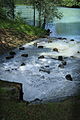
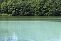
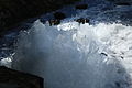
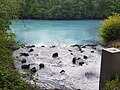
The following 24 files are in this category, out of 24 total.
-
Bochum - Werner Straße - Harpener Teiche - Grubenwasser (1) 01 ies.ogv 7.8 s, 1,270 × 720; 21.42 MB
-
Bochum - Werner Straße - Harpener Teiche - Grubenwasser (1) 02 ies.ogv 17 s, 1,270 × 720; 51.97 MB
-
 Bochum - Werner Straße - Harpener Teiche - Grubenwasser 01 ies.jpg 3,744 × 5,616; 7.87 MB
-
 Bochum - Werner Straße - Harpener Teiche - Grubenwasser 02 ies.jpg 3,744 × 5,616; 10.44 MB
-
 Bochum - Werner Straße - Harpener Teiche - Grubenwasser 03 ies.jpg 5,616 × 3,744; 10.54 MB
-
 Bochum - Werner Straße - Harpener Teiche - Grubenwasser 04 ies.jpg 5,616 × 3,744; 8.19 MB
-
 Bochum - Werner Straße - Harpener Teiche - Grubenwasser 05 ies.jpg 5,616 × 3,744; 10.03 MB
-
 Bochum - Werner Straße - Harpener Teiche - Grubenwasser 06 ies.jpg 3,744 × 5,616; 10.77 MB
-
 Bochum - Werner Straße - Harpener Teiche - Grubenwasser 07 ies.jpg 5,616 × 3,744; 7.75 MB
-
 Bochum - Werner Straße - Harpener Teiche - Grubenwasser 08 ies.jpg 5,616 × 3,744; 9.67 MB
-
 Bochum - Werner Straße - Harpener Teiche - Grubenwasser 09 ies.jpg 3,744 × 5,616; 11.06 MB
-
 Bochum - Werner Straße - Harpener Teiche - Grubenwasser 10 ies.jpg 5,616 × 3,744; 6.29 MB
-
 Bochum - Werner Straße - Harpener Teiche - Grubenwasser 11 ies.jpg 5,616 × 3,744; 7.21 MB
-
 Bochum - Werner Straße - Harpener Teiche - Grubenwasser 12 ies.jpg 5,616 × 3,744; 9.72 MB
-
 Bochum Grubenwasserabfluss Robert Müser.JPG 5,223 × 3,473; 2.41 MB
-
 Germany coal mine Robert Mueser water.jpg 1,600 × 1,200; 217 KB
-
 Grubenwasser Robert Müser 1.jpg 4,032 × 3,024; 5.21 MB
-
 Grubenwasser Robert Müser 2.jpg 4,032 × 3,024; 7.27 MB
-
Grubenwasser Robert Müser 3.webm 31 s, 1,920 × 1,080; 65.52 MB
-
Grubenwasser Robert Müser 4.webm 36 s, 1,920 × 1,080; 81.39 MB
-
Grubenwasser Robert Müser 5.webm 32 s, 1,920 × 1,080; 96 MB
-
 Grubenwasser Robert Müser 6.jpg 4,032 × 3,024; 6.15 MB
-
Grubenwasser Robert Müser 7.webm 32 s, 1,920 × 1,080; 94.22 MB
-
 Grubenwasser Robert Müser 8.jpg 4,032 × 3,024; 5.95 MB


