Category:Political maps of Africa

Subcategories
This category has the following 46 subcategories, out of 46 total.
Media in category "Political maps of Africa"
The following 129 files are in this category, out of 129 total.
-
 "Political Africa" CIA World Factbook.jpg 529 × 660; 86 KB
-
 "Political Middle East" CIA World Factbook.jpg 544 × 660; 162 KB
-
 'Political Middle East' CIA World Factbook-ar.jpg 544 × 660; 193 KB
-
 1976 olympics boycott info.PNG 542 × 500; 20 KB
-
 2001 Africa Flag Cartogram (30249837003).jpg 2,013 × 1,375; 700 KB
-

-
 Acrwc africa.jpg 585 × 600; 40 KB
-
 Active RECs of the AEC.svg 1,000 × 1,000; 745 KB
-
 AEC pillars.png 347 × 336; 28 KB
-
 Political map Afar triangle.png 373 × 454; 436 KB
-
 Africa (Arab Maghreb Union).png 341 × 341; 10 KB
-
 Africa (political) 22.18772E 0.25705N.jpg 1,280 × 958; 107 KB
-
 Africa 1a.svg 580 × 530; 116 KB
-
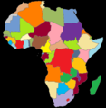
 Africa countries.svg 800 × 520; 195 KB
-
 Africa just countries.svg 580 × 530; 87 KB
-
 Africa Map en.svg 891 × 927; 764 KB
-
 Africa map political.svg 1,525 × 1,440; 700 KB
-
 Africa mapa mudo.png 868 × 929; 19 KB
-
 Africa-countries-CEMAC.png 360 × 392; 12 KB
-
 Africa-countries-CEMAC.svg 1,000 × 1,000; 197 KB
-
 Africa-countries-COMESA.png 360 × 392; 13 KB
-
 Africa-countries-EAC.png 350 × 350; 10 KB
-
 Africa-countries-EAC.svg 1,200 × 1,230; 67 KB
-
 Africa-countries-northern.png 360 × 392; 10 KB
-
 Africa-countries-UEMOA.png 360 × 392; 12 KB
-
 Africa-countries-UEMOA.svg 1,000 × 1,000; 197 KB
-
 Africa-map.jpg 505 × 627; 97 KB
-
 Africa-political-map.jpg 2,088 × 1,986; 1.55 MB
-
 Africa.png 1,052 × 1,072; 715 KB
-
 African continent-en.svg 1,525 × 1,440; 752 KB
-
 African continent-ur2.svg 1,525 × 1,440; 752 KB
-
 African countries 2013.png 1,143 × 1,047; 142 KB
-
 African Economic Community membership map.png 323 × 360; 12 KB
-
 African EMUs.svg 1,200 × 1,230; 88 KB
-
 African monarchies.png 325 × 383; 11 KB
-
 African Nuclear Weapon Free Zone Signators.png 347 × 335; 12 KB
-
 African Nuclear Weapon Free Zone Signators.svg 1,000 × 1,000; 192 KB
-
 Africa’s wars and conflicts, 1980–96.jpg 403 × 391; 37 KB
-
 Africa’s wars and conflicts, 1980–96.svg 801 × 698; 130 KB
-
 Afrik kárttá smn.svg 1,525 × 1,440; 751 KB
-
 Afrika Politisch 2.png 982 × 991; 210 KB
-
 Afrika politisk.png 1,000 × 1,000; 406 KB
-
 Afrika politisk.svg 1,000 × 1,000; 392 KB
-
 Afrikamapde.png 1,050 × 1,152; 46 KB
-
 Afriko-meza.png 350 × 384; 31 KB
-
 Afrobarometer survey countries.png 1,754 × 1,546; 100 KB
-
 BlankMap-Africa-1912.png 360 × 360; 9 KB
-
 BlankMap-Africa-1935.png 360 × 360; 7 KB
-
 Blankmap-Africa2.png 757 × 785; 35 KB
-
 BlankMap-Africa2.png 2,000 × 2,000; 307 KB
-
 Carta politica d'Africa 2013.png 989 × 1,009; 256 KB
-
 Carte de la commission du Golfe de Guinée.svg 1,000 × 1,000; 152 KB
-
 CEN-SAD.svg 1,000 × 1,000; 184 KB
-
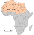
 Central Africa regions map (fr).png 1,823 × 2,098; 691 KB
-
 Central Africa regions map (ru).png 1,667 × 1,987; 526 KB
-
 Central Africa regions map.png 1,810 × 2,101; 678 KB
-
 Central Africa regions map.svg 940 × 477; 3.31 MB
-
 Cold War Africa 1980.PNG 458 × 437; 18 KB
-
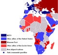 Cold–War Africa 1980.PNG 458 × 437; 18 KB
-
 Colonial Past (2710789398).jpg 2,000 × 1,039; 2.44 MB
-
 Colored map of Africa.png 585 × 600; 61 KB
-
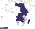 COMESA - 2.png 940 × 794; 30 KB
-
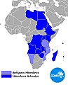
 COMESA Members.svg 1,000 × 1,000; 192 KB
-
 COMESA.JPG 353 × 438; 44 KB
-
 COMESA.svg 1,000 × 1,000; 172 KB
-
 Community of Sahel-Saharan States-map.PNG 940 × 794; 40 KB
-
 Community of Sahel-Saharan States-map.svg 1,200 × 1,230; 86 KB
-
 Community of Sahel-Saharan States.png 585 × 600; 53 KB
-
 Conseil de l'entente countries.PNG 726 × 726; 49 KB
-
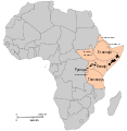
 East Africa regions map (fr).png 1,500 × 2,440; 732 KB
-
 East Africa regions map (ru).png 1,500 × 2,440; 735 KB
-
 East Africa regions map.png 1,998 × 2,148; 502 KB
-
 East Africa regions map.svg 73 × 119; 3.55 MB
-
 East African Community.JPG 360 × 392; 14 KB
-
 ECCAS and CEMAC.svg 1,000 × 1,000; 183 KB
-
 ECCAS.png 323 × 360; 12 KB
-
 Electoral Democracies in Africa, Freedom House 2007.png 521 × 580; 21 KB
-
 File Africa just countries.svg 580 × 530; 116 KB
-
 Flags with Pan-African colors.svg 500 × 500; 185 KB
-
 Horn-von-Afrika.JPG 330 × 355; 26 KB
-
 Igad.png 997 × 996; 132 KB
-
 IGAD.svg 1,000 × 1,000; 189 KB
-
 Insurgency Maghreb.png 476 × 281; 10 KB
-
 Kinshasa Convention Adopters.png 1,000 × 1,000; 126 KB
-
 Kinshasa Convention Status.svg 1,000 × 1,000; 125 KB
-
 Libya Sahel (1998).png 476 × 281; 10 KB
-
 Maghreb2.PNG 353 × 391; 13 KB
-
 MagribModified.png 330 × 216; 7 KB
-
 Mano River Union.png 650 × 400; 14 KB
-
 Map of Africa with flags.svg 560 × 540; 299 KB
-
 Map of Colonial Africa.jpg 3,477 × 2,942; 2.3 MB
-
 Map of ECOWAS.svg 638 × 635; 175 KB
-
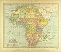
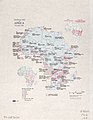
 Map Political map of Africa 1928 - Touring Club Italiano CART-TRC-11 01.jpg 2,459 × 2,616; 3.12 MB
-
 Mapa CEEAC.PNG 660 × 768; 33 KB
-
 Cercano Oriente.png 443 × 247; 13 KB
-
 Organisation of African unity.svg 1,000 × 1,000; 208 KB
-
 Organizacion de l'Unitat Africana - Extension territòriala.png 2,269 × 2,088; 566 KB
-
 Other trade blocks in Africa.svg 1,000 × 1,000; 181 KB
-
 Pan-African Countries.png 341 × 341; 8 KB
-

-
 Political map of Africa, November 1962. LOC 97687630.jpg 3,368 × 4,358; 1.4 MB
-
 Political map of Africa, November 1962. LOC 97687630.tif 3,368 × 4,358; 41.99 MB
-
 Political map of Central Africa according UN mk.svg 1,200 × 1,230; 61 KB
-
 Political map of Central Africa mk.svg 1,200 × 1,230; 60 KB
-
 Political map of East Africa according UN mk.svg 1,200 × 1,230; 64 KB
-
 Political map of East Africa mk.svg 1,200 × 1,230; 61 KB
-
 Political map of North Africa according UN mk.svg 1,200 × 1,230; 58 KB
-
 Political map of North Africa mk.svg 1,200 × 1,230; 59 KB
-
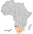 Political map of Southern Africa according UN mk.svg 1,200 × 1,230; 59 KB
-
 Political map of Southern Africa mk.svg 1,200 × 1,230; 63 KB
-
 Political map of West Africa according UN mk.svg 1,200 × 1,230; 65 KB
-
 Political map of West Africa mk.svg 1,200 × 1,230; 63 KB
-
 RECs of the AEC without CEN-SAD & COMESA.svg 1,000 × 1,000; 443 KB
-
 RECs of the AEC.svg 1,000 × 1,000; 1.81 MB
-
 Regions of Africa mk.svg 1,200 × 1,230; 60 KB
-
 SACU 2006.png 341 × 341; 8 KB
-
 Sacu 2008.png 997 × 996; 232 KB
-
 Sahel Base Map v2.png 954 × 703; 503 KB
-
 Sahel Base Map.png 4,227 × 3,136; 641 KB
-
 Separatist movements in Africa.png 1,320 × 1,199; 565 KB
-
 States and territories of Africa.svg 1,564 × 1,633; 265 KB
-
 Sudan political map 1994.jpg 501 × 600; 324 KB
-
 UMA.PNG 323 × 360; 12 KB
-
 Union Africana - Extension territòriala de l'OUA e de l'UA de 1963 a 2023.png 2,127 × 1,957; 537 KB
-
 USAFRICOM United States Africa Command Map Draft.jpg 960 × 720; 141 KB
-
 WAMZ.svg 1,000 × 1,000; 172 KB
-
 World borders sat 0 0 geostat.png 1,824 × 1,824; 426 KB
-
 Zentralafrikanische-republik-karte-politisch-ombella-mpoko.png 425 × 596; 165 KB
-
 Östafrikanska gemenskapen 2008.png 997 × 996; 232 KB


.jpg)
_and_republics_(blue).png)


.png)
_22.18772E_0.25705N.jpg)


.png)
.png)


.jpg)


.png)
.png)


.png)


