Category:Ponthir

Cymraeg: Pentref a chymuned ym mwrdeisdref sirol Torfaen yn ne-ddwyrain Cymru yw Ponthir, hefyd Pont-hir. Saif yn ne Torfaen, yn agos i'r ffîn a Chasnewydd ac i'r dwyrain o'r briffordd A4042. Mae Afon Llwyd yn llifo trwy'r pentref..
English: Ponthir is a large village at the south-west of the county borough of Torfaen on the boundary of the city of Newport, South Wales.
village and community in Torfaen County Borough in south east Wales  Ar gyrion Pont-hir | |||||
| Upload media | |||||
| Pronunciation audio | |||||
|---|---|---|---|---|---|
| Instance of | |||||
| Location | Torfaen, Wales | ||||
| Population |
| ||||
| Area |
| ||||
 | |||||
Subcategories
This category has the following 4 subcategories, out of 4 total.
L
P
- Ponthir Baptist Chapel (5 F)
- Ponthir railway station (1 F)
- Ponthir reservoir (5 F)
Media in category "Ponthir"
The following 108 files are in this category, out of 108 total.
-

-

-
 All Saints Church, Llanfrechfa - geograph.org.uk - 6223591.jpg 709 × 531; 82 KB
-
 All Saints Church, Llanfrechfa - geograph.org.uk - 6223608.jpg 399 × 531; 54 KB
-
 Barnfield, Ponthir - geograph.org.uk - 6202939.jpg 1,600 × 1,126; 368 KB
-
 Bough Spring Farm Shop, Ponthir - geograph.org.uk - 1768639.jpg 640 × 427; 62 KB
-
 Boulder on a side road SE of Newport Road, Llantarnam - geograph.org.uk - 6236970.jpg 1,600 × 1,383; 634 KB
-
 Brechfa Close, Ponthir - geograph.org.uk - 1768700.jpg 614 × 640; 84 KB
-

-

-
 Caerleon Road bus stop and shelter, Ponthir - geograph.org.uk - 6202871.jpg 1,581 × 1,600; 609 KB
-
 Caerleon Road in Ponthir towards Cwmbran - geograph.org.uk - 6202712.jpg 1,022 × 1,024; 213 KB
-
 Caerleon Road semis, Ponthir - geograph.org.uk - 6202722.jpg 1,600 × 1,362; 412 KB
-
 Candwr Brook, Ponthir - geograph.org.uk - 1860363.jpg 640 × 480; 135 KB
-
 Candwr Park, Ponthir - geograph.org.uk - 1769238.jpg 640 × 373; 65 KB
-
 Candwr Road, Ponthir - geograph.org.uk - 1860343.jpg 640 × 378; 66 KB
-
 East along Stokes Drive, Ponthir - geograph.org.uk - 6202887.jpg 1,600 × 1,322; 326 KB
-

-

-
 Entering Ponthir from Llanfrechfa - geograph.org.uk - 1768474.jpg 640 × 600; 99 KB
-

-
 Farm buildings, Brook Farm - geograph.org.uk - 1860378.jpg 640 × 397; 69 KB
-
 Farm entrance, Ponthir - geograph.org.uk - 1947420.jpg 640 × 499; 100 KB
-
 Farmland beyond the railway line - geograph.org.uk - 4261617.jpg 4,000 × 3,000; 3.02 MB
-

-
 Footpath and railway line near Rose Farm - geograph.org.uk - 4261638.jpg 4,000 × 3,000; 5.97 MB
-
 Footpath and track near Ponthir - geograph.org.uk - 4261619.jpg 4,000 × 3,000; 3.44 MB
-
 Fork in the road, Candwr Road - geograph.org.uk - 1860433.jpg 640 × 577; 107 KB
-
-
 Freight train at Ponthir - geograph.org.uk - 4261612.jpg 4,000 × 3,000; 3.29 MB
-

-
 Grade II Listed Ponthir House Inn, Ponthir - geograph.org.uk - 6202826.jpg 1,600 × 1,251; 374 KB
-
 Green cabinets on a Ponthir corner - geograph.org.uk - 6202864.jpg 1,600 × 1,066; 455 KB
-
 Hafod Close, Ponthir - geograph.org.uk - 1947434.jpg 640 × 480; 72 KB
-
 Hafod Road, Ponthir - geograph.org.uk - 1769262.jpg 640 × 460; 79 KB
-
 Hafod Road, Ponthir - geograph.org.uk - 1947407.jpg 640 × 426; 60 KB
-
 Hafod Road, Ponthir - geograph.org.uk - 1947431.jpg 640 × 451; 64 KB
-

-
 Hilly ground, Ponthir - geograph.org.uk - 1947467.jpg 640 × 455; 74 KB
-
 Junction of Caerleon Road and Candwr Road, Ponthir - geograph.org.uk - 6202927.jpg 1,600 × 1,335; 509 KB
-
 Junction of Stokes Court and Caerleon Road, Ponthir - geograph.org.uk - 6202708.jpg 1,600 × 1,205; 348 KB
-

-
 Lamb Lane, Ponthir - geograph.org.uk - 1768675.jpg 640 × 459; 71 KB
-
 Llwyn Onn, Ponthir - geograph.org.uk - 1769297.jpg 640 × 569; 90 KB
-
 Longbridge, Ponthir - geograph.org.uk - 1947058.jpg 640 × 390; 72 KB
-

-
 Malthouse Lane climbs to the NW - geograph.org.uk - 2198238.jpg 640 × 480; 117 KB
-

-
 Moyle Grove, Ponthir - geograph.org.uk - 1947430.jpg 640 × 472; 81 KB
-
 Muddy track, Ponthir water works - geograph.org.uk - 1947457.jpg 640 × 480; 116 KB
-
 Name sign, The Gate at Llanfrechfa - geograph.org.uk - 3280469.jpg 640 × 530; 61 KB
-

-
 Not your everyday farmyard site^ - geograph.org.uk - 241525.jpg 640 × 480; 86 KB
-
 Oaklands, Ponthir - geograph.org.uk - 1947429.jpg 640 × 480; 74 KB
-
 Park Stores, Ponthir - geograph.org.uk - 1769127.jpg 640 × 353; 58 KB
-
 Pen-y-Brenin, Ponthir - geograph.org.uk - 1769225.jpg 640 × 480; 102 KB
-
 Pipeline and girder bridges across the Afon Lwyd - geograph.org.uk - 4261642.jpg 4,000 × 3,000; 4.17 MB
-

-
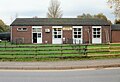
 Ponthir Church in Wales School - geograph.org.uk - 1768692.jpg 640 × 385; 70 KB
-
 Ponthir Community Council flower tub - geograph.org.uk - 6202912.jpg 1,600 × 1,207; 525 KB
-
 Ponthir House Inn - geograph.org.uk - 1769313.jpg 640 × 400; 66 KB
-
 Ponthir House Inn - geograph.org.uk - 5040239.jpg 1,024 × 758; 128 KB
-
 Ponthir House Inn, from the Main Road.jpg 5,184 × 3,456; 7.87 MB
-
 Ponthir Inn 1710.jpg 5,184 × 3,456; 5.67 MB
-
 Ponthir level crossing approach - geograph.org.uk - 1947413.jpg 640 × 455; 65 KB
-

-
 Ponthir Village Hall - geograph.org.uk - 1769107.jpg 640 × 437; 73 KB
-
 Ponthir, Afon Lwyd - geograph.org.uk - 5040226.jpg 1,024 × 768; 258 KB
-
 Post Office Terrace, Ponthir - geograph.org.uk - 1947267.jpg 640 × 480; 58 KB
-
 Queen Elizabeth II pillarbox, Caerleon Road, Ponthir - geograph.org.uk - 6202937.jpg 1,423 × 1,600; 407 KB
-

-
 Railway line to north of the crossing at Rose Farm - geograph.org.uk - 4261626.jpg 3,767 × 2,825; 4.31 MB
-
 Railway line to south of the crossing at Rose Farm - geograph.org.uk - 4261632.jpg 4,000 × 3,000; 4.61 MB
-
 Railway wagon farm shed, Malthouse Lane - geograph.org.uk - 2198232.jpg 640 × 480; 109 KB
-
 Road junction at Llanfrechfa - geograph.org.uk - 2249000.jpg 640 × 480; 89 KB
-
 Road junction west of the reservoir, near Ponthir - geograph.org.uk - 1702753.jpg 3,296 × 2,472; 1.88 MB
-

-
 SE boundary of Cwmbran - geograph.org.uk - 3280602.jpg 640 × 465; 97 KB
-
 Several shades of grey, Llanfrechfa - geograph.org.uk - 3280555.jpg 640 × 449; 60 KB
-
 Southern end of Crown Road, Cwmbran - geograph.org.uk - 3287011.jpg 640 × 477; 123 KB
-
 Speed cameras sign, Caerleon Road, Ponthir - geograph.org.uk - 6202905.jpg 1,600 × 1,344; 453 KB
-
 Start of the 40 zone, Newport Road, Llantarnam - geograph.org.uk - 6236966.jpg 1,600 × 1,492; 468 KB
-
 Station Road, Ponthir - geograph.org.uk - 1769175.jpg 640 × 365; 55 KB
-
 Stile on a bridge, Ponthir - geograph.org.uk - 1947459.jpg 640 × 480; 132 KB
-
 Stile, Candwr Road - geograph.org.uk - 1860417.jpg 640 × 493; 116 KB
-
 Stokes Court in Ponthir - geograph.org.uk - 6202696.jpg 1,600 × 986; 285 KB
-
 Stokes Court, Ponthir - geograph.org.uk - 1769251.jpg 640 × 543; 93 KB
-
 Stokes Drive, Ponthir - geograph.org.uk - 6202893.jpg 1,495 × 1,600; 580 KB
-
 Stop, look, listen, Ponthir - geograph.org.uk - 1947423.jpg 640 × 480; 84 KB
-
 SW along Hafod Road, Ponthir - geograph.org.uk - 6202843.jpg 1,600 × 1,144; 397 KB
-

-
 The Gate at Llanfrechfa - geograph.org.uk - 3280455.jpg 640 × 469; 76 KB
-

-
 The Orchard, Ponthir - geograph.org.uk - 1769269.jpg 640 × 504; 65 KB
-

-

-
 The view SE from Ponthir level crossing - geograph.org.uk - 1947426.jpg 640 × 590; 107 KB
-

-
 Track on the west side of Caerleon Road, Ponthir - geograph.org.uk - 6202703.jpg 1,600 × 1,200; 783 KB
-

-

-
 Turn right for Church Road, Llanfrechfa - geograph.org.uk - 3280493.jpg 640 × 540; 101 KB
-
 Twyn Cottages, Ponthir - geograph.org.uk - 1947438.jpg 640 × 480; 56 KB
-
 Ulett House - geograph.org.uk - 425101.jpg 640 × 480; 113 KB
-
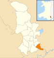 Wales Torfaen Community Ponthir map.svg 512 × 546; 321 KB
-
 Welcome to Torfaen County Borough, Ponthir - geograph.org.uk - 6202923.jpg 1,600 × 1,200; 490 KB
-

-
 Wooden bench between flower tubs, Caerleon Road, Ponthir - geograph.org.uk - 6202855.jpg 1,600 × 1,546; 774 KB


