Category:Pontneddfechan
hamlet in the county of Powys, Wales  | |||||
| Upload media | |||||
| Instance of | |||||
|---|---|---|---|---|---|
| Location | Powys, Wales | ||||
| Located in or next to body of water |
| ||||
 | |||||

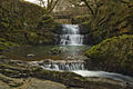
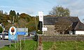
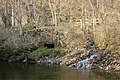
English: Pontneddfechan ( Welsh language meaning : bridge over the lesser River Neath) is a village in the Vale of Neath in Powys, Wales.
Subcategories
This category has the following 2 subcategories, out of 2 total.
S
- Sgwd Einion Gam (7 F)
- Sgwd Gwladys (11 F)
Media in category "Pontneddfechan"
The following 55 files are in this category, out of 55 total.
-
 A465 Flyover at Pontneddfechan - geograph.org.uk - 70652.jpg 640 × 401; 53 KB
-
-
 Afon Hepste - geograph.org.uk - 1445230.jpg 640 × 480; 147 KB
-
 Afon Nedd Fechan - geograph.org.uk - 383872.jpg 640 × 425; 244 KB
-
 Afon Pyrddin above Sgwd Gwladus - geograph.org.uk - 383889.jpg 640 × 425; 260 KB
-
 Afon Sychryd (geograph 6399338).jpg 2,716 × 3,626; 4.11 MB
-

-
 Bridge at Pwll Du ar Byrddin - geograph.org.uk - 1657395.jpg 640 × 480; 143 KB
-
 Bwa Maen, Dinas Rock, Pontneddfechen.JPG 3,264 × 2,176; 4.62 MB
-
 Confluence of the Sychryd and the Mellte (geograph 2909035).jpg 1,024 × 768; 192 KB
-
 Craig y Ddinas above Sychryd - geograph.org.uk - 819090.jpg 480 × 640; 143 KB
-
 Craig Y Dinas - Breconshire.jpeg 900 × 598; 390 KB
-
 Craig y Dinas.jpeg 472 × 700; 138 KB
-
 Cwm Porth Cavern, near Pont Neath Vaughan.jpeg 700 × 515; 147 KB
-
 Dinas Craig - above the Vale of Neath, near Pont Neath Vaughan.jpeg 618 × 900; 401 KB
-
 Dinas Craig, in the vale of Neath, near pont Neath Vaughan.jpeg 483 × 700; 142 KB
-
 Ebeneezer Chapel - geograph.org.uk - 42397.jpg 640 × 480; 59 KB
-
 Fall of The Purthen - near Pont Neath Vaughan, Brecknockshire.jpeg 573 × 900; 402 KB
-
 Farewell Rock - geograph.org.uk - 685206.jpg 640 × 480; 172 KB
-

-
 Gauging weir - geograph.org.uk - 5618608.jpg 480 × 640; 100 KB
-
 Horseshoe Falls - geograph.org.uk - 1657457.jpg 640 × 480; 119 KB
-
 Horseshoe Falls - geograph.org.uk - 42404.jpg 640 × 480; 112 KB
-
 Nedd Fechan River - geograph.org.uk - 42561.jpg 640 × 480; 120 KB
-
 Old Pen cae drain bridge - geograph.org.uk - 1215034.jpg 600 × 450; 154 KB
-
 Pont Neath Faughan - Breconshire (1133303).jpg 1,000 × 688; 208 KB
-
 Pont Neath Faughan - Breconshire.jpeg 900 × 623; 417 KB
-
 Pontneddfechan Church - geograph.org.uk - 1598944.jpg 640 × 425; 79 KB
-
 River Sychryd - geograph.org.uk - 1215070.jpg 600 × 450; 182 KB
-
 Rock, track and river (geograph 6399219).jpg 1,536 × 2,048; 1.45 MB
-
 Sgwd y Ddwli from above - geograph.org.uk - 14640.jpg 600 × 360; 38 KB
-
 Sgydau Sychryd - geograph.org.uk - 1144702.jpg 480 × 640; 130 KB
-
 Small gorge on the river Sychryd - geograph.org.uk - 2906657.jpg 1,024 × 768; 136 KB
-
 St John Church - geograph.org.uk - 1657174.jpg 640 × 480; 74 KB
-
 Steep path down Craig y Ddinas - geograph.org.uk - 14636.jpg 600 × 520; 56 KB
-
 Sychryd Cascade - geograph.org.uk - 4789678.jpg 2,448 × 3,264; 2.99 MB
-

-
 The Gunpowder Works - geograph.org.uk - 504274.jpg 480 × 640; 136 KB
-
 Trackbed of abandoned railway - geograph.org.uk - 383878.jpg 426 × 640; 124 KB
-
 View along the valley of the Afon Mellte - geograph.org.uk - 95351.jpg 480 × 640; 108 KB
-
 Waterfall and footbridge on the river Sychryd (geograph 2909053).jpg 1,200 × 800; 204 KB
-
 Waterfall on Afon Sychryd - geograph.org.uk - 1470392.jpg 640 × 428; 97 KB
-
 Waterfalls Centre, Pontneddfechan, Wales.jpg 3,225 × 1,927; 2.61 MB
-
 Afon Mellte - geograph.org.uk - 1462690.jpg 640 × 480; 123 KB
-

-
 Craig y Ddinas - geograph.org.uk - 376955.jpg 640 × 480; 83 KB
-
 Craig-Y-Ddinas - geograph.org.uk - 95332.jpg 480 × 640; 116 KB
-
 Cwm Gored - geograph.org.uk - 383900.jpg 640 × 425; 252 KB
-
 Cynon Valley Cottage and Bunkhouse - geograph.org.uk - 374630.jpg 640 × 480; 111 KB
-
 Forest Footpath - geograph.org.uk - 376977.jpg 640 × 480; 115 KB
-
 Near Pont Melin-fach - geograph.org.uk - 14641.jpg 600 × 450; 66 KB
-
 Road Junction on Comin y Rhos - geograph.org.uk - 70653.jpg 640 × 480; 218 KB
-
 Scwd Ddwli falls - geograph.org.uk - 273579.jpg 640 × 480; 111 KB
-
 The Afon Mellte - geograph.org.uk - 95226.jpg 640 × 480; 149 KB
-
 The Afon Mellte - geograph.org.uk - 95232.jpg 640 × 480; 176 KB


.jpg)


.jpg)


.jpg)


.jpg)


.jpg)


