Category:Pool, West Yorkshire
civil parish in Leeds, West Yorkshire, England | |||||
| Upload media | |||||
| Instance of | |||||
|---|---|---|---|---|---|
| Location | Leeds, West Yorkshire, Yorkshire and the Humber, England | ||||
 | |||||
Media in category "Pool, West Yorkshire"
The following 193 files are in this category, out of 193 total.
-
 A Gap in Caley Wood - geograph.org.uk - 3352541.jpg 4,320 × 3,240; 4.52 MB
-
 A658 at Pool - geograph.org.uk - 5372383.jpg 3,072 × 2,048; 1.21 MB
-
 A658 at Pool Bridge - geograph.org.uk - 5365176.jpg 640 × 480; 63 KB
-
 A658 at Pool village boundary - geograph.org.uk - 5365170.jpg 640 × 479; 92 KB
-
 A658, A659 junction, Pool - geograph.org.uk - 4932311.jpg 640 × 426; 55 KB
-
 A658, Pool - geograph.org.uk - 4932302.jpg 640 × 426; 79 KB
-
 A658, Pool Bridge - geograph.org.uk - 4932312.jpg 640 × 426; 53 KB
-
 A659 at Caley Lodge - geograph.org.uk - 6175581.jpg 1,024 × 770; 203 KB
-
 A659 at Pool village boundary - geograph.org.uk - 6175573.jpg 1,024 × 769; 252 KB
-
 A659 Heading West out of Pool - geograph.org.uk - 3149298.jpg 4,320 × 3,240; 3.52 MB
-
 A659 Pool Road - geograph.org.uk - 3051451.jpg 1,024 × 682; 257 KB
-
 A659, Pool - geograph.org.uk - 4932307.jpg 640 × 426; 58 KB
-
 A659, Pool in Wharfedale - geograph.org.uk - 5987479.jpg 5,184 × 3,888; 4.22 MB
-
 A660 Leeds Road, Pool Bank - geograph.org.uk - 3075737.jpg 1,024 × 682; 215 KB
-
 Acorn Way - Swallow Drive - geograph.org.uk - 3616155.jpg 640 × 480; 61 KB
-

-

-

-

-

-
 Barn, Pool Bank - geograph.org.uk - 5240428.jpg 1,942 × 2,110; 959 KB
-
 Benchmarked wall on Leeds Road - geograph.org.uk - 5744632.jpg 1,024 × 683; 308 KB
-
 Bramble Court - Acorn Way - geograph.org.uk - 3616168.jpg 640 × 472; 62 KB
-
 Bramble Grove - Acorn Way - geograph.org.uk - 3616158.jpg 640 × 480; 74 KB
-
 Bridge across the dismantled NER line, Old Pool Bank - geograph.org.uk - 5372290.jpg 3,072 × 2,048; 1.31 MB
-
 Bus shelter - geograph.org.uk - 2959098.jpg 1,600 × 1,200; 436 KB
-
 Caley Crags - geograph.org.uk - 1126058.jpg 640 × 430; 61 KB
-
 Caley Crags - geograph.org.uk - 1126060.jpg 640 × 480; 65 KB
-
 Caley Deer Park - geograph.org.uk - 3270649.jpg 4,608 × 3,072; 2.01 MB
-
 Caley Deer Park - geograph.org.uk - 5371134.jpg 2,904 × 1,496; 639 KB
-
 Caley Wood - geograph.org.uk - 5635443.jpg 1,024 × 768; 301 KB
-
 Carved tree trunk in Chevin Forest - geograph.org.uk - 5635452.jpg 1,024 × 768; 302 KB
-
 Chapel Hill Road - Old Pool Bank - geograph.org.uk - 3616179.jpg 640 × 480; 61 KB
-
 Chapel Hill Road, Pool - geograph.org.uk - 5372363.jpg 3,068 × 1,758; 1.11 MB
-
 Chevin Forest Park (11) - geograph.org.uk - 3885646.jpg 1,024 × 768; 203 KB
-
 Chevin Forest Park (12) - geograph.org.uk - 3885649.jpg 1,024 × 768; 245 KB
-
 Church Close - Church Lane - geograph.org.uk - 3616300.jpg 640 × 480; 64 KB
-

-
 Church of St Wilfrid, Pool - geograph.org.uk - 5372782.jpg 1,955 × 1,479; 445 KB
-

-

-
-
 Cut bench mark, Leeds Road wall - geograph.org.uk - 5744634.jpg 1,024 × 683; 348 KB
-
 Cut Bench Mark, Pool Bank - geograph.org.uk - 3018825.jpg 1,024 × 682; 328 KB
-
 Dales Way Link through Chevin Forest - geograph.org.uk - 5635451.jpg 1,024 × 768; 326 KB
-
 Disused Railway Bridge, Pool Bank - geograph.org.uk - 3018836.jpg 1,024 × 682; 193 KB
-
 Ebor Way at Caley Crags - geograph.org.uk - 5371252.jpg 2,048 × 3,072; 1.93 MB
-
 Electricity Substation - Arthington Lane - geograph.org.uk - 3616223.jpg 640 × 480; 101 KB
-

-

-
 Elizabeth II postbox on Main Street, Pool in Wharfedale - geograph.org.uk - 5987470.jpg 2,397 × 4,764; 2.47 MB
-
 Elizabeth II postbox on the A659, Pool in Wharfedale - geograph.org.uk - 5987476.jpg 3,583 × 3,814; 3.98 MB
-
 Far Row, Pool Bank - geograph.org.uk - 1137974.jpg 640 × 480; 119 KB
-
 Farm yard at Pool - geograph.org.uk - 5372548.jpg 3,041 × 1,982; 958 KB
-
 Fells Plantation - geograph.org.uk - 5370957.jpg 3,072 × 2,048; 1.85 MB
-
 Flush Bracket Bench Mark, Main Street - geograph.org.uk - 1923371.jpg 681 × 1,024; 320 KB
-
 Footpath - Church Lane - geograph.org.uk - 3616308.jpg 480 × 640; 139 KB
-
 Former bridge supports on Leeds Road - geograph.org.uk - 5744603.jpg 1,024 × 683; 292 KB
-
 Frost at Pool - geograph.org.uk - 5372322.jpg 2,910 × 1,499; 784 KB
-
 Frosty field at Pool Bank - geograph.org.uk - 5359419.jpg 2,718 × 1,668; 860 KB
-
 Frosty field by Old Pool Bank - geograph.org.uk - 5371810.jpg 3,072 × 2,048; 1.39 MB
-
 Frosty path, Caley Crags - geograph.org.uk - 5371456.jpg 2,048 × 3,072; 1.48 MB
-
 Frosty rock on Caley Crags - geograph.org.uk - 5371265.jpg 3,072 × 2,048; 1.34 MB
-
 Frosty trees by the Wharfe - geograph.org.uk - 5240466.jpg 3,072 × 2,048; 1.62 MB
-
 Garden Area - off Acorn Way - geograph.org.uk - 3616162.jpg 640 × 458; 80 KB
-
 Grazing, Old Pool Bank - geograph.org.uk - 5985609.jpg 640 × 480; 57 KB
-
 Hawthorn Avenue - Swallow Drive - geograph.org.uk - 3616177.jpg 640 × 480; 39 KB
-

-
 In Caley Park - geograph.org.uk - 3352530.jpg 4,320 × 3,240; 5.99 MB
-
 Junction of the A659 and A658 at Pool - geograph.org.uk - 5958408.jpg 4,608 × 3,456; 4.16 MB
-
 Junction with carving - geograph.org.uk - 5371163.jpg 3,072 × 2,048; 1.46 MB
-
 Leeds Road junction with Old Pool Bank - geograph.org.uk - 5744637.jpg 1,024 × 683; 298 KB
-
 Literally a Branch Line - geograph.org.uk - 5744676.jpg 1,024 × 683; 365 KB
-
 Main Street, Pool - geograph.org.uk - 1923374.jpg 1,024 × 681; 191 KB
-
 Main Street, Pool - geograph.org.uk - 5372705.jpg 1,847 × 2,321; 647 KB
-
 Marton Mills near Pool - geograph.org.uk - 2549827.jpg 800 × 600; 225 KB
-
 Marton Mills on Pool Road - geograph.org.uk - 4080408.jpg 1,600 × 1,064; 633 KB
-
 Milepost - Leeds Road - geograph.org.uk - 1407698.jpg 480 × 640; 300 KB
-
 Millcroft - off Mill Lane - geograph.org.uk - 3616317.jpg 640 × 480; 72 KB
-
 Millcroft - off Mill lane - geograph.org.uk - 3616321.jpg 640 × 480; 94 KB
-
 Mulberry Chase - Swallow Drive - geograph.org.uk - 3616175.jpg 640 × 441; 63 KB
-

-
 Old Lane, Bramhope - geograph.org.uk - 3270650.jpg 4,608 × 3,072; 1.32 MB
-
 Old Pool Bank - geograph.org.uk - 3084084.jpg 4,320 × 3,240; 4.65 MB
-
 Old Pool Bank - geograph.org.uk - 5985611.jpg 640 × 480; 117 KB
-

-

-

-
 On Caley Crags - geograph.org.uk - 5371419.jpg 3,000 × 1,902; 1.15 MB
-
 Ordnance Survey Flush Bracket 2333 - geograph.org.uk - 3753009.jpg 1,920 × 2,560; 2.47 MB
-
 Otley from Caley Crag - geograph.org.uk - 4558969.jpg 1,600 × 1,060; 558 KB
-

-
 Park Mews - looking towards Park Way - geograph.org.uk - 3616237.jpg 640 × 480; 77 KB
-
 Park Mount - Quarry Farm Road - geograph.org.uk - 1407711.jpg 640 × 480; 245 KB
-

-
 Park Terrace - Quarry Farm Road - geograph.org.uk - 1407712.jpg 640 × 480; 232 KB
-
 Path junction at Caley Deer Park - geograph.org.uk - 3403503.jpg 2,048 × 1,536; 508 KB
-
 Permissive Track in the Chevin Forest Country Park - geograph.org.uk - 3352996.jpg 4,320 × 3,240; 5.12 MB
-

-
 Playground, Pool - geograph.org.uk - 5372798.jpg 3,072 × 2,048; 1.34 MB
-
 Poll Bank Court - Pool Bank New Road - geograph.org.uk - 3616149.jpg 640 × 480; 92 KB
-
 Pool Bank - geograph.org.uk - 3018861.jpg 1,024 × 682; 223 KB
-
 Pool Bank New Road (A658) - geograph.org.uk - 5987678.jpg 640 × 480; 105 KB
-

-
 Pool Bridge - geograph.org.uk - 4932329.jpg 640 × 426; 57 KB
-
 Pool Bridge - Harrogate Road - geograph.org.uk - 3616370.jpg 640 × 401; 39 KB
-
 Pool Methodist Church - geograph.org.uk - 4932298.jpg 640 × 426; 59 KB
-
 Pool Pharmacy - Main Street - geograph.org.uk - 3616297.jpg 640 × 480; 61 KB
-
 Pool Quarry railway bridge abutments - geograph.org.uk - 4959021.jpg 3,184 × 2,120; 4.23 MB
-

-
 Pool Road - looking towards Otley - geograph.org.uk - 3616375.jpg 640 × 480; 51 KB
-
 Pool Village Hall, Pool, Yorkshire - geograph.org.uk - 4080376.jpg 1,600 × 1,101; 692 KB
-

-
 Quarry Farm Road - Old Pool Bank - geograph.org.uk - 1407705.jpg 640 × 480; 209 KB
-
 Reaching Old Lane - geograph.org.uk - 5370992.jpg 1,638 × 2,251; 710 KB
-
 River Wharfe - geograph.org.uk - 4789852.jpg 640 × 430; 67 KB
-
 River Wharfe - geograph.org.uk - 4932292.jpg 640 × 426; 43 KB
-
 River Wharfe - geograph.org.uk - 4932294.jpg 640 × 426; 44 KB
-
 River Wharfe - geograph.org.uk - 4932316.jpg 640 × 395; 64 KB
-
 River Wharfe - geograph.org.uk - 4932318.jpg 640 × 426; 61 KB
-
 River Wharfe - geograph.org.uk - 4932319.jpg 640 × 426; 67 KB
-

-
 River Wharfe at Pool - geograph.org.uk - 42276.jpg 640 × 480; 115 KB
-
 River Wharfe at Pool Bridge - geograph.org.uk - 5241152.jpg 2,942 × 1,844; 1.23 MB
-
 River Wharfe at Pool Bridge - geograph.org.uk - 5241227.jpg 1,810 × 1,134; 428 KB
-
 River Wharfe at Pool Bridge - geograph.org.uk - 5241232.jpg 2,555 × 1,452; 710 KB
-
 River Wharfe at Pool Bridge - geograph.org.uk - 5373232.jpg 3,068 × 1,801; 987 KB
-
 River Wharfe near Pool - geograph.org.uk - 5178318.jpg 683 × 1,024; 325 KB
-
 Rocks at Caley Crags - geograph.org.uk - 5371445.jpg 3,072 × 2,048; 1.32 MB
-
 Rowan Close - Acorn Way - geograph.org.uk - 3616171.jpg 640 × 480; 52 KB
-
 Sandy Lobby - Old Pool Bank - geograph.org.uk - 1407728.jpg 640 × 480; 262 KB
-
 Service station, Pool in Wharfedale - geograph.org.uk - 5987528.jpg 640 × 407; 41 KB
-
 Sheep by Old Pool Bank - geograph.org.uk - 5372270.jpg 3,072 × 1,887; 1.04 MB
-
 Sheep near Pool Bank - geograph.org.uk - 5359220.jpg 3,072 × 1,801; 991 KB
-
 Shell filling station, Pool - geograph.org.uk - 4932308.jpg 640 × 426; 49 KB
-

-

-
 Singletrack in Chevin Forest - geograph.org.uk - 5635449.jpg 1,024 × 768; 274 KB
-
 St Wilfrid's Church, Pool in Wharfedale - geograph.org.uk - 5198687.jpg 1,024 × 683; 260 KB
-
 Stocks, Pool - geograph.org.uk - 5372665.jpg 2,048 × 3,072; 1.1 MB
-
 Swallow Close - Swallow Drive - geograph.org.uk - 1407737.jpg 640 × 480; 225 KB
-
 Swallow Drive - Pool Bank New Road - geograph.org.uk - 1407736.jpg 640 × 480; 233 KB
-
 Sycamore Fold - Acorn Way - geograph.org.uk - 3616165.jpg 640 × 480; 80 KB
-

-
 The A659 at Pool - geograph.org.uk - 4080367.jpg 1,600 × 1,064; 747 KB
-
 The Bar House, Pool Bank - geograph.org.uk - 1137980.jpg 640 × 480; 110 KB
-
 The Bar House, Pool Bank - geograph.org.uk - 5985613.jpg 640 × 426; 65 KB
-
 The Blue Barn Pet Food Store - geograph.org.uk - 3051456.jpg 1,024 × 682; 214 KB
-
 The Half Moon, Pool in Wharfedale - geograph.org.uk - 5987535.jpg 627 × 640; 90 KB
-
 The Hollies - Swallow Drive - geograph.org.uk - 1407739.jpg 640 × 480; 294 KB
-
 The River Wharfe, Pool in Wharfedale - geograph.org.uk - 5987525.jpg 640 × 480; 40 KB
-
 The Tower Drive - Arthington Lane - geograph.org.uk - 1408558.jpg 640 × 480; 296 KB
-
 The White Hart public house Pool - geograph.org.uk - 5958402.jpg 4,608 × 3,456; 3.75 MB
-
 The White Hart, Pool in Wharfedale - geograph.org.uk - 5987664.jpg 640 × 469; 61 KB
-

-
 Tour De France Bunting at Pool School - geograph.org.uk - 4080381.jpg 1,600 × 1,064; 792 KB
-

-
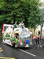
 Tour de France Caravan 1, Pool in Wharfedale - geograph.org.uk - 4059361.jpg 1,024 × 768; 225 KB
-
 Tour de France Caravan 2, Pool in Wharfedale - geograph.org.uk - 4059369.jpg 1,024 × 768; 201 KB
-
 Tour de France Caravan 3, Pool in Wharfedale - geograph.org.uk - 4059373.jpg 768 × 1,024; 379 KB
-
 Tour de France Caravan 3, Pool in Wharfedale - geograph.org.uk - 4059381.jpg 768 × 1,024; 303 KB
-
 Tour de France Caravan 4, Pool in Wharfedale - geograph.org.uk - 4059386.jpg 1,024 × 768; 241 KB
-
 Tour de France Caravan 5, Pool in Wharfedale - geograph.org.uk - 4059394.jpg 768 × 1,024; 340 KB
-
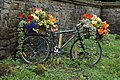 Tour De France Floral Bike - geograph.org.uk - 4080360.jpg 1,600 × 1,064; 942 KB
-
 Tour De France Floral Bike - geograph.org.uk - 4080374.jpg 1,600 × 1,064; 829 KB
-
 Tour De France Red, White and Blue Bikes - geograph.org.uk - 4080406.jpg 1,600 × 1,064; 919 KB
-

-

-

-
 Tour de France, Les Gendarmes 1 - geograph.org.uk - 4059469.jpg 640 × 480; 115 KB
-
 Tour de France, Les Gendarmes 2 - geograph.org.uk - 4059472.jpg 1,024 × 768; 248 KB
-
 Tour de France, the Riders 1 - geograph.org.uk - 4059483.jpg 1,024 × 768; 286 KB
-
 Towards Ferndale Farm - geograph.org.uk - 5370096.jpg 3,072 × 1,654; 1.01 MB
-
 Towards Pool - geograph.org.uk - 5371465.jpg 3,072 × 2,048; 1.28 MB
-
 Towards the Wharfe valley - geograph.org.uk - 5371792.jpg 3,072 × 2,048; 1.31 MB
-
 Track through Caley Deer Park near Otley - geograph.org.uk - 3270669.jpg 4,608 × 3,072; 2.25 MB
-
 Track through Cold Flats Wood in Chevin Forest Park - geograph.org.uk - 5758355.jpg 4,000 × 3,000; 5.82 MB
-
 Track to Far Row - geograph.org.uk - 1137976.jpg 480 × 640; 138 KB
-
 Track, Pool Bank - geograph.org.uk - 5359383.jpg 3,064 × 1,807; 893 KB
-
 View from Caley Crags - geograph.org.uk - 5371257.jpg 3,072 × 2,048; 1.36 MB
-
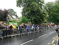 Waiting for the Tour de France 1, a grey start - geograph.org.uk - 4059305.jpg 1,024 × 783; 281 KB
-
 Waiting for the Tour de France 2, sunny now - geograph.org.uk - 4059459.jpg 1,024 × 768; 379 KB
-
 Wall, Caley Deer Park - geograph.org.uk - 5371083.jpg 3,072 × 2,048; 1.61 MB
-
 War Memorial at Pool - geograph.org.uk - 4080399.jpg 1,064 × 1,600; 680 KB
-
 War Memorial, Pool in Wharfedale - geograph.org.uk - 5198690.jpg 683 × 1,024; 237 KB
-
 War Memorial, Pool in Wharfedale - geograph.org.uk - 5987663.jpg 640 × 480; 109 KB
-

-

-
 Wharfe Crescent - Mill Lane - geograph.org.uk - 3616313.jpg 640 × 480; 79 KB
-
 Wharfedale Court, Pool - geograph.org.uk - 5372721.jpg 3,020 × 1,883; 936 KB
-
 White Hart, Pool - geograph.org.uk - 5372650.jpg 3,072 × 2,048; 904 KB
-
 White Holme Drive - Arthington Lane - geograph.org.uk - 1408554.jpg 640 × 480; 262 KB
-
 Willow Court - Old Pool Bank - geograph.org.uk - 1407732.jpg 640 × 480; 240 KB


_approaching_its_junction_with_the_A658_in_Pool-in-Wharfedale_-_geograph.org.uk_-_5758370.jpg)
,_Pool_in_Wharfedale_-_geograph.org.uk_-_5987668.jpg)


_-_geograph.org.uk_-_3885646.jpg)
_-_geograph.org.uk_-_3885649.jpg)


_-_geograph.org.uk_-_5987678.jpg)


