Category:Population maps of the Soviet Union
Media in category "Population maps of the Soviet Union"
The following 17 files are in this category, out of 17 total.
-
 Ct002923.jpg 12,048 × 9,052; 52.67 MB
-
 Ethnic map USSR 1941.jpg 3,560 × 2,194; 3.84 MB
-

-

-
 General survey of the U.S.S.R. LOC 77695775.jpg 12,617 × 8,239; 11.81 MB
-
 Map of the ethnic groups living in the Soviet Union.jpg 1,342 × 941; 286 KB
-
 Map of the ethnic groups of the Soviet Union.png 1,343 × 933; 1.56 MB
-
 Population distribution of Kurds in the USSR in 1989.svg 940 × 624; 2.08 MB
-
-
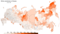
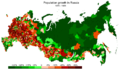 Russiadynamics7089.PNG 6,199 × 3,547; 1.35 MB
-
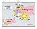
 Soviet Union Muslim Population 1979.jpg 1,035 × 1,238; 179 KB
-
 Tatarbashkirs1989ru.PNG 6,199 × 3,547; 1.23 MB
-
 U.S.S.R.; major terrain features. 5-69. LOC gm70004100.jpg 8,340 × 6,417; 4.74 MB
-
 Ukrainians1989ru.PNG 6,199 × 3,547; 1.3 MB
-

-
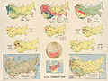
 USSR Population 1974.jpg 1,299 × 869; 258 KB
-
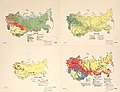
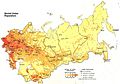 USSR population density map 1982.jpg 1,470 × 1,024; 239 KB


_Population_Density_-_DPLA_-_25e3cd2509c8892ac222ec596224e90f_(page_1).jpg)
_Population_Density_-_DPLA_-_25e3cd2509c8892ac222ec596224e90f_(page_2).jpg)


_-_Caucasus_Area_Population_Density_-_DPLA_-_30e071c292fb37298d8dc9840f8ee606.jpg)

