Category:Portishead, Somerset
Deutsch: Portishead ( Somerset) ist eine Stadt mit etwa 17.130 Einwohnern (Stand Volkszählung 2001) in der Region South West in England, Vereinigtes Königreich.
English: Portishead is a coastal town in North Somerset, England, with a population of 21,000 (estimate by town council, July 24, 2007) an increase of nearly 4,000 since 2001.
Nederlands: Portishead is een plaats in het bestuurlijke gebied North Somerset, in het Engelse graafschap Somerset. De plaats telt 17.130 inwoners.
Polski: Portishead - miasto w Wielskiej Brytanii, w Anglii, w hrabstwie Somerset, w jednostce administracyjnej North Somerset, położone nad Kanałem Bristolskim, przy granicy z miastem Bristol (18 km od centrum miasta).
Română: Portishead (pronunţat ) este un oraş în comitatul Somerset, regiunea South West, Anglia. Oraşul se află în districtul unitar North Somerset.
Simple English: Portishead is a town near the sea in North Somerset, England, where about 21000 people live (Local council update July 24, 2007).
town in Somerset, England  | |||||
| Upload media | |||||
| Instance of | |||||
|---|---|---|---|---|---|
| Location | North Somerset, Somerset, South West England, England | ||||
| official website | |||||
 | |||||
Subcategories
This category has the following 12 subcategories, out of 12 total.
B
- Black Nore lighthouse (9 F)
G
- Gordano School (3 F)
L
- Portishead Lifeboat Station (9 F)
- Portishead Lifeboat Trust (3 F)
P
- Portishead Lighthouse (25 F)
- Portishead Marina (48 F)
- Portishead Power Station (1 F)
- Portishead railway station (5 F)
T
W
Media in category "Portishead, Somerset"
The following 200 files are in this category, out of 559 total.
(previous page) (next page)-
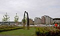
 'Arc of Angels' by Rick Kirby - geograph.org.uk - 2499405.jpg 2,304 × 1,704; 1.73 MB
-
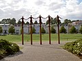 'Arc of Angels', by Rick Kirby - geograph.org.uk - 2499397.jpg 2,304 × 1,704; 1.63 MB
-
 'Flying' by Lucy Glendinning - geograph.org.uk - 2499424.jpg 1,704 × 2,304; 1.28 MB
-
 'Flying' by Lucy Glendinning - geograph.org.uk - 2499434.jpg 2,304 × 1,704; 1.15 MB
-
 'Topping Out' by Michael Disley - geograph.org.uk - 2499451.jpg 2,304 × 1,704; 1.67 MB
-
 'Towards the Sky', 2000 - geograph.org.uk - 2499354.jpg 1,704 × 2,304; 1.4 MB
-
 108 Granite Pillars, Portishead - geograph.org.uk - 6082894.jpg 3,648 × 2,736; 1.76 MB
-
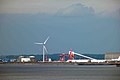 A distant Avonmouth Docks - geograph.org.uk - 2991679.jpg 1,024 × 679; 74 KB
-
 A369 at Middle Bridge roundabout - geograph.org.uk - 5812530.jpg 1,024 × 768; 166 KB
-
 A369 at Portbury Common roundabout - geograph.org.uk - 5813349.jpg 1,024 × 768; 84 KB
-
 A369 Wyndham Way, Portishead - geograph.org.uk - 5813362.jpg 1,024 × 769; 105 KB
-
 Across Clapton Moor - geograph.org.uk - 5639377.jpg 2,304 × 1,704; 1.33 MB
-
 Admiralty Chart No 1859 Port of Bristol King Road, Published 1930.jpg 12,215 × 8,352; 36.28 MB
-

-

-
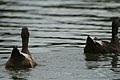 Anything Ducks Portishead - geograph.org.uk - 3046242.jpg 1,556 × 1,037; 441 KB
-
 Arc of Angels, Portishead - geograph.org.uk - 6082474.jpg 3,524 × 2,401; 1.32 MB
-
 Avonmouth - Container Port - geograph.org.uk - 5266999.jpg 2,560 × 1,920; 1.97 MB
-
 Avonmouth Docks - geograph.org.uk - 5266927.jpg 2,560 × 982; 962 KB
-
 Avonmouth docks and lighthouse - geograph.org.uk - 2002573.jpg 1,024 × 589; 143 KB
-

-
 Avonmouth docks from Portishead - geograph.org.uk - 6241138.jpg 1,280 × 720; 872 KB
-
 B3124 Clevedon Road at North Weston - geograph.org.uk - 5813378.jpg 1,024 × 769; 107 KB
-
 Battery Point - Portishead - geograph.org.uk - 3477934.jpg 640 × 424; 74 KB
-
 Battery Point across Woodhill Bay - geograph.org.uk - 1701253.jpg 640 × 480; 75 KB
-
 Battery Point Light - geograph.org.uk - 5092003.jpg 1,067 × 1,600; 494 KB
-
 Battery Point Light - geograph.org.uk - 5101928.jpg 1,600 × 1,053; 1.37 MB
-
 Battery Point Light. - panoramio.jpg 3,648 × 2,736; 2.98 MB
-
 Battery Point Monument and Light - geograph.org.uk - 4416554.jpg 800 × 600; 236 KB
-
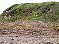 Battery Point strata - geograph.org.uk - 3917255.jpg 1,600 × 1,200; 461 KB
-

-
 Battery Point, Portishead - geograph.org.uk - 1706280.jpg 640 × 497; 47 KB
-
 Battery Point, Portishead - geograph.org.uk - 5092001.jpg 1,600 × 1,067; 606 KB
-
 Battery Point, Portishead. - panoramio.jpg 3,546 × 2,276; 1.73 MB
-
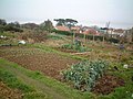 Beach Hill Allotments - geograph.org.uk - 117689.jpg 640 × 480; 123 KB
-
 Bear Reeds - geograph.org.uk - 2516392.jpg 778 × 519; 218 KB
-
 Bedwin Close, Portishead - geograph.org.uk - 1971260.jpg 640 × 480; 80 KB
-
 Behind the High Street - geograph.org.uk - 2454333.jpg 640 × 480; 78 KB
-
 Benchmark on the pier wall - geograph.org.uk - 2499361.jpg 1,704 × 2,304; 1.73 MB
-
 Beside the marine lake at Portishead - geograph.org.uk - 6079574.jpg 1,024 × 683; 192 KB
-
 Beware, badger holes - geograph.org.uk - 1706277.jpg 640 × 480; 121 KB
-
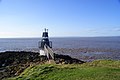
 Black Nore Lighthouse - geograph.org.uk - 6079566.jpg 1,024 × 683; 115 KB
-
 Black Nore Lighthouse - Portishead - geograph.org.uk - 5627546.jpg 5,513 × 3,676; 4.42 MB
-
 Black Nore Lighthouse, Portishead - geograph.org.uk - 5609077.jpg 5,184 × 2,920; 4.61 MB
-
 Black Nore Lighthouse, Portishead - geograph.org.uk - 6015472.jpg 5,184 × 2,920; 5.47 MB
-
 Black Nore.jpg 640 × 480; 114 KB
-
 Boat lift at Portishead Marina - geograph.org.uk - 6079579.jpg 1,024 × 683; 184 KB
-

-
 Boats In the Lock - geograph.org.uk - 3158426.jpg 2,961 × 4,469; 2.39 MB
-
 Boats leaving the Lock - geograph.org.uk - 3158446.jpg 4,592 × 3,056; 3.72 MB
-
 Boundary Stone - geograph.org.uk - 4867279.jpg 640 × 480; 128 KB
-
 Bristol Channel panorama.png 22,196 × 2,120; 60.04 MB
-
 British Rail - geograph.org.uk - 337185.jpg 640 × 480; 133 KB
-
 Broad Walk (geograph 1783598).jpg 480 × 640; 143 KB
-
 Bulk Carrier - geograph.org.uk - 347442.jpg 640 × 480; 51 KB
-
 Burlington Road South Road Portishead - geograph.org.uk - 319922.jpg 640 × 480; 187 KB
-
 Bus Shelter - geograph.org.uk - 208993.jpg 640 × 480; 94 KB
-
 Bus stops on Bristol Road - geograph.org.uk - 3032626.jpg 1,024 × 701; 128 KB
-
 Can Swan Portishead - geograph.org.uk - 3046249.jpg 1,468 × 922; 323 KB
-
 Car park with a view - geograph.org.uk - 2082044.jpg 1,500 × 978; 197 KB
-

-
 Carpark in Portishead - geograph.org.uk - 1701234.jpg 640 × 480; 62 KB
-
 Central tower on former Nautical School, Portishead - geograph.org.uk - 6015474.jpg 2,920 × 5,184; 4.11 MB
-
 Charlcombe Bay. - panoramio.jpg 2,581 × 1,793; 940 KB
-
 Charlcombe Rise - geograph.org.uk - 1045818.jpg 640 × 480; 50 KB
-
 Church converted into housing, Portishead 01.JPG 4,608 × 2,592; 7.61 MB
-
 Church converted into housing, Portishead 02.JPG 4,608 × 3,456; 7.2 MB
-
 Church converted into housing, Portishead 03.JPG 4,608 × 3,456; 7.8 MB
-
 Ciko coffee time at Portishead - geograph.org.uk - 2002167.jpg 640 × 480; 91 KB
-
 Clapton Halt MMB 01.jpg 2,304 × 1,728; 668 KB
-
 Clapton Lane - geograph.org.uk - 3032620.jpg 1,024 × 772; 195 KB
-
 Clevedon MMB 23.jpg 2,304 × 1,728; 1.77 MB
-
 Cliff South of Port's Head - geograph.org.uk - 330110.jpg 514 × 559; 48 KB
-
 Coast (5296046997).jpg 3,184 × 2,120; 1.9 MB
-
 Coast Path (5296034097).jpg 3,184 × 2,120; 1.78 MB
-
 Coast Path (5296037009).jpg 3,184 × 2,120; 1.81 MB
-
 Coast Path (5296038801).jpg 3,184 × 2,120; 1.78 MB
-
 Coast Path (5296041703).jpg 3,184 × 2,120; 1.71 MB
-
 Coast Path (5296634944).jpg 3,184 × 2,120; 1.77 MB
-
 Coast Path (5296639980).jpg 3,184 × 2,120; 1.82 MB
-
 Coast path at Redcliff Bay - geograph.org.uk - 1757049.jpg 640 × 426; 128 KB
-
 Coastal house near Black Nore - geograph.org.uk - 6079567.jpg 1,024 × 683; 232 KB
-
 Container Ship - panoramio (2).jpg 2,742 × 1,408; 2.5 MB
-
 Cormorant sunbathing, Portishead - geograph.org.uk - 314968.jpg 640 × 480; 92 KB
-
 Cottage with a sea view - geograph.org.uk - 4302775.jpg 1,600 × 1,071; 487 KB
-
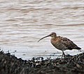 Curlew Portishead - geograph.org.uk - 2002591.jpg 640 × 566; 119 KB
-

-
 Cut Mark, Portishead, Church Road South - geograph.org.uk - 5996864.jpg 1,280 × 960; 638 KB
-
 Cut Mark, Portishead, Church Road South - geograph.org.uk - 5996866.jpg 1,280 × 960; 497 KB
-
 Cut Mark, Portishead, St Mary's Road - geograph.org.uk - 5997536.jpg 960 × 1,280; 444 KB
-
 Cut Mark, Portishead, ^147 High Street - geograph.org.uk - 5996882.jpg 1,280 × 960; 654 KB
-

-
 D3S 0068 (5296647420).jpg 2,120 × 3,184; 1.53 MB
-

-

-
 Ditch - geograph.org.uk - 212110.jpg 450 × 600; 107 KB
-
 Down Road - geograph.org.uk - 2455524.jpg 640 × 480; 83 KB
-

-
 Dredger 'Welsh Piper' - geograph.org.uk - 4364516.jpg 640 × 428; 56 KB
-
 Dredger ahead (3297030229) (2).jpg 1,008 × 667; 619 KB
-
 Dredging between lands lower Severn sands - geograph.org.uk - 3046270.jpg 1,556 × 1,037; 421 KB
-
 Drive to How Ham Farm - geograph.org.uk - 1766892.jpg 640 × 426; 72 KB
-
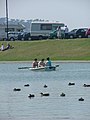
 Ducks on Marine Lake - geograph.org.uk - 3158415.jpg 1,571 × 988; 484 KB
-
-
 East wood woods - geograph.org.uk - 1860729.jpg 4,288 × 2,848; 3.06 MB
-

-
 Entrance lock, Portishead Marina - geograph.org.uk - 6079582.jpg 1,024 × 683; 163 KB
-
-
 Far end of Pennant Place, Portishead - geograph.org.uk - 1832183.jpg 640 × 621; 78 KB
-
 Faux lighthouse - Portishead - geograph.org.uk - 3574059.jpg 474 × 640; 84 KB
-
 Filling the sea lock at Portishead Marina - geograph.org.uk - 3561932.jpg 2,346 × 3,128; 1.42 MB
-
 Fishermen at Battery Point - geograph.org.uk - 1706286.jpg 640 × 480; 49 KB
-
 Fishermen at Battery Point - geograph.org.uk - 3339405.jpg 4,752 × 3,168; 3.34 MB
-
 Five Tug Barge to Portbury - geograph.org.uk - 318232.jpg 629 × 480; 54 KB
-
 Flood sediment - geograph.org.uk - 347972.jpg 500 × 640; 26 KB
-

-
 Footpath to the pier - geograph.org.uk - 2085826.jpg 1,500 × 968; 228 KB
-
 Former Church - Portishead - geograph.org.uk - 4416347.jpg 800 × 600; 275 KB
-

-
 Former windmill, Portishead - geograph.org.uk - 1755716.jpg 640 × 426; 63 KB
-
 Frosty morning in Nightingale Valley - geograph.org.uk - 3343370.jpg 2,560 × 1,920; 2.99 MB
-
 Full Fathom Five - geograph.org.uk - 3574085.jpg 640 × 480; 86 KB
-
 Gardens above Portishead Lake - geograph.org.uk - 4416385.jpg 800 × 600; 221 KB
-
 Gate onto Portishead Down - geograph.org.uk - 1971268.jpg 640 × 441; 68 KB
-
 Gordano school.jpg 640 × 480; 79 KB
-
 Grande Scandinavia (7628967530).jpg 1,024 × 692; 466 KB
-
 Grid - geograph.org.uk - 355439.jpg 640 × 480; 134 KB
-

-
 Harbourmaster's office - geograph.org.uk - 2499381.jpg 1,704 × 2,304; 1.63 MB
-
 Herring gulls Portishead - geograph.org.uk - 2002588.jpg 640 × 492; 65 KB
-
 High View - geograph.org.uk - 2454408.jpg 640 × 480; 87 KB
-
 Hillside Road (5296032781).jpg 3,184 × 2,120; 1.66 MB
-
 House in St Mary's Lane, Portishead - geograph.org.uk - 5997539.jpg 960 × 1,280; 371 KB
-
 Houses on Clapton Lane - geograph.org.uk - 3032525.jpg 1,024 × 712; 141 KB
-
 Ice to Thaw - geograph.org.uk - 1630923.jpg 640 × 306; 36 KB
-
 IMGP6887 (50841647682).jpg 5,508 × 3,472; 6.26 MB
-
 IMGP6891 (50841557771).jpg 5,737 × 3,483; 3.9 MB
-
 IMGP6892 (50841646957).jpg 5,776 × 3,320; 5.74 MB
-
 IMGP6894 (50841556831).jpg 5,788 × 3,747; 5.76 MB
-
 Inner Lock Gates Portishead Marina - geograph.org.uk - 4870248.jpg 1,024 × 768; 595 KB
-
 Kilkenny Bay, Portishead - geograph.org.uk - 1701248.jpg 640 × 480; 91 KB
-
 Lake at Portishead - geograph.org.uk - 10386.jpg 482 × 640; 79 KB
-

-

-

-
 LibLab Paddy Wack - geograph.org.uk - 347924.jpg 640 × 339; 96 KB
-
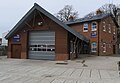 Lifeboat Station, Portishead - geograph.org.uk - 6082893.jpg 2,593 × 1,785; 634 KB
-
 Lighthouse at Battery Point Portishead - geograph.org.uk - 3158395.jpg 4,592 × 3,056; 3.89 MB
-
 Lights Road - geograph.org.uk - 347907.jpg 640 × 480; 82 KB
-
 Ligia oceanica Flickr.jpg 2,572 × 1,718; 1.87 MB
-
 Looking across Marine lake Portishead - geograph.org.uk - 3158384.jpg 4,592 × 3,056; 4.22 MB
-

-
 Looking to Avonmouth - geograph.org.uk - 1705482.jpg 640 × 480; 32 KB
-

-
 Looking towards the Severn Bridges - geograph.org.uk - 3158343.jpg 4,592 × 3,056; 2.77 MB
-
 Marina - Portishead - geograph.org.uk - 3574069.jpg 640 × 480; 83 KB
-
 Marina Lock Portishead - geograph.org.uk - 4870177.jpg 1,024 × 768; 628 KB
-
 Marina sculpture Portishead - geograph.org.uk - 2002136.jpg 640 × 388; 54 KB
-
 Marine boating Lake Portishead - geograph.org.uk - 3158405.jpg 4,278 × 3,025; 4.68 MB
-
 Mark Merer Artwork - geograph.org.uk - 4870240.jpg 1,024 × 768; 609 KB
-
 Mary Irene Millar - geograph.org.uk - 4870187.jpg 1,024 × 768; 573 KB
-
 Memorial Battery Point in rain. - geograph.org.uk - 486265.jpg 640 × 402; 50 KB
-
 Merchant Navy Association memorial at Battery Point - geograph.org.uk - 3339675.jpg 2,560 × 1,920; 2.81 MB
-

-

-
 Modern town-houses - geograph.org.uk - 3032636.jpg 1,024 × 768; 183 KB
-
 Morning at Portishead Marina - geograph.org.uk - 4755280.jpg 768 × 1,024; 172 KB
-
 Mud bank at the mouth of Portishead Marina - geograph.org.uk - 2183962.jpg 1,024 × 768; 289 KB
-
 Mud sucker (3297854414).jpg 1,006 × 668; 508 KB
-
 Mudflats at Kilkenny Bay - geograph.org.uk - 1361203.jpg 640 × 480; 47 KB
-
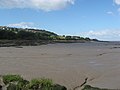
 Mudflats at Portishead - geograph.org.uk - 2085832.jpg 1,500 × 989; 118 KB
-
 Mudflats in the Severn Estuary - geograph.org.uk - 4416513.jpg 800 × 600; 207 KB
-
 Mudflats with drainage channel - geograph.org.uk - 1361201.jpg 640 × 480; 69 KB
-
 MV Autosun off Battery Point, Portishead - geograph.org.uk - 5609078.jpg 5,184 × 2,920; 4.08 MB
-

-

-
 Navigation mark, Portishead, Marina Outer Gates - geograph.org.uk - 5977996.jpg 960 × 1,280; 324 KB
-
 New flats development at Portishead - geograph.org.uk - 4886547.jpg 640 × 480; 64 KB
-

-
 New lifeboat station - geograph.org.uk - 4216271.jpg 1,600 × 1,064; 387 KB
-
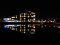 Nighttime at Portishead Marina - geograph.org.uk - 3339567.jpg 2,560 × 1,920; 1.94 MB
-
 North Somerset , Blacknore Point Lighthouse - geograph.org.uk - 4621964.jpg 4,288 × 2,848; 4.54 MB
-
 North Somerset , Bristol Channel - geograph.org.uk - 4621968.jpg 4,269 × 2,835; 6.15 MB
-
 North Somerset , Portishead Point - geograph.org.uk - 4621967.jpg 4,111 × 2,731; 5.05 MB
-
 North Somerset , Portishead Scenery - geograph.org.uk - 4621965.jpg 4,269 × 2,835; 4.43 MB
-
 North Somerset , Portishead Scenery - geograph.org.uk - 4623314.jpg 4,084 × 2,712; 6.48 MB
-
 North Somerset , Portishead Scenery - geograph.org.uk - 4624321.jpg 4,282 × 2,844; 5.93 MB
-
 North Somerset , The Bristol Channel - geograph.org.uk - 4621966.jpg 4,249 × 2,822; 6.52 MB
-
 Northeast Portishead - geograph.org.uk - 1832177.jpg 640 × 427; 71 KB
-

-
 Old pier, new use - geograph.org.uk - 2499374.jpg 2,304 × 1,704; 1.63 MB
-
 Old Pill Box, Portishead - geograph.org.uk - 6083456.jpg 3,648 × 2,736; 2.32 MB
-
 Old winding gear by the lock - geograph.org.uk - 3339665.jpg 2,560 × 1,920; 2.84 MB
-
 Open All Hours^ - geograph.org.uk - 3917253.jpg 1,600 × 1,200; 284 KB
-
 Ordnance Survey 1GL Bolt - geograph.org.uk - 4853590.jpg 480 × 640; 113 KB
-
 Ordnance Survey Cut Mark - geograph.org.uk - 4867270.jpg 480 × 640; 125 KB
-
 Ordnance Survey Cut Mark - geograph.org.uk - 4867273.jpg 640 × 480; 121 KB
-
 Ordnance Survey Cut Mark - geograph.org.uk - 4867275.jpg 640 × 480; 124 KB
-
 Ordnance Survey Cut Mark - geograph.org.uk - 4867282.jpg 480 × 640; 108 KB
-
 Ordnance Survey Cut Mark - geograph.org.uk - 4867287.jpg 480 × 640; 65 KB


_with_fuel_depot_behind_-_geograph.org.uk_-_2002579.jpg)


.jpg)


.jpg)
.jpg)
.jpg)
.jpg)
.jpg)
.jpg)
.jpg)


.jpg)


.jpg)


_(2).jpg)


.jpg)


.jpg)


.jpg)
.jpg)
.jpg)
.jpg)


.jpg)


