Category:Potterspury
Cymraeg: Pentref a phlwyf yn Swydd Northampton ydy Potterspury; saif yn Nwyrain Canolbarth Lloegr. (→Potterspury)
English: Potterspury is a village and civil parish in the district of South Northamptonshire. The nearest main town is Milton Keynes, the centre of which is about 7 miles south-east. At the time of the 2001 census, the parish's population was 1,391 people living in 591 households. (→Potterspury)
Español: Potterspury es un pueblo y una parroquia civil del distrito de South Northamptonshire, en el condado de Northamptonshire (Inglaterra). (→Potterspury)
Nederlands: Potterspury is een plaats en civil parish in het bestuurlijke gebied South Northamptonshire, in het Engelse graafschap Northamptonshire met 1.391 inwoners. (→Potterspury)
Polski: Potterspury – wieś w Anglii, w hrabstwie Northamptonshire, w dystrykcie South Northamptonshire. Leży 17 km na południe od miasta Northampton i 84 km na północny zachód od Londynu. Miejscowość liczy 1391 mieszkańców. (→Potterspury)

village and civil parish in Northamptonshire, United Kingdom  | |||||
| Upload media | |||||
| Instance of | |||||
|---|---|---|---|---|---|
| Location | West Northamptonshire, Northamptonshire, East Midlands, England | ||||
| Population |
| ||||
| Area |
| ||||
 | |||||
Subcategories
This category has the following 2 subcategories, out of 2 total.
F
W
Media in category "Potterspury"
The following 91 files are in this category, out of 91 total.
-
 A5 at Potterspury village boundary - geograph.org.uk - 4873188.jpg 640 × 480; 58 KB
-
 A5 heading north - geograph.org.uk - 5647165.jpg 640 × 428; 116 KB
-
 A5 northbound - geograph.org.uk - 5647140.jpg 640 × 428; 124 KB
-
 A5 northbound - geograph.org.uk - 5647150.jpg 640 × 428; 89 KB
-
 A5 northbound - geograph.org.uk - 5647262.jpg 640 × 428; 85 KB
-
 A5 northbound at Potterspury - geograph.org.uk - 4873189.jpg 640 × 480; 63 KB
-
 Arable land east of Dairy Farm - geograph.org.uk - 5681194.jpg 1,024 × 768; 220 KB
-
 Arable land south of Pottersbury - geograph.org.uk - 5681192.jpg 1,024 × 768; 216 KB
-
 Barn and farmbuildings north of Puxley - geograph.org.uk - 256888.jpg 640 × 480; 140 KB
-
 Bear's Copse - geograph.org.uk - 3496864.jpg 1,600 × 1,067; 623 KB
-
 Bench by the path - geograph.org.uk - 2951706.jpg 640 × 427; 105 KB
-
 Boarding Houses.jpg 640 × 480; 131 KB
-
 Buttercups and horses by Wakefield Lodge - geograph.org.uk - 3496873.jpg 1,600 × 1,069; 576 KB
-

-
 Church End looking North East - geograph.org.uk - 1007082.jpg 640 × 480; 59 KB
-
 Church End looking South East - geograph.org.uk - 1007080.jpg 640 × 480; 75 KB
-
 Copse on Kennels Drive - geograph.org.uk - 3496843.jpg 1,600 × 1,066; 554 KB
-
 Dogsmouth Brook - geograph.org.uk - 2960929.jpg 640 × 427; 112 KB
-
 Drive to Wakefield Farm - geograph.org.uk - 3496863.jpg 1,200 × 1,600; 574 KB
-

-
 Entrance to Potterspury House - geograph.org.uk - 256696.jpg 640 × 480; 132 KB
-
 Farmland in front of Wakefield Lawn - geograph.org.uk - 3496860.jpg 1,600 × 1,069; 683 KB
-
 Fishing lake by Wakefield Farm - geograph.org.uk - 3496851.jpg 1,600 × 1,069; 342 KB
-
 Footbridge on the Grafton Way - geograph.org.uk - 2961026.jpg 640 × 427; 140 KB
-

-
 Footpath to Potterspury - geograph.org.uk - 256890.jpg 640 × 480; 131 KB
-
 Gate on the Grafton Way - geograph.org.uk - 2961024.jpg 640 × 427; 108 KB
-
 Gate on the path to Potterspury - geograph.org.uk - 3019058.jpg 1,600 × 1,068; 454 KB
-
 Grafton Terrace Potterspury 1840 - geograph.org.uk - 2960906.jpg 640 × 427; 77 KB
-
 Grafton Way along the field edge - geograph.org.uk - 2961027.jpg 480 × 640; 106 KB
-
 House and farm shop off Towcester Drive - geograph.org.uk - 5073485.jpg 3,786 × 2,528; 1.96 MB
-
 Houses on High Street - geograph.org.uk - 5071433.jpg 5,184 × 3,456; 7.69 MB
-
 Joining the A508 - geograph.org.uk - 2681022.jpg 640 × 480; 46 KB
-
 Lake in front of Wakefield Lodge - geograph.org.uk - 3496867.jpg 1,600 × 1,068; 545 KB
-
 Layby on Watling Street, Potterspury - geograph.org.uk - 6162038.jpg 1,920 × 1,280; 1.14 MB
-

-
 Main Drive to Wakefield Lodge - geograph.org.uk - 3496855.jpg 1,600 × 1,066; 518 KB
-
 Mansion Gardens, new development - geograph.org.uk - 2482157.jpg 640 × 480; 72 KB
-
 New houses on Furtho Lane - geograph.org.uk - 2960912.jpg 480 × 640; 121 KB
-

-

-
 Path between the houses - geograph.org.uk - 2965185.jpg 480 × 640; 141 KB
-
 Path through the spinney - geograph.org.uk - 2965196.jpg 480 × 640; 159 KB
-
 Path to Cherrytree Lodge - geograph.org.uk - 3019070.jpg 1,600 × 1,067; 587 KB
-
 Path to Dairy Farm - geograph.org.uk - 2965177.jpg 640 × 429; 90 KB
-
 Path to Potterspury - geograph.org.uk - 2960925.jpg 640 × 427; 89 KB
-
 Plant table at Roman Way Garden Centre - geograph.org.uk - 1966896.jpg 1,600 × 1,200; 425 KB
-
 Poppies in Potterspury 2007 - geograph.org.uk - 471036.jpg 640 × 457; 176 KB
-
 Pots at Roman Way Garden Centre - geograph.org.uk - 1966901.jpg 1,600 × 1,200; 324 KB
-
 Potterspury Chapel - geograph.org.uk - 2315703.jpg 1,280 × 960; 476 KB
-
 Potterspury House - geograph.org.uk - 2315708.jpg 1,280 × 960; 492 KB
-
 Potterspury Lodge Front of School.jpg 640 × 480; 130 KB
-
 Potterspury Lodge School front.JPG 2,016 × 1,512; 938 KB
-
 Potterspury Lodge School.jpg 640 × 480; 113 KB
-

-
 Poundfield Road - geograph.org.uk - 2681027.jpg 640 × 480; 65 KB
-

-
 Road Junction at Puxley Farm - geograph.org.uk - 2315683.jpg 1,280 × 960; 437 KB
-
 Roman Way Garden Centre at Potterspury - geograph.org.uk - 1966893.jpg 1,500 × 980; 134 KB
-
 St Nicholas Church - geograph.org.uk - 2961034.jpg 640 × 428; 110 KB
-
 Stable buildings - geograph.org.uk - 2960919.jpg 640 × 427; 65 KB
-
 Summerhouses at Roman Way Garden Centre - geograph.org.uk - 1966899.jpg 1,600 × 1,200; 254 KB
-
 Tennis court and shelter on the Wakefield estate - geograph.org.uk - 3496872.jpg 1,600 × 1,078; 670 KB
-
 The brook in Potterspury - geograph.org.uk - 2681008.jpg 640 × 480; 101 KB
-
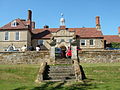
 The Cock - Potterspury - geograph.org.uk - 2315694.jpg 1,280 × 960; 453 KB
-
 The Cock in Potterspury - geograph.org.uk - 2960903.jpg 640 × 426; 67 KB
-
 The Cock Inn - geograph.org.uk - 5071460.jpg 5,184 × 3,456; 7.17 MB
-
 The Cock Inn sign - geograph.org.uk - 5071623.jpg 2,346 × 3,124; 1.47 MB
-
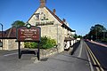 The Old Talbot on the A5 - geograph.org.uk - 2965172.jpg 640 × 427; 74 KB
-
 The road to Dairy Farm - geograph.org.uk - 5681198.jpg 1,024 × 768; 208 KB
-
 The Super Sausage Cafe - geograph.org.uk - 2965160.jpg 640 × 427; 66 KB
-
 Tree trunk on the Wakefield Lawn - geograph.org.uk - 3496870.jpg 1,600 × 1,069; 524 KB
-
 Wakefield farm shops - geograph.org.uk - 2965168.jpg 640 × 427; 80 KB
-
 Whittlewood Forest - geograph.org.uk - 437742.jpg 640 × 480; 118 KB
-
 Whittlewood Forest - geograph.org.uk - 442291.jpg 640 × 480; 117 KB
-
 Woodlands by Watling Street, Potterspury - geograph.org.uk - 6162039.jpg 1,920 × 1,280; 1.35 MB
-
 Yardley Road - geograph.org.uk - 5071445.jpg 5,184 × 3,456; 7.56 MB
-
 Yardley Road - geograph.org.uk - 5071455.jpg 5,184 × 3,456; 7.64 MB
-

-
 High Street, Potterspury 2007 - geograph.org.uk - 436921.jpg 640 × 399; 76 KB
-
 Meadow View, Potterspury - geograph.org.uk - 436914.jpg 640 × 478; 73 KB
-
 Queen's Oak - geograph.org.uk - 281365.jpg 640 × 479; 90 KB
-

-
 View through a hedge - geograph.org.uk - 437219.jpg 640 × 480; 100 KB
-
 Whittlebury - geograph.org.uk - 437255.jpg 640 × 480; 82 KB
-
 Whittlewood Forest - geograph.org.uk - 437231.jpg 640 × 480; 117 KB
-
 Whittlewood Forest - geograph.org.uk - 437707.jpg 640 × 480; 142 KB
-
 Whittlewood Forest - geograph.org.uk - 440459.jpg 640 × 480; 95 KB
-
 Whittlewood Forest - geograph.org.uk - 452812.jpg 640 × 480; 117 KB
-
 Whittlewood Forest - geograph.org.uk - 454361.jpg 640 × 480; 110 KB
-
 Wicken Wood - geograph.org.uk - 437734.jpg 640 × 480; 101 KB


