Category:Prince of Wales Island, Alaska
island in Alaska, United States of America   | |||||
| Upload media | |||||
| Instance of | |||||
|---|---|---|---|---|---|
| Part of | |||||
| Location | Unorganized Borough, Alaska | ||||
| Located in or next to body of water | |||||
| Width |
| ||||
| Length |
| ||||
| Population |
| ||||
| Area |
| ||||
| Different from | |||||
 | |||||
Subcategories
This category has the following 8 subcategories, out of 8 total.
C
D
- Dolomi, Alaska (6 F)
H
K
- Klinkwan, Alaska (10 F)
M
- Moira Sound (6 F)
O
- On Your Knees Cave (1 F)
Media in category "Prince of Wales Island, Alaska"
The following 47 files are in this category, out of 47 total.
-
 1926 Canada-Alaska 1903 boundary-map.png 429 × 418; 433 KB
-

-
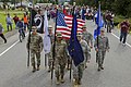 Alaska Organized Militia color guard.jpg 4,865 × 3,244; 6.04 MB
-
 Bald eagle nest tree.jpg 687 × 1,050; 135 KB
-
 Bokan mountain locator USGS.JPG 631 × 794; 81 KB
-
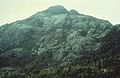 Bokan Mountain.JPG 360 × 233; 16 KB
-
 Bokan prospects.PNG 2,835 × 1,993; 237 KB
-

-
 Coppermount.JPG 689 × 902; 75 KB
-
 Eagle's nest POW 1986 FWS.jpg 606 × 900; 135 KB
-
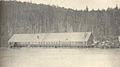 FMIB 38777 Salmon Cannery, Hunter Bay.jpeg 1,135 × 631; 265 KB
-
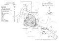
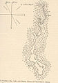
 FMIB 38802 Sketch of Hunter Bay Lake System.jpeg 583 × 729; 56 KB
-
 FMIB 40753 Stream and Leads, Salmon Bay, Prince of Wales Island.jpeg 493 × 951; 67 KB
-
 FMIB 40754 Lake and Stream at Head of Red Bay, Prince of Wales Island.jpeg 676 × 1,007; 115 KB
-

-
 FMIB 40757 Lake and stream, Shipley Bay, Prince of Wales Island.jpeg 780 × 1,033; 146 KB
-
 FMIB 40758 Humpback Stream, Shipley Bay, Prince of Wales Island.jpeg 693 × 1,098; 89 KB
-
 FMIB 40765 Lake and Stream, Kima Bay, Prince of Wales Island.jpeg 841 × 1,072; 140 KB
-

-

-
-

-

-
 Heceta Island.png 805 × 627; 929 KB
-
 Hunter Bay 1898 USGS mwc00047.jpg 1,400 × 1,010; 865 KB
-
 Indian - Alaska - DPLA - 8905fba170c59cb3d049543cf20f2f7e.jpg 4,756 × 3,858; 2.13 MB
-
 Indian - Alaska - DPLA - 9a070bfeb85c0e1b1a4df1f983dff1c3.jpg 4,773 × 3,872; 2.58 MB
-

-

-
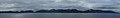
 Kasaan Peninsula pano.JPG 3,503 × 686; 313 KB
-
 Kasaan Peninsula, Prince of Wales Island.JPG 4,608 × 3,456; 3.48 MB
-
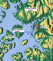 Klawock Map.png 555 × 643; 803 KB
-
 Klawock sporting group. - NARA - 297637.jpg 3,000 × 2,103; 3.5 MB
-
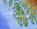
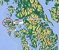
 Map of Alaska highlighting Prince of Wales Island.png 300 × 186; 8 KB
-
 Mappa Skowl Arm.png 766 × 686; 821 KB
-
 Maybeso EF bog area - DPLA - 8ff951e73c79ed900b987797d0cdebc7.jpg 3,008 × 2,000; 4.07 MB
-
 Nakat Packing Corp Waterfall Cannery Meyer.jpg 800 × 773; 125 KB
-
-
 Noyes Island Mappa.jpg 733 × 632; 260 KB
-

-
 Prince of Wales ferry, Ketchikan.jpg 3,072 × 2,304; 1.15 MB
-
 Prince of Wales Island banner Kasaan Peninsula.JPG 3,071 × 449; 204 KB
-
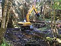 Prince of Wales Landscape Restoration Partnership work.jpg 878 × 659; 158 KB
-
 Ross-Adams mine diagram.PNG 1,039 × 676; 55 KB
-

-
 Sulzer Tongass National Forest.jpg 3,176 × 1,768; 857 KB
-
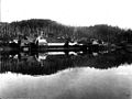
 View of village of Waterfall, ca 1910 (THWAITES 356).jpeg 766 × 447; 59 KB


.jpg)


.jpg)
.jpeg)


.jpeg)

.jpg)


.jpg)

.jpeg)