Category:Probus, Cornwall
village in Cornwall, United Kingdom  | |||||
| Upload media | |||||
| Instance of | |||||
|---|---|---|---|---|---|
| Location | Cornwall, South West England, England | ||||
| Population |
| ||||
| Elevation above sea level |
| ||||
 | |||||
Subcategories
This category has the following 5 subcategories, out of 5 total.
Media in category "Probus, Cornwall"
The following 77 files are in this category, out of 77 total.
-
 Allotments, Ladock Road, Probus, Cornwall - August 2023.jpg 4,423 × 3,289; 2.35 MB
-
 An active quarry - geograph.org.uk - 6471207.jpg 1,024 × 711; 994 KB
-
 An additional private entrance to Trewithen Farms - geograph.org.uk - 6451336.jpg 1,024 × 683; 1.05 MB
-
 Apple tree on an allotment, Ladock Road, Probus, Cornwall - August 2023.jpg 3,289 × 4,382; 2.28 MB
-
 Barn at Golden Manor Geograph-1696874-by-D-Gore.jpg 1,780 × 1,183; 400 KB
-
 Barns at Golden Mill - geograph.org.uk - 3418234.jpg 640 × 480; 122 KB
-
 Cattle grazing, Rasparveth - geograph.org.uk - 5889780.jpg 1,024 × 681; 116 KB
-
 Cattle grazing, Resparveth - geograph.org.uk - 5650010.jpg 640 × 453; 49 KB
-
 Commemorative lantern in Probus - geograph.org.uk - 2788302.jpg 480 × 640; 93 KB
-
 Cornish Pasture - geograph.org.uk - 5889778.jpg 1,024 × 681; 77 KB
-
 Cornish pasture - geograph.org.uk - 5894861.jpg 1,024 × 559; 73 KB
-
 Cornwall Council recycling lorry, Fore Street, Probus, Cornwall - August 2023.jpg 3,913 × 2,670; 1.37 MB
-
 Crossroads to the west of Golden - geograph.org.uk - 5392052.jpg 4,000 × 3,000; 3.04 MB
-
 Cuskayne Farm - geograph.org.uk - 5889777.jpg 1,024 × 681; 97 KB
-

-
 East side of Grampound - geograph.org.uk - 6439615.jpg 1,024 × 683; 627 KB
-
 Electricity Sub-Station - geograph.org.uk - 194410.jpg 640 × 427; 89 KB
-
 Field by Cornish Main Line - geograph.org.uk - 5889775.jpg 1,024 × 681; 115 KB
-
 Field, Resparveth - geograph.org.uk - 5889779.jpg 1,024 × 681; 74 KB
-
 Grampound Road village speed limit ahead - geograph.org.uk - 6443130.jpg 1,024 × 683; 809 KB
-
 Grazing, Tregurno - geograph.org.uk - 5650011.jpg 640 × 414; 50 KB
-
 Hedge 'Tunnel' - geograph.org.uk - 6451139.jpg 1,024 × 683; 1.18 MB
-
 Hedge-lined road to Probus - geograph.org.uk - 5391749.jpg 4,000 × 3,000; 3.53 MB
-
 Houses, Probus - geograph.org.uk - 6324761.jpg 1,024 × 683; 193 KB
-
 Inside Geen Mill - geograph.org.uk - 5418740.jpg 2,592 × 1,944; 1.58 MB
-
 Junction of roads to the east of Trewithen - geograph.org.uk - 5392043.jpg 4,000 × 3,000; 3.41 MB
-
 Ladock Road crossing a bridge over a small stream - geograph.org.uk - 5391819.jpg 4,000 × 3,000; 4.53 MB
-
 Leafy country lane - geograph.org.uk - 6471219.jpg 1,024 × 683; 1.09 MB
-
 Little Trewirgie Farm - geograph.org.uk - 1907952.jpg 640 × 480; 84 KB
-
 Little Trewirgie Farm - geograph.org.uk - 1907959.jpg 640 × 480; 112 KB
-
 Milestone - geograph.org.uk - 4308561.jpg 640 × 480; 92 KB
-
 Milestone on the A390 at Tregoose - geograph.org.uk - 2352389.jpg 640 × 480; 108 KB
-
 MilestoneProbus.jpg 3,740 × 5,610; 18.26 MB
-
 MilestoneTruckHill.jpg 3,976 × 5,964; 20.71 MB
-

-
-

-
 Old Direction Sign - Signpost south of Levardro - geograph.org.uk - 6096264.jpg 1,363 × 1,124; 344 KB
-
-

-
 Old Milestone by the B3275, Tresowga - geograph.org.uk - 5623214.jpg 428 × 640; 67 KB
-
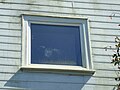 Owl impression left on window, Geen Mill - geograph.org.uk - 5418373.jpg 2,592 × 1,944; 2.03 MB
-
 Parish Council notice board, Probus, Cornwall - August 2023.jpg 2,835 × 4,196; 1.91 MB
-
 Pasture land - geograph.org.uk - 5889784.jpg 1,024 × 681; 93 KB
-
 Pasture, Probus - geograph.org.uk - 6324745.jpg 1,024 × 683; 209 KB
-
 Pasture, Probus - geograph.org.uk - 6324750.jpg 1,024 × 683; 245 KB
-
 Post box, Fore Street, Probus, Cornwall - August 2023.jpg 2,722 × 4,310; 1.63 MB
-
 Private entrance to Trewithen Farms - geograph.org.uk - 6451143.jpg 1,024 × 683; 1.12 MB
-
 Private Track in Barteliver Woods - geograph.org.uk - 6443916.jpg 1,024 × 683; 1 MB
-
 Probus Snake.jpg 4,128 × 2,322; 3.5 MB
-
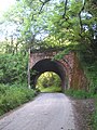 Railway bridge near Tresournes - geograph.org.uk - 2984470.jpg 480 × 640; 122 KB
-
 Road and farmland, Probus - geograph.org.uk - 6144462.jpg 1,024 × 768; 280 KB
-
 Road at Barteiliver - geograph.org.uk - 5392038.jpg 4,000 × 3,000; 4.23 MB
-
 Road at Beechleigh - geograph.org.uk - 5391691.jpg 4,000 × 3,000; 3.12 MB
-
 Road from Grampound to Grampound Road - geograph.org.uk - 5392009.jpg 4,000 × 3,000; 4.32 MB
-
 Road from Grampound to Grampound Road - geograph.org.uk - 5392016.jpg 4,000 × 3,000; 3.71 MB
-
 Road junction near Grampound Road - geograph.org.uk - 6443212.jpg 1,024 × 683; 847 KB
-
 Road Junction near Trewithen Estate - geograph.org.uk - 6471200.jpg 1,024 × 683; 649 KB
-
 Road to Grampound from Barteliver - geograph.org.uk - 5392031.jpg 4,000 × 3,000; 3.39 MB
-

-
 Stone stile, Fore Street, Probus, Cornwall - August 2023.jpg 3,289 × 4,423; 2.52 MB
-
 Surprisingly straight country lane - geograph.org.uk - 6443182.jpg 1,024 × 683; 819 KB
-
 Traditional stone walling in Probus Garden - geograph.org.uk - 2352223.jpg 3,072 × 2,048; 1.75 MB
-
 Tree-lined road between Treworyan and Ventonglidder - geograph.org.uk - 5391737.jpg 4,000 × 3,000; 4.63 MB
-
 Trees along small stream - geograph.org.uk - 6025706.jpg 1,024 × 681; 118 KB
-
 Tregony Road joining Fore Street in Probus - geograph.org.uk - 5391832.jpg 4,000 × 3,000; 2.78 MB
-
 Trewithen Gardens - biomass boiler house - geograph.org.uk - 5800129.jpg 640 × 480; 119 KB
-
 Trewithen Gardens - geograph.org.uk - 5895923.jpg 640 × 480; 87 KB
-

-
 View from viaduct - geograph.org.uk - 6025707.jpg 1,024 × 681; 151 KB
-
 Village pump, Probus, Cornwall - August 2023.jpg 3,024 × 3,969; 3.38 MB
-
 Wind Turbine between Grampound and Probus - geograph.org.uk - 6439791.jpg 1,024 × 656; 460 KB
-
 Wind Turbine near Grampound - geograph.org.uk - 6440070.jpg 1,024 × 683; 450 KB
-
 Woods below viaduct - geograph.org.uk - 5894862.jpg 1,024 × 681; 122 KB
-
 Badly Maintained Lay-by - geograph.org.uk - 197294.jpg 640 × 452; 154 KB
-
 Probus Village Cemetery - geograph.org.uk - 195032.jpg 640 × 427; 111 KB
-
 Probus Village Centre from the Churchyard - geograph.org.uk - 194999.jpg 640 × 491; 118 KB


