Category:Public domain Ordnance Survey images
Media in category "Public domain Ordnance Survey images"
The following 200 files are in this category, out of 2,170 total.
(previous page) (next page)-
 0 Arbeia 01.png 1,200 × 600; 1.74 MB
-
 1 Segedunum.png 1,200 × 600; 1.83 MB
-
 10 Magnis.png 1,200 × 600; 1.81 MB
-
 11 Banna.png 1,200 × 600; 1.81 MB
-
 12 Camboglanna.png 1,200 × 600; 1.69 MB
-
 13 Petriana.png 1,200 × 600; 1.79 MB
-
 14 Aballava.png 1,200 × 600; 1.6 MB
-
 15 Congavata.png 1,200 × 600; 1.5 MB
-
 16 Maia.png 1,200 × 600; 1.5 MB
-
 1801 Ordnance Survey map of Kent.jpg 600 × 410; 108 KB
-
 1868 Boundary map of Milford.jpg 580 × 466; 79 KB
-
 1877 - Sharptor Map.jpg 916 × 559; 120 KB
-
 1880 Map on Chippy withj Horse Racing.png 1,581 × 856; 512 KB
-

-
 1900 Vaux Monmouth Race Course.png 1,581 × 856; 1.01 MB
-
 1907 - Sharptor Map.jpg 953 × 565; 108 KB
-
 1908 Kings Lines Ordnance Survey map.jpg 2,358 × 1,275; 1.7 MB
-
 1908 Queens Lines and Princes Lines Ordnance Survey map.jpg 2,294 × 1,117; 1.42 MB
-
 1910 Cheshire ordnance survey map showing Edgeley Park (cropped).jpg 2,282 × 2,782; 1.53 MB
-
 1920 Vaux Monmouth Race Course.png 1,581 × 856; 766 KB
-
 1935 OS Map of Vale Park.jpg 781 × 640; 537 KB
-
 1945 map of Runwell.png 313 × 342; 211 KB
-
 1945 map of street layout around Burgess Park, Southwark.png 489 × 268; 825 KB
-
 1966 Ordnance Survey - Sutton Hoo helmet - original.jpg 773 × 1,112; 254 KB
-
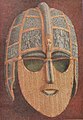 1966 Ordnance Survey - Sutton Hoo helmet.jpg 1,418 × 2,044; 1.69 MB
-
 2 PonsAelius.png 1,200 × 600; 1.9 MB
-
 21 Gulls way (blue peter)(plan).png 1,761 × 1,575; 1.91 MB
-
 21 Gulls way (blue peter).png 4,854 × 3,082; 22.79 MB
-
 3 Condercum.png 1,200 × 600; 1.87 MB
-
 4 Vindovala.png 1,200 × 600; 1.65 MB
-
 5 Onnum.png 1,200 × 600; 1.7 MB
-
 6 Cilurnum.png 1,200 × 600; 1.84 MB
-
 7 Brocolitia.png 1,200 × 600; 1.67 MB
-
 8 Vercovicium.png 1,200 × 600; 1.78 MB
-
 9 Aesica.png 1,200 × 600; 1.78 MB
-
 A map of Old Holbrook, circa 1937.png 206 × 447; 103 KB
-
 A1 in London 1923.jpg 289 × 424; 55 KB
-
 A74 road 1932.png 546 × 679; 831 KB
-
 Aa filton near Bristol UK 1935.jpg 1,357 × 795; 235 KB
-
 Aa oldwythenshawe 00.jpg 1,275 × 1,275; 430 KB
-
 Aberdeen stations on 1869 OS map.png 765 × 475; 714 KB
-
 Abu Shusheh and caves in Survey of Western Palestine 1880.16 (cropped).jpg 1,126 × 1,081; 645 KB
-

-
 Admiralty Chart No 262c Guernsey Western Part, Published 1954.jpg 11,026 × 16,245; 31.74 MB
-
 Admiralty Chart No 62a Jersey (Eastern Sheet), Published 1901.jpg 11,293 × 18,769; 44.62 MB
-
 Admiralty Chart No 62b Jersey (Middle Sheet), Published 1960.jpg 11,285 × 18,772; 57.89 MB
-
 Admiralty Ordnance Survey Falklands, Published 1884 - 1928.jpg 16,410 × 11,880; 56.16 MB
-

-
-
 Airedale 1922 OS Map.png 1,200 × 900; 2.53 MB
-
 Airship Raid 31 March - 1 April, 1916.jpg 2,000 × 2,688; 3.18 MB
-
 Alexandra Palace station, 1920.png 1,105 × 674; 1.04 MB
-
 Alexandra Quarry 1913.jpg 2,000 × 1,170; 1,000 KB
-
 Alnwick 1945.png 513 × 385; 455 KB
-
 Altens - OS 25 inch 1892-1914.png 704 × 502; 333 KB
-
 Altrinchammap1924.jpg 3,504 × 2,544; 1.51 MB
-
 Alvamap1945.png 842 × 647; 1.31 MB
-
 Apsley house on an 1869 Ordnance Survey Map.JPG 500 × 492; 79 KB
-
 Ascot Racecoursemap 1947.png 1,210 × 918; 2.46 MB
-
 Ashwell Street OS 1893.jpg 3,004 × 1,500; 2.42 MB
-

-
 Austin Village OS map 1936 1 2500 25 inch.jpg 3,720 × 4,272; 4.01 MB
-
 Avoncliff - Westwood Tramway.jpg 711 × 530; 140 KB
-
 Axminster 177 NPseries.jpg 635 × 508; 218 KB
-
 Ayres of Swinister and the Houb, Shetland - 1902 O.S map.jpg 829 × 674; 169 KB
-
 Bailiff Bridge station from 1907 OS map.png 937 × 590; 1.05 MB
-
 Balerno Loop 25000 Composite.jpg 6,500 × 3,776; 6.62 MB
-
 Balham Station, OSMap.png 934 × 611; 1.64 MB
-
 Baltic lands in 1661.jpg 1,716 × 2,243; 893 KB
-
 Bamber Bridge in 1845.jpg 2,663 × 3,568; 5.07 MB
-
 Bamburgh map 1947.jpg 746 × 436; 199 KB
-
 Bangormap1947.png 1,143 × 1,146; 2.31 MB
-
 Banias in the Survey of Western Palestine 1880.02 (cropped).jpg 1,441 × 942; 627 KB
-
 Bank street os.jpg 280 × 210; 104 KB
-
 Barnstablemap 1937.jpg 2,544 × 3,504; 1.67 MB
-
 Barnstablemap.jpg 506 × 288; 52 KB
-
 Bassett 1810.png 363 × 195; 173 KB
-
 Bassett and Bassett Green locations.png 639 × 328; 424 KB
-
 Bath Sydney Gardens 1886.jpg 2,220 × 2,296; 2.58 MB
-
 Bath To Midford 1903.png 4,257 × 5,428; 6.05 MB
-
 Battersea Park Road and Battersea Park Stations, 1896.jpg 978 × 573; 426 KB
-
 Battersea station on 1879 OS Map.jpg 689 × 668; 340 KB
-
 Battle of Arras - First Army communications map.jpg 1,981 × 2,286; 1.24 MB
-
 Battle of Arras - Map showing British advance on the Arras front.jpg 2,198 × 3,001; 1.27 MB
-
 Battle of Broodseinde - barrage map (central section).jpg 10,369 × 8,312; 12.6 MB
-
 Battle of Broodseinde - rough attack planning map.jpg 1,502 × 1,865; 500 KB
-
 Battle of Broodseinde - situation map.jpg 6,727 × 5,139; 10.64 MB
-
 Battle of Broodseinde - Trench map showing disposition of the 2nd Autralian Division.jpg 2,005 × 1,528; 490 KB
-
 Battle of Drocourt-Quéant Line - Barrage Map.jpg 2,800 × 1,827; 1.07 MB
-
 Battle of Hill 70 - local planning map.jpg 21,871 × 15,837; 42.02 MB
-
 Battle of Menin Road - meesage map.jpg 1,481 × 1,162; 1.27 MB
-
 Battle of Menin Road - objective lines map.jpg 2,301 × 3,192; 4.65 MB
-
 Battle of Menin Road- Australian situation map (autocoloured).jpg 2,893 × 1,837; 5.21 MB
-
 Battle of Menin Road- Australian situation map.jpg 2,893 × 1,837; 3.98 MB
-
 Battle of Messines - 1-10000 planning map.jpg 2,851 × 2,678; 1,005 KB
-
 Battle of Messines - II ANZAC Corps attack plan down to brigade level.jpg 2,581 × 1,597; 1.14 MB
-
 Battle of Messines - II ANZAC Corps traffic circuit map.jpg 2,019 × 1,612; 290 KB
-
 Battle of Messines - II ANZAC railway map.jpg 1,825 × 1,545; 239 KB
-
 Battle of Messines - Intelligence map of Messines village.jpg 976 × 1,550; 116 KB
-
 Battle of Messines - planning map (cropped).jpg 2,598 × 4,496; 8.09 MB
-
 Battle of Messines - planning map cropped mit Ort Wytschaete.jpg 466 × 361; 326 KB
-
 Battle of Messines - planning map cropped Wytschaete.jpg 303 × 264; 161 KB
-
 Battle of Messines - planning map.png 3,497 × 4,794; 25.28 MB
-
 Battle of Poelcappelle - barrage map (full & higher resolution).jpg 1,830 × 2,723; 936 KB
-
 Battle of Poelcappelle - barrage map for II ANZAC Corps only.jpg 2,701 × 2,334; 1.08 MB
-
 Battle of Poelcappelle - barrage map.jpg 850 × 1,134; 232 KB
-

-

-

-
 Battle of the Canal du Nord - 1st Canadian Division planning map.jpeg 19,409 × 6,747; 55.2 MB
-
 Battle of the Canal du Nord - battle map (Sept 1918).jpg 6,828 × 4,403; 27.12 MB
-
 Battle of the Canal du Nord - Canadian Machine Gun Corps barrage map.jpg 20,797 × 13,498; 49.88 MB
-
 Battle of the Canal du Nord - Intellligence Target Map (25 Sept 1918).jpg 20,553 × 13,592; 49.69 MB
-
 Baynard Castle, Cottingham, OS map, 1910.jpg 730 × 639; 186 KB
-
 Baynard Castle, Cottingham, OS map, 1927.jpg 1,784 × 942; 560 KB
-
 Bayswater station 1869 map.png 1,200 × 600; 2.06 MB
-
 Bbstreet.jpg 626 × 440; 329 KB
-
 Beaminster tunnel maps.png 850 × 337; 197 KB
-
 Beaumont Cut.png 1,096 × 278; 147 KB
-
 Becclesmap 1921.jpg 2,544 × 3,504; 1.37 MB
-
 BeershevaRegion1940s.jpg 1,126 × 1,128; 435 KB
-
 Before Stansted Airport aa.jpg 1,424 × 935; 265 KB
-
 Belle Isle1925.jpg 286 × 258; 59 KB
-
 Belstead Map 1946.png 573 × 443; 464 KB
-
 Ben Nevis and Glen Coe, One-inch Ordnance Survey Tourist Map, Published 1959.jpg 9,630 × 12,446; 16.89 MB
-
 Bidefordmap 1937.jpg 758 × 702; 929 KB
-
 Birkenheadmap1947.jpg 2,544 × 3,504; 1.8 MB
-
 Birkhouse Moor Map.jpg 739 × 444; 73 KB
-
 Birmingham OS 1834 map.JPG 1,109 × 577; 230 KB
-

-
 Birmingham Worcester Wharf Central Goods Depot OS map 2nd edition 1905.png 4,853 × 5,394; 5.93 MB
-
 Blaen y Cwm Quarry 1899.jpg 1,100 × 969; 338 KB
-
 Blake Hall Station Map 1923.png 1,027 × 699; 2.06 MB
-
 Blue Coat School Birmingham Map 1918.jpg 857 × 603; 263 KB
-
 Blyth map c.1860.jpg 1,103 × 747; 755 KB
-
 Bognor regis crop.jpg 646 × 456; 48 KB
-
 Bognor regismap1945s.jpg 3,504 × 2,544; 1.06 MB
-
 Borrowstounnessmap.png 2,018 × 1,125; 4.86 MB
-
 Bournemouthmap 1937.jpg 3,504 × 2,544; 1.74 MB
-
 Bowaters Paper Railway-old map.jpg 223 × 435; 80 KB
-
 Boxmoor railway station 1898.png 2,283 × 1,025; 1.82 MB
-
 Bradwall hall reformatory school.jpg 757 × 981; 300 KB
-
 Brasted railway station, 1896.jpg 1,041 × 831; 530 KB
-
 Brede Waterworks Tramway of Brede Valley Water Works (Hastings Corporation).jpg 2,021 × 597; 289 KB
-
 Brentford Dock Map, 1960.jpg 819 × 583; 462 KB
-
 Brentford, 1856 map.jpg 350 × 235; 86 KB
-
 Bricklayers Arms & Willow Walk Goods Depots, 1916.jpg 1,682 × 867; 1.29 MB
-
 Bride baymap1946.jpg 2,581 × 1,926; 559 KB
-
 Bridge of Allanmap1945.png 913 × 797; 1.65 MB
-
 Bridgetown, Barbados (1-10,000) (1955).jpg 5,000 × 4,138; 10.33 MB
-
-

-
 Bristol map 1946.jpg 4,960 × 4,608; 3.75 MB
-
 British Isles According to Ptolemy.jpg 3,907 × 3,060; 1.73 MB
-
 British Possessions in 1842 in and Near Present-day India.jpg 1,051 × 878; 141 KB
-
 Brompton Road station map, 1915.jpg 916 × 612; 535 KB
-
 Broomfields Map 1852.jpg 2,898 × 3,300; 4.4 MB
-
 Bryneithinog squatter settlement near Ystrad Fflur.jpg 547 × 483; 100 KB
-

-
 Built up bit from london NW OS map 1944.jpg 4,880 × 5,760; 4.45 MB
-
 Builth road.jpg 399 × 440; 85 KB
-
 Burnham marketmap 1946.png 1,029 × 1,037; 2.6 MB
-
 Burnley Barracks - 1851 OS.jpg 1,414 × 1,144; 325 KB
-
 Burnt Ash marked.JPG 264 × 440; 39 KB
-
 Burry portmap1954.jpg 1,952 × 976; 269 KB
-
 Byrom Street cutting map.jpg 720 × 604; 401 KB
-
 Caldey Island map 1952.jpg 2,400 × 1,104; 172 KB
-
 Cambrian Quarry map 1913.jpg 1,580 × 880; 427 KB
-
 Cambridge University Rifle Ground 1886.jpg 3,484 × 2,008; 2.46 MB
-
 Canterbury Orchards 1945 OS Map 171 detail.jpg 2,890 × 1,996; 2.7 MB
-
 Canton Map 1945.png 6,788 × 5,305; 69.82 MB
-
 Cardiffmap1946.jpg 2,000 × 1,568; 3.09 MB
-
 Cardiffroad map 1948.jpg 2,550 × 2,415; 585 KB
-
 Carmarthenmap 1952.jpg 2,880 × 1,520; 626 KB
-
 Carmarthenshiremap1946.jpg 6,992 × 5,072; 5.23 MB
-
 Carr Hill Map 1862.gif 700 × 470; 26 KB
-
 Castle Frome, Herefordshire OS Map Gloucester and Malvern. 1960.jpg 1,703 × 905; 2.09 MB
-
 Castlle Bromwich Exhbition Hall OS 1st ed 1-25.png 638 × 375; 455 KB
-
 Catstye Cam Map.jpg 733 × 537; 77 KB
-
 Cemmaes Road map 1900.png 2,866 × 1,430; 4.16 MB
-
 Central CLC Tunnel map.jpg 744 × 706; 434 KB
-
 Centralgoodsmap.png 972 × 351; 351 KB
-
 Cerne-abbas-giant-1891-ordnance-survey.jpg 387 × 435; 53 KB
-
 Chalk Farn railway station, 1895.jpg 1,048 × 779; 676 KB
-
 Chanctonbury Ring OS map 1934.jpg 699 × 430; 134 KB
-
 Charing Cross Map 1860s-1870s.png 3,616 × 2,787; 9.3 MB
-
 Charing Cross Map 1880s.png 3,616 × 2,787; 9.36 MB
-
 Charing Cross Map 1890s.png 3,616 × 2,787; 9.3 MB
-
 Charing Cross Map 1901.png 3,616 × 2,787; 9.33 MB
-
 Charing Cross Map 1902.png 3,616 × 2,787; 9.28 MB
-
 Charlton Ropeworks, Greenwich.png 712 × 1,028; 1.06 MB
-
 Chat moss.jpg 2,000 × 2,116; 6.09 MB
-
 Cheadle branch line (OS Map).jpg 705 × 719; 201 KB
-
 Cheadle branch line OS map 1921.png 674 × 553; 243 KB
-
 Cheltenhammap 1933.jpg 1,856 × 1,552; 478 KB
-
 Chemlesfordmap 1936.jpg 3,504 × 2,544; 1.45 MB
-
 Cheyne Walk map, 1873.jpg 1,677 × 815; 931 KB
-
 Cheyne Walk map, 1898.jpg 1,464 × 712; 760 KB
-
 Chichestermap1945.jpg 2,544 × 3,504; 1.59 MB
-
 Chilston Park 1876 OS Map.jpg 707 × 788; 286 KB


.jpg)


(plan).png)
.png)


.jpg)
.jpg)

,_Published_1901.jpg)
,_Published_1960.jpg)

.jpg)
_in_the_Survey_of_Western_Palestine_1880.17_(cropped).jpg)


.jpg)


.jpg)


.jpg)


.jpg)


.jpg)


.jpg)


.jpg)

.jpg)


_(1955).jpg)


.jpg)


.jpg)