Category:Public footpaths in Northamptonshire
Ceremonial counties of England: Bedfordshire · Berkshire · Buckinghamshire · Cambridgeshire · Cheshire · Cornwall · Cumbria · Derbyshire · Devon · Dorset · Durham · East Riding of Yorkshire · East Sussex · Essex · Gloucestershire · Greater London · Greater Manchester · Hampshire · Herefordshire · Hertfordshire · Kent · Lancashire · Leicestershire · Lincolnshire · Merseyside · Norfolk · North Yorkshire · Northamptonshire · Northumberland · Nottinghamshire · Oxfordshire · Rutland · Shropshire · Somerset · South Yorkshire · Staffordshire · Suffolk · Surrey · Tyne and Wear · Warwickshire · West Midlands · West Sussex · West Yorkshire · Wiltshire · Worcestershire
City-counties: Bristol · City of London
Former historic counties:
Other former counties:
City-counties: Bristol · City of London
Former historic counties:
Other former counties:
Subcategories
This category has the following 9 subcategories, out of 9 total.
- Bridleways in Northamptonshire (82 F)
- Towpaths in Northamptonshire (20 F)
F
H
- Hereward Way (68 F)
J
- Jurassic Way in Northamptonshire (72 F)
N
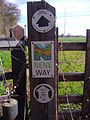
- Nene Way (150 F)
O
- Oxford Canal Bridge 89 (5 F)
S
- Stiles in Northamptonshire (43 F)
Media in category "Public footpaths in Northamptonshire"
The following 113 files are in this category, out of 113 total.
-
 Bridleway north of the A14 - geograph.org.uk - 1516441.jpg 640 × 537; 65 KB
-

-
 Track through Great Wood - geograph.org.uk - 204211.jpg 640 × 541; 140 KB
-
 Bridleway - geograph.org.uk - 422784.jpg 640 × 427; 163 KB
-
 Bridleway to Faxton. - geograph.org.uk - 456929.jpg 640 × 480; 134 KB
-

-
 Hall Lane, Welford - geograph.org.uk - 17206.jpg 640 × 480; 127 KB
-
 A14 and River Avon - geograph.org.uk - 1778696.jpg 1,014 × 761; 161 KB
-

-
-
 Bridle way along Withmale wood - geograph.org.uk - 390919.jpg 640 × 427; 130 KB
-
 Bridleway - geograph.org.uk - 207269.jpg 640 × 480; 95 KB
-

-
 Bridleway at Ryehill Lodge - geograph.org.uk - 223987.jpg 640 × 480; 119 KB
-
 Bridleway beside Badsaddle Wood. - geograph.org.uk - 450714.jpg 640 × 480; 165 KB
-
 Bridleway beside Short Wood. - geograph.org.uk - 444073.jpg 640 × 480; 83 KB
-
 Bridleway by the Rape. - geograph.org.uk - 444061.jpg 640 × 480; 88 KB
-
 Bridleway heading towards Keyson - geograph.org.uk - 719962.jpg 640 × 425; 80 KB
-

-

-
 Bridleway north to Fermyn Woods - geograph.org.uk - 378595.jpg 640 × 480; 111 KB
-
 Bridleway past small copse - geograph.org.uk - 453171.jpg 640 × 640; 196 KB
-
 Bridleway to Crossway Hand Cottages - geograph.org.uk - 269345.jpg 640 × 480; 81 KB
-
 Bridleway to Fritwell - geograph.org.uk - 453211.jpg 640 × 480; 182 KB
-
 Bridleway to Great Gidding - geograph.org.uk - 230131.jpg 640 × 480; 69 KB
-
 Bridleway to Short Wood - geograph.org.uk - 187420.jpg 640 × 480; 110 KB
-
 Bridleway to Upper Astrop - geograph.org.uk - 453147.jpg 640 × 640; 159 KB
-
 Bridleway to Chacombe - geograph.org.uk - 202583.jpg 640 × 480; 73 KB
-
 Church Charwelton - geograph.org.uk - 185922.jpg 640 × 480; 123 KB
-
 Church Slade - geograph.org.uk - 517205.jpg 640 × 480; 146 KB
-
 Bridleway to Corby - geograph.org.uk - 461912.jpg 640 × 428; 113 KB
-
 Daventry, footpath behind Rawlings Close - geograph.org.uk - 1775294.jpg 640 × 426; 108 KB
-
 Footpath crossing gallops - geograph.org.uk - 431225.jpg 640 × 480; 144 KB
-
 North from the fork in the bridleways - geograph.org.uk - 431184.jpg 640 × 480; 120 KB
-
 Steep slope - geograph.org.uk - 431188.jpg 640 × 480; 129 KB
-

-
 Ash Beds - geograph.org.uk - 442879.jpg 640 × 420; 84 KB
-
 Bridleway - geograph.org.uk - 339266.jpg 480 × 640; 90 KB
-
 Footpath - geograph.org.uk - 442799.jpg 640 × 480; 123 KB
-
 Footpath - geograph.org.uk - 442820.jpg 640 × 480; 94 KB
-
 Footpath - geograph.org.uk - 442830.jpg 480 × 640; 98 KB
-
 Footpath - geograph.org.uk - 442868.jpg 454 × 640; 156 KB
-
 Footpath and fields - geograph.org.uk - 442804.jpg 640 × 480; 106 KB
-
 Footpath and Hill Ground Spinney - geograph.org.uk - 442810.jpg 640 × 480; 128 KB
-
 Footpath to Evenley - geograph.org.uk - 442851.jpg 640 × 480; 122 KB
-
 Footpath to Evenley - geograph.org.uk - 442872.jpg 440 × 640; 144 KB
-
 Footpath to Evenley Hall - geograph.org.uk - 442795.jpg 640 × 480; 116 KB
-
 Hill Ground Spinney - geograph.org.uk - 442885.jpg 640 × 480; 127 KB
-
 Path and South Ground Covert - geograph.org.uk - 442843.jpg 640 × 480; 132 KB
-
 Path and South Ground Covert - geograph.org.uk - 442847.jpg 640 × 480; 125 KB
-
 Second Tree - geograph.org.uk - 442827.jpg 480 × 640; 123 KB
-
 South Ground Covert - geograph.org.uk - 442812.jpg 640 × 468; 104 KB
-
 South Ground Covert - geograph.org.uk - 442865.jpg 480 × 640; 154 KB
-
 Evenley Footpath - geograph.org.uk - 442788.jpg 640 × 464; 89 KB
-
 Footpath - geograph.org.uk - 108258.jpg 640 × 480; 83 KB
-
 Footpath across Darsdale - geograph.org.uk - 143577.jpg 640 × 480; 97 KB
-
 Footpath across fields, Lilbourne - geograph.org.uk - 1737715.jpg 768 × 1,024; 239 KB
-
-

-
 Footpath and Black Bags - geograph.org.uk - 214405.jpg 640 × 480; 115 KB
-
 Footpath and Bridleway - geograph.org.uk - 214440.jpg 640 × 480; 103 KB
-
 Footpath and Pipes - geograph.org.uk - 214445.jpg 640 × 480; 99 KB
-
 Footpath at Astrop - geograph.org.uk - 1381439.jpg 427 × 640; 212 KB
-

-

-

-
 Footpath from Astrop Hill - geograph.org.uk - 1360956.jpg 640 × 426; 196 KB
-

-
 Footpath from Raunds to Denford Ash - geograph.org.uk - 129911.jpg 640 × 480; 73 KB
-
 Footpath from Stone Cross to Finedon - geograph.org.uk - 120214.jpg 640 × 480; 97 KB
-
 Footpath in Grange Park - geograph.org.uk - 114795.jpg 640 × 480; 132 KB
-
 Footpath in Northamptonshire - geograph.org.uk - 382565.jpg 480 × 640; 121 KB
-
 Footpath in Pytchley - geograph.org.uk - 191366.jpg 640 × 480; 88 KB
-

-

-

-
 Footpath near Bragborough Hall - geograph.org.uk - 798082.jpg 640 × 480; 81 KB
-
 Footpath near Bragborough Lodge Farm - geograph.org.uk - 798076.jpg 640 × 480; 86 KB
-
 Footpath ramp besides the A605 - geograph.org.uk - 1252697.jpg 640 × 480; 79 KB
-
 Footpath south-west - geograph.org.uk - 1700778.jpg 640 × 480; 220 KB
-

-
 Footpath to Braybrooke - geograph.org.uk - 175216.jpg 640 × 480; 115 KB
-
 Footpath to Greens Norton - geograph.org.uk - 1573492.jpg 480 × 640; 172 KB
-
 Footpath to Hartwell End - geograph.org.uk - 422664.jpg 640 × 480; 124 KB
-
 Footpath to Potterspury - geograph.org.uk - 256890.jpg 640 × 480; 131 KB
-
 Footpath towards Charlton - geograph.org.uk - 1381601.jpg 640 × 425; 190 KB
-
 Footpath west of Barby - geograph.org.uk - 1640740.jpg 640 × 426; 82 KB
-
 Footpath-near-Bugbrooke-by-Stephen-McKay.jpg 640 × 480; 107 KB
-
 Footpaths and track, Lilbourne - geograph.org.uk - 1737782.jpg 1,024 × 768; 151 KB
-
 Green Arch Bridleway - geograph.org.uk - 187438.jpg 640 × 480; 136 KB
-
 Hill Ground Spinney - geograph.org.uk - 442883.jpg 512 × 640; 154 KB
-
 Limestone path from Collyweston to Easton - geograph.org.uk - 487751.jpg 640 × 477; 117 KB
-
 Nene way marker post 30,03,2008 (11).JPG 1,920 × 2,560; 1.09 MB
-
 Nene Way towards Nassington - geograph.org.uk - 1319837.jpg 640 × 480; 84 KB
-
 Path from Collyweston Road - geograph.org.uk - 487762.jpg 640 × 477; 127 KB
-
 Rape, footpath, hedge - geograph.org.uk - 422655.jpg 640 × 480; 107 KB
-
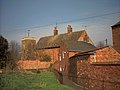 Rear of the House - geograph.org.uk - 355625.jpg 640 × 480; 106 KB
-
 Stanwick Lakes Rail Trail - geograph.org.uk - 714563.jpg 640 × 480; 89 KB
-
 The Nene Way looking south west - geograph.org.uk - 1319814.jpg 640 × 480; 96 KB
-
 The Public Footpath East of Bozeat - geograph.org.uk - 519244.jpg 640 × 480; 120 KB
-
 The Public Footpath to Bozeat - geograph.org.uk - 519246.jpg 640 × 480; 144 KB
-
 Bridleway - geograph.org.uk - 386999.jpg 640 × 480; 118 KB
-
 Bridleway beside the Rape. - geograph.org.uk - 460435.jpg 640 × 480; 100 KB
-

-
 Bridleway to Elton - geograph.org.uk - 718636.jpg 640 × 425; 115 KB
-
 Minimalist View - geograph.org.uk - 115271.jpg 480 × 640; 92 KB
-
 Riders cross the River Til on a bridleway - geograph.org.uk - 527285.jpg 640 × 479; 239 KB
-
 Sundial at Wadenhoe - geograph.org.uk - 796089.jpg 640 × 428; 102 KB
-
 Cracked Path - geograph.org.uk - 190769.jpg 640 × 480; 96 KB
-
 Bridleway and footpaths cross - geograph.org.uk - 433392.jpg 640 × 480; 106 KB
-
 Bridleway and Teasel - geograph.org.uk - 187419.jpg 640 × 480; 130 KB
-
 Diverging footpaths - geograph.org.uk - 530649.jpg 640 × 480; 111 KB
-
 Footpath at Southwick near Oundle - geograph.org.uk - 93825.jpg 640 × 480; 142 KB


.JPG)


