Category:Public footpaths in the London Borough of Lewisham

Subcategories
This category has the following 3 subcategories, out of 3 total.
G
Media in category "Public footpaths in the London Borough of Lewisham"
The following 68 files are in this category, out of 68 total.
-
 Ancient woodland in Forster Memorial Park - geograph.org.uk - 2358248.jpg 960 × 1,280; 574 KB
-
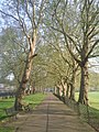 Avenue of plane trees in Deptford Park - geograph.org.uk - 2405284.jpg 960 × 1,280; 606 KB
-
 Beckenham Place Park - geograph.org.uk - 4705983.jpg 2,304 × 1,728; 821 KB
-
 Bluebells, Deptford Park - geograph.org.uk - 3942973.jpg 1,024 × 768; 646 KB
-
 Brockley to Nunhead Footpath - geograph.org.uk - 775634.jpg 640 × 616; 106 KB
-
 Brookmill Park-pergola - geograph.org.uk - 4078266.jpg 640 × 480; 87 KB
-
 Capital Ring, Beckenham Place Park - geograph.org.uk - 1946936.jpg 640 × 430; 199 KB
-
 Cyclepath to Downham Heath and Leisure Centre - geograph.org.uk - 2609492.jpg 4,288 × 3,216; 4.83 MB
-
 Entrance to Forster Memorial Park - geograph.org.uk - 3459987.jpg 640 × 480; 88 KB
-
 Entrance to Forster Memorial Park, SE6 - geograph.org.uk - 2431321.jpg 640 × 480; 108 KB
-
 Footpath alongside the railway - geograph.org.uk - 1655298.jpg 640 × 480; 544 KB
-

-

-

-

-
 Forster Memorial Park (Opened 1922). - geograph.org.uk - 377776.jpg 640 × 355; 130 KB
-
 Forster Park Fork - geograph.org.uk - 5671631.jpg 424 × 640; 125 KB
-
 Green Chain - Capital Ring in Beckenham Place Park - geograph.org.uk - 4930379.jpg 1,600 × 1,064; 765 KB
-
 Green Chain Walk in Beckenham Place Park - geograph.org.uk - 2609678.jpg 4,288 × 3,216; 6.83 MB
-
 Green Chain Walk junction in Summerhouse Wood - geograph.org.uk - 2609733.jpg 4,288 × 3,216; 6.85 MB
-
 Green Chain Walk, Beckenham Place Park - geograph.org.uk - 1946910.jpg 640 × 430; 192 KB
-
 Green Chain Walk, Beckenham Place Park - geograph.org.uk - 1946923.jpg 640 × 430; 194 KB
-

-
 Green Chain Walk, Beckenham Place Park - geograph.org.uk - 3459900.jpg 476 × 640; 120 KB
-
 In Fordham Park - geograph.org.uk - 2627823.jpg 640 × 480; 229 KB
-
 In Forster Memorial Park - geograph.org.uk - 2396348.jpg 1,280 × 960; 637 KB
-
 In Forster Park - geograph.org.uk - 5223010.jpg 640 × 480; 269 KB
-
 Mayow Park (3) - geograph.org.uk - 4268555.jpg 584 × 640; 326 KB
-
 Mayow Park (4) - geograph.org.uk - 4268557.jpg 640 × 534; 366 KB
-
 Mayow Park - geograph.org.uk - 3201452.jpg 640 × 430; 85 KB
-
 Mayow Park - geograph.org.uk - 3201459.jpg 640 × 430; 87 KB
-
 Mayow Park - geograph.org.uk - 3201480.jpg 640 × 430; 98 KB
-
 Mayow Park - geograph.org.uk - 3457869.jpg 497 × 640; 107 KB
-
 Mayow Park - geograph.org.uk - 3457960.jpg 640 × 480; 119 KB
-
 Mayow Park - geograph.org.uk - 3458005.jpg 640 × 480; 107 KB
-
 Mayow Park - geograph.org.uk - 840960.jpg 640 × 480; 127 KB
-
 Mountsfield Park - geograph.org.uk - 376595.jpg 640 × 403; 146 KB
-

-
 Path across Blackheath (2) - geograph.org.uk - 2762008.jpg 1,024 × 768; 658 KB
-
 Path across Blackheath - geograph.org.uk - 2762005.jpg 1,024 × 768; 277 KB
-
 Path beside Summerhouse Wood - geograph.org.uk - 2609701.jpg 4,288 × 3,216; 7.09 MB
-
 Path in Beckenham Place Park - geograph.org.uk - 2358262.jpg 960 × 1,280; 613 KB
-
 Path in Beckenham Place Park - geograph.org.uk - 5240619.jpg 640 × 427; 160 KB
-
 Path in Forster Park - geograph.org.uk - 4798078.jpg 640 × 427; 121 KB
-
 Path in Mayow Park - geograph.org.uk - 2634244.jpg 3,908 × 3,216; 5.75 MB
-
 Path junction in Ladywell Fields - geograph.org.uk - 2618846.jpg 4,288 × 3,216; 7.15 MB
-
 Path junction in Summerhouse Wood - geograph.org.uk - 2609712.jpg 4,288 × 3,216; 6.63 MB
-
 Path through Fordham Park - geograph.org.uk - 2462155.jpg 1,024 × 768; 256 KB
-
 Path, Beckenham Place Park - geograph.org.uk - 4278127.jpg 575 × 640; 338 KB
-
 Path. Forster Park - geograph.org.uk - 5222983.jpg 640 × 480; 283 KB
-
 Railway bridge no. 469, Catford - geograph.org.uk - 1633773.jpg 640 × 480; 90 KB
-
-
 St Paul's Churchyard, Deptford - geograph.org.uk - 3929579.jpg 4,000 × 3,000; 4.12 MB
-
 Sydenham Wells Park (1) - geograph.org.uk - 4268531.jpg 640 × 490; 192 KB
-
 Sydenham Wells Park (3) - geograph.org.uk - 4268537.jpg 602 × 640; 303 KB
-
 Sydenham Wells Park (4) - geograph.org.uk - 4268541.jpg 640 × 499; 248 KB
-
 Sydenham Wells Park (5) - geograph.org.uk - 4268543.jpg 640 × 520; 367 KB
-
 Sydenham Wells Park (6) - geograph.org.uk - 4268546.jpg 640 × 540; 330 KB
-
 Sydenham Wells Park - geograph.org.uk - 3457374.jpg 640 × 480; 65 KB
-
 Track in Beckenham Place Park - geograph.org.uk - 2610535.jpg 4,288 × 3,216; 6.88 MB
-
 Trees beginning to turn in Mountsfield Park - geograph.org.uk - 4209073.jpg 5,400 × 3,600; 3.25 MB
-
 Trees beside the path, Beckenham Place Park - geograph.org.uk - 4930434.jpg 1,600 × 1,064; 594 KB
-
 View along a path in the Ladywell ^ Brockwell Cemetery - geograph.org.uk - 5879703.jpg 3,872 × 2,592; 4.92 MB
-
 View along a path in the Ladywell ^ Brockwell Cemetery ^2 - geograph.org.uk - 5879709.jpg 3,872 × 2,592; 3.44 MB
-
 View of Convoys Wharf from the Thames Path.jpg 1,600 × 1,200; 772 KB
-
 Waterlink Way at Bellingham - geograph.org.uk - 841078.jpg 640 × 480; 117 KB
-
 Woodland path in Beckenham Place Park - geograph.org.uk - 4715226.jpg 6,000 × 4,000; 5.71 MB
-
 Woodland Path in Beckenham Place Park - geograph.org.uk - 5671578.jpg 424 × 640; 123 KB


_-_geograph.org.uk_-_2416874.jpg)


._-_geograph.org.uk_-_377776.jpg)


_-_geograph.org.uk_-_4268555.jpg)
_-_geograph.org.uk_-_4268557.jpg)


_-_geograph.org.uk_-_2762008.jpg)


_-_geograph.org.uk_-_4268531.jpg)
_-_geograph.org.uk_-_4268537.jpg)
_-_geograph.org.uk_-_4268541.jpg)
_-_geograph.org.uk_-_4268543.jpg)
_-_geograph.org.uk_-_4268546.jpg)


