Category:Public toilets in the East Riding of Yorkshire
Ceremonial counties of England: Bedfordshire · Buckinghamshire · Cambridgeshire · Cheshire · Cornwall · Cumbria · Derbyshire · Devon · Dorset · East Riding of Yorkshire · East Sussex · Essex · Gloucestershire · Greater London · Hampshire · Herefordshire · Hertfordshire · Kent · Lancashire · Lincolnshire · Merseyside · Norfolk · North Yorkshire · Northamptonshire · Northumberland · Oxfordshire · Shropshire · South Yorkshire · Suffolk · Surrey · Tyne and Wear · Warwickshire · West Midlands · West Sussex · West Yorkshire · Wiltshire · Worcestershire
City-counties: Bristol · City of London
Former historic counties:
Other former counties:
City-counties: Bristol · City of London
Former historic counties:
Other former counties:
Subcategories
This category has only the following subcategory.
K
Media in category "Public toilets in the East Riding of Yorkshire"
The following 35 files are in this category, out of 35 total.
-
 A model of the pier (geograph 1992519).jpg 800 × 600; 276 KB
-
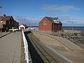
 Beverley Station - geograph.org.uk - 879452.jpg 640 × 444; 85 KB
-
 Brid beach.jpg 2,448 × 3,264; 1,001 KB
-

-
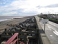
 Central Promenade, Withernsea (geograph 5082701).jpg 1,200 × 799; 285 KB
-
 Cup of tea^ - geograph.org.uk - 760570.jpg 640 × 480; 77 KB
-
 Ebor House, Bridlington (geograph 6358069).jpg 3,924 × 3,210; 2.53 MB
-
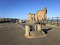
 Elizabeth II postbox and phonebox on Queen Street, Bridlington (geograph 4823009).jpg 3,888 × 2,592; 3.52 MB
-
 Hornsea 4.jpg 3,072 × 2,304; 2.67 MB
-
 Hornsea banner seafront.jpg 2,450 × 350; 284 KB
-
 Inshore Rescue Boat (IRB) Station, Withernsea (geograph 3727388).jpg 1,600 × 1,200; 485 KB
-
 IRB Station - geograph.org.uk - 1047940.jpg 640 × 427; 242 KB
-
 Memorial Avenue, Withernsea (geograph 3110154).jpg 1,600 × 1,190; 410 KB
-
 Memorial Avenue, Withernsea (geograph 3110188).jpg 1,600 × 1,179; 218 KB
-
 Memorial Gardens, Withernsea (geograph 5082708).jpg 1,200 × 799; 349 KB
-
 Model of Withernsea Pier - geograph.org.uk - 1743100.jpg 800 × 600; 115 KB
-
 Pier Towers x 2 (geograph 4330361).jpg 1,024 × 768; 182 KB
-
 Public Conveniences on Piggy Lane, Withernsea (geograph 3611341).jpg 1,024 × 768; 137 KB
-
 Public Conveniences on Southcliff Road, Withernsea (geograph 5075554).jpg 1,200 × 799; 311 KB
-
 Public Conveniences on the Promenade, Withernsea (geograph 5083229).jpg 1,200 × 799; 367 KB
-
 Public Conveniences Withernsea Sea Front (geograph 3607058).jpg 1,024 × 768; 121 KB
-
 Public toilets, Driffield - geograph.org.uk - 970563.jpg 640 × 474; 84 KB
-
 Public Toilets, North Beach - geograph.org.uk - 1566931.jpg 640 × 453; 43 KB
-
 Public Toilets, North Landing - geograph.org.uk - 1703572.jpg 800 × 439; 57 KB
-
 Sea Defences, Hornsea - geograph.org.uk - 1326210.jpg 640 × 480; 87 KB
-
 Sea front Car Park, Mappleton - geograph.org.uk - 357178.jpg 640 × 480; 63 KB
-
 South Promenade, Hornsea - geograph.org.uk - 856029.jpg 465 × 640; 108 KB
-
 St Nicholas Church Wetwang 1.jpg 1,024 × 768; 186 KB
-
 The Memorial Gardens, Withernsea (geograph 3606998).jpg 1,024 × 768; 168 KB
-
 The Valley Gardens, Withernsea - geograph.org.uk - 215681.jpg 640 × 495; 118 KB
-
 Toilets - geograph.org.uk - 454298.jpg 640 × 480; 109 KB
-
 Valley Gardens - viewed from Pier Road (geograph 4595246).jpg 640 × 480; 67 KB
-
 Valley Gardens at Withernsea - geograph.org.uk - 1412881.jpg 640 × 493; 116 KB
-
 Withernsea IMG 6413 - panoramio.jpg 1,000 × 512; 233 KB
-
 Would you take a chance^ - geograph.org.uk - 269566.jpg 640 × 433; 101 KB
.jpg)


.jpg)
.jpg)

.jpg)
.jpg)

_Station,_Withernsea_(geograph_3727388).jpg)

.jpg)
.jpg)
.jpg)

.jpg)
.jpg)
.jpg)
.jpg)
.jpg)


.jpg)


.jpg)


