Category:Public transport maps of Budapest
Subcategories
This category has the following 5 subcategories, out of 5 total.
Media in category "Public transport maps of Budapest"
The following 20 files are in this category, out of 20 total.
-
 Meyers b3 s0587a.jpg 1,661 × 2,048; 865 KB
-
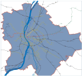
 Budapest and Surroundings Metro and Rail Network by 2040 According to Plans and Proposals.svg 14,400 × 14,400; 18.83 MB
-
 Budapest metro map 2.svg 512 × 582; 67 KB
-
 Budapest metro map 3.svg 512 × 523; 47 KB
-
 Budapest metro plans 2.svg 512 × 527; 91 KB
-
 Budapest metro plans historical.svg 512 × 470; 242 KB
-
 Budapest night buses.svg 512 × 565; 86 KB
-
 Budapest public transport map 2004.svg 512 × 505; 526 KB
-
 Budapest public transport map 2007.jpg 4,000 × 3,722; 3.69 MB
-
 Budapest public transport map 2007.svg 512 × 477; 5.47 MB
-
 Budapest public transport map.svg 512 × 493; 958 KB
-
 Budapest public transport system map (with stations).png 9,730 × 8,939; 31.1 MB
-
 Budapest train network 7.svg 600 × 566; 155 KB
-
 Budapest és környékének vasúti térképe.svg 1,680 × 1,570; 131 KB
-
 Budapest-villamoshalozata-2012.svg 828 × 759; 1.24 MB
-
 Metró-undStraßenbahnGleis-undOBusLeitungsplanBudapest2013.png 9,954 × 10,188; 5.27 MB
-
 Metró-undStraßenbahnGleis-undOBusLeitungsplanBudapest2014.png 9,954 × 10,188; 5.39 MB
-
 Metró-undStraßenbahnGleis-undOBusLeitungsplanBudapest2016.png 9,711 × 9,940; 5.27 MB
-
 Metró-undStraßenbahnGleis-undOBusLeitungsplanBudapest2020.png 9,711 × 9,940; 5.41 MB
-
 Metró-undStraßenbahnGleis-undOBusLeitungsplanBudapest2021.png 9,711 × 9,940; 5.35 MB


.png)