Category:Pubs in West Sussex

Subcategories
This category has the following 51 subcategories, out of 51 total.
- Pub interiors in West Sussex (16 F)
A
- Maypole pub, Ashurst Wood (3 F)
B
C
- Crown and Anchor, Dell Quay (15 F)
D
- Devil's Dyke Hotel (14 F)
F
- Pubs in Felpham (10 F)
- Flying Bull pub, Rake (8 F)
- Sloop Inn, Freshfield (6 F)
G
H
- The Half Moon Inn, Balcombe (8 F)
- Friars Oak pub, Hassocks (5 F)
- The Hassocks pub, Hassocks (6 F)
- Green Man pub, Horsted Keynes (10 F)
J
K
- Thatched Inn, Keymer (3 F)
- Kings Head, Upper Beeding (4 F)
L
M
P
- Royal Oak pub, Poynings (5 F)
- Pubs in Bognor Regis (23 F)
- Pubs in East Grinstead (13 F)
- Pubs in Littlehampton (13 F)
R
- The Rising Sun, Milland (7 F)
S
- Pubs in Selsey (12 F)
- The Fox pub, Sharpthorne (5 F)
- Ship pub, Southwick (3 F)
T
- The Farmers, Scaynes Hill (4 F)
- The Partridge Inn, Singleton (6 F)
W
- The White Horse, Rogate (8 F)
Media in category "Pubs in West Sussex"
The following 179 files are in this category, out of 179 total.
-

-
 Beer garden gazebo at Staplefield, West Sussex, England.jpg 3,000 × 2,000; 4.24 MB
-
 Alfold village centre - geograph.org.uk - 40245.jpg 640 × 427; 90 KB
-
 Badgers Pub - geograph.org.uk - 4396.jpg 640 × 480; 67 KB
-
 Bat and Ball, Newpound Common - geograph.org.uk - 779344.jpg 640 × 479; 91 KB
-
 Before the Good Beer Guide (20010539384).jpg 4,000 × 2,666; 2 MB
-
 Black Horse pub.JPG 1,280 × 960; 446 KB
-
 Bull Inn.JPG 4,608 × 3,456; 4.52 MB
-
 Bull's Head Goring by Sea Front.JPG 4,272 × 2,840; 755 KB
-
 Bus stopping at the Selsey Arms - geograph.org.uk - 2665659.jpg 640 × 428; 85 KB
-

-
 A snowy A264 Cherry Tree layby - geograph.org.uk - 1626961.jpg 640 × 428; 108 KB
-
 Church and pub, Plaistow.JPG 3,264 × 2,448; 2.19 MB
-
 Jack and Jill Free House and gardens - geograph.org.uk - 2261265.jpg 4,000 × 3,000; 2.54 MB
-
 Jack and Jill Inn - geograph.org.uk - 1631116.jpg 640 × 480; 84 KB
-
 Cocking Blue Bell pub.JPG 1,280 × 960; 516 KB
-
 Duke's Head pub, Turners Hill Road, Copthorne (March 2011).JPG 1,800 × 1,000; 472 KB
-
 Duke of York Inn, Sayers Common - geograph.org.uk - 226403.jpg 640 × 479; 110 KB
-
 Duke of York public house, Sayers Common - geograph.org.uk - 2617019.jpg 2,048 × 1,536; 1,009 KB
-
 Elsted Inn at Elsted Marsh. - geograph.org.uk - 73258.jpg 436 × 640; 84 KB
-
 Geograph 2538003 Badgers on the A285.jpg 4,000 × 3,000; 3.2 MB
-
 Goddards Green, showing Sportsman Pub.jpg 640 × 479; 179 KB
-
 New Inn, High Street, Hurstpierpoint - geograph.org.uk - 4109349.jpg 640 × 480; 65 KB
-
 King's Arms on A286 near Henley - geograph.org.uk - 351346.jpg 640 × 480; 85 KB
-
 Labour in Vain - geograph.org.uk - 21771.jpg 640 × 480; 66 KB
-
 Light and sound (15388034734).jpg 3,504 × 2,336; 4.48 MB
-

-
 MurlArBnhm.JPG 3,072 × 2,304; 2.69 MB
-
 Murrell Arms, Barnham - geograph.org.uk - 1294143.jpg 640 × 480; 105 KB
-
 Pretty Inn at Elsted Marsh - geograph.org.uk - 779138.jpg 640 × 480; 59 KB
-
 Rear of The Elsted Inn - geograph.org.uk - 779158.jpg 640 × 480; 76 KB
-
 Red Lion pub - geograph.org.uk - 577303.jpg 640 × 480; 102 KB
-
 Royal Oak, Wineham.JPG 4,608 × 3,456; 4.77 MB
-
 Shaves Thatch Inn - geograph.org.uk - 36506.jpg 640 × 480; 57 KB
-
 Sidlesham Anchor Inn geograph-3299714-by-Ben-Brooksbank.jpg 2,350 × 1,375; 2.2 MB
-

-
 The Barleycorn - geograph.org.uk - 653578.jpg 640 × 480; 56 KB
-
 The Bell Inn - geograph.org.uk - 671790.jpg 640 × 480; 77 KB
-
 The Black Horse Byworth - geograph.org.uk - 288474.jpg 640 × 480; 120 KB
-
 The Black Horse Inn, Climping - geograph.org.uk - 672362.jpg 640 × 480; 86 KB
-
 The Black Horse, Byworth - geograph.org.uk - 1773178.jpg 601 × 800; 168 KB
-
 The Black Horse, Climping - geograph.org.uk - 638195.jpg 479 × 640; 78 KB
-
 The Blue Ship Pub.jpg 432 × 291; 35 KB
-
 The Boar's Head, Pict's Hill - geograph.org.uk - 1296421.jpg 640 × 430; 58 KB
-
 The Bridge Inn - geograph.org.uk - 1229062.jpg 640 × 480; 77 KB
-
 The Chequers Inn - geograph.org.uk - 1494115.jpg 640 × 480; 82 KB
-
 The Chequers Inn - geograph.org.uk - 895655.jpg 640 × 479; 96 KB
-
 The Country Inn at Bepton Common - geograph.org.uk - 778471.jpg 640 × 480; 76 KB
-
 The Cowdray Arms - geograph.org.uk - 774521.jpg 640 × 360; 80 KB
-
 The Cowdray Arms - geograph.org.uk - 774524.jpg 640 × 360; 79 KB
-
 The Cricketers in Commonside - geograph.org.uk - 1203092.jpg 480 × 640; 51 KB
-
 The Dolphin - geograph.org.uk - 926178.jpg 640 × 360; 60 KB
-
 The Dolphin, Dominion Road - geograph.org.uk - 1034350.jpg 640 × 480; 73 KB
-
 The Eight Bells, Bolney.JPG 4,608 × 3,456; 3.75 MB
-
 The Eight Bells.JPG 4,608 × 3,456; 3.91 MB
-
 The Elsted Inn, Elsted Marsh - geograph.org.uk - 1719505.jpg 800 × 600; 158 KB
-
 The Fox Inn near Griggs Green - geograph.org.uk - 350955.jpg 640 × 480; 86 KB
-
 The Fox Inn, Bucks Green - geograph.org.uk - 633372.jpg 640 × 480; 81 KB
-
 The Fox, Arundel Road - geograph.org.uk - 1256741.jpg 455 × 640; 74 KB
-
 The Frog and Nightgown, Wimland Rd - geograph.org.uk - 1290094.jpg 640 × 430; 86 KB
-
 The garden of the Duke of Cumberland - geograph.org.uk - 1773161.jpg 800 × 600; 280 KB
-
 The Gate - geograph.org.uk - 1461026.jpg 640 × 402; 73 KB
-

-
 "The Good Intent" PH in Westbourne - geograph.org.uk - 1636315.jpg 640 × 638; 74 KB
-
 The Green Dragon, 12 Bishopric - geograph.org.uk - 1038991.jpg 640 × 480; 93 KB
-
 The Greets Inn - geograph.org.uk - 550377.jpg 640 × 480; 104 KB
-
 The Greyhound Inn near West Lavington - geograph.org.uk - 1336995.jpg 640 × 480; 138 KB
-

-
 The Half Moon, Northchapel - geograph.org.uk - 416561.jpg 640 × 480; 100 KB
-
 The Half Moon, Warninglid.jpg 640 × 480; 90 KB
-
 The Halfway Bridge Inn - geograph.org.uk - 260007.jpg 640 × 480; 124 KB
-
 The Happy Medium, St. Paul's Road - geograph.org.uk - 1729717.jpg 3,072 × 2,304; 674 KB
-
 The Henty Arms, Ferring - geograph.org.uk - 586881.jpg 640 × 480; 100 KB
-
 The Hollist Arms, Lodsworth. - geograph.org.uk - 203066.jpg 640 × 480; 142 KB
-
 The Horse and Groom - geograph.org.uk - 1503320.jpg 640 × 457; 199 KB
-
 The Horse Guards Inn, Tillington - geograph.org.uk - 353428.jpg 640 × 480; 127 KB
-
 The Inglenook Hotel in Pagham - geograph.org.uk - 1408406.jpg 640 × 427; 79 KB
-
 The Inglenook Hotel in Pagham - geograph.org.uk - 1408408.jpg 640 × 427; 66 KB
-
 The Lamb, Yapton - geograph.org.uk - 117606.jpg 640 × 480; 89 KB
-
 The Lickfold Inn - geograph.org.uk - 1333263.jpg 640 × 453; 67 KB
-
 The Lickfold Inn - geograph.org.uk - 415393.jpg 640 × 480; 100 KB
-
 The Lively Lady - geograph.org.uk - 671693.jpg 640 × 298; 51 KB
-
 The Lively Lady, Bracklesham - geograph.org.uk - 814183.jpg 640 × 481; 70 KB
-
 The Lord Raglan - geograph.org.uk - 805358.jpg 640 × 480; 65 KB
-
 The Old Greyhound at West Harting - geograph.org.uk - 1424682.jpg 640 × 360; 68 KB
-

-
 THE Partridge at Partridge Green - geograph.org.uk - 635751.jpg 640 × 480; 71 KB
-
 The Plough - geograph.org.uk - 1629515.jpg 640 × 480; 84 KB
-
 The Prince Albert PH at Copthorne - geograph.org.uk - 2516832.jpg 1,024 × 768; 121 KB
-
 The Queen's Head, Barns Green.jpg 4,608 × 3,456; 5.14 MB
-
 The Red Lion at Turners Hill - geograph.org.uk - 20193.jpg 640 × 480; 83 KB
-
 The Red Lion, Handcross - geograph.org.uk - 709836.jpg 640 × 480; 73 KB
-
 The Rising Sun - Milland - geograph.org.uk - 898635.jpg 640 × 480; 104 KB
-
 The Romans Pub, Southwick - geograph.org.uk - 2605130.jpg 1,600 × 1,200; 275 KB
-
 The Royal Oak - East Wittering - geograph.org.uk - 580880.jpg 640 × 425; 87 KB
-
 The Royal Oak at Lagness - geograph.org.uk - 672257.jpg 640 × 312; 58 KB
-

-
 The Royal Oak, Friday Street, Rusper - geograph.org.uk - 1779318.jpg 800 × 600; 161 KB
-
 The Royal Oak, Lagness - geograph.org.uk - 93950.jpg 640 × 479; 144 KB
-
 The Royal Oak, Wineham, Sussex - geograph.org.uk - 193810.jpg 640 × 480; 97 KB
-
 The Ship Inn, Itchenor - geograph.org.uk - 1409185.jpg 640 × 426; 136 KB
-
 The Ship Inn, Itchenor - geograph.org.uk - 1409315.jpg 640 × 376; 126 KB
-
-

-
 The Snowdrop - geograph.org.uk - 21847.jpg 640 × 480; 121 KB
-
 The Sportsman - geograph.org.uk - 1335689.jpg 640 × 480; 82 KB
-
 The Spotted Cow, Angmering - geograph.org.uk - 611057.jpg 640 × 480; 84 KB
-
 The Stag Inn, Balls Cross - geograph.org.uk - 1041448.jpg 640 × 480; 118 KB
-
 The Sun Inn, Rake - geograph.org.uk - 350934.jpg 640 × 480; 95 KB
-
 The Sussex Brewery in Main Road - geograph.org.uk - 1286596.jpg 480 × 640; 81 KB
-
 The Tamarind, Main Road - geograph.org.uk - 1261741.jpg 480 × 640; 67 KB
-
 The Thatched Tavern - geograph.org.uk - 671744.jpg 640 × 310; 39 KB
-

-
 The Three Crowns - geograph.org.uk - 1330538.jpg 640 × 480; 60 KB
-
 The White Hart - geograph.org.uk - 1630504.jpg 640 × 480; 125 KB
-
 The White Hart Inn - geograph.org.uk - 1239558.jpg 480 × 640; 102 KB
-
 The White Hart Inn - geograph.org.uk - 1441440.jpg 640 × 480; 85 KB
-
 The White Hart on the B 2028 - geograph.org.uk - 1623025.jpg 640 × 480; 82 KB
-
 The White Hart, High Street (A281) - geograph.org.uk - 739628.jpg 640 × 480; 89 KB
-
 The White Hart, South Harting - geograph.org.uk - 358394.jpg 640 × 480; 99 KB
-
 "The White Horse Inn" in Westbourne - geograph.org.uk - 1636343.jpg 640 × 360; 33 KB
-
-
 The White Horse, Marehill - geograph.org.uk - 246025.jpg 640 × 479; 135 KB
-
 The White Swan, Bosham - geograph.org.uk - 1345.jpg 640 × 480; 40 KB
-
 The Windmill Inn at Littleworth - geograph.org.uk - 1501965.jpg 640 × 480; 103 KB
-
 The Wise Old Owl, Kingsfold. - geograph.org.uk - 185548.jpg 640 × 349; 84 KB
-
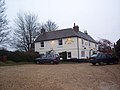
 The Woodman Arms - geograph.org.uk - 926189.jpg 640 × 480; 130 KB
-
 The Worlds End - geograph.org.uk - 1629460.jpg 640 × 480; 101 KB
-
 The Worlds End, Arundel Road - geograph.org.uk - 1256787.jpg 640 × 480; 90 KB
-
 Toby Carvery, Goring Road - geograph.org.uk - 597586.jpg 640 × 480; 84 KB
-
 Victoria Inn, West Marden - geograph.org.uk - 415385.jpg 640 × 480; 99 KB
-
 Wassailing musicians at Maplehurst, West Sussex.jpg 640 × 426; 115 KB
-
 West Itchenor pub.JPG 3,262 × 2,446; 1.4 MB
-
 Wick, The Six Bells - geograph.org.uk - 1509072.jpg 640 × 480; 77 KB
-
 Windmill Pub, Littleworth - geograph.org.uk - 635747.jpg 640 × 480; 67 KB
-
 Woodgate Crossing - geograph.org.uk - 22655.jpg 640 × 449; 60 KB
-

-
 Worthing Road, Dial Post - geograph.org.uk - 149501.jpg 640 × 479; 154 KB
-
 Ye John Selden, Salvington Road - geograph.org.uk - 657055.jpg 640 × 480; 59 KB
-
 Ye Olde Coach House, Angmering - geograph.org.uk - 615492.jpg 640 × 480; 71 KB
-
 Arun journey - geograph.org.uk - 803107.jpg 637 × 425; 84 KB
-
 Balltree Inn, Busticle Lane - geograph.org.uk - 728498.jpg 640 × 480; 70 KB
-
 Barnham Bridge Inn - geograph.org.uk - 577275.jpg 640 × 480; 92 KB
-
 Business as usual at the Three Compasses - geograph.org.uk - 242948.jpg 640 × 415; 295 KB
-
 Cocking's Village Pub - geograph.org.uk - 48843.jpg 640 × 480; 103 KB
-
 Cowdray Arms - geograph.org.uk - 20170.jpg 640 × 480; 105 KB
-
 Deepwell Inn, Northchapel - geograph.org.uk - 41458.jpg 640 × 428; 61 KB
-
 Gardners Arms at Ardingly - geograph.org.uk - 19640.jpg 629 × 404; 58 KB
-
 Illuminations at the Shelley public house - geograph.org.uk - 238702.jpg 640 × 283; 184 KB
-
 Lickfold Inn - geograph.org.uk - 40933.jpg 640 × 428; 60 KB
-
 Murrell Arms, Barnham - geograph.org.uk - 598610.jpg 640 × 480; 52 KB
-
 Star and Garter Inn, East Dean - geograph.org.uk - 225635.jpg 640 × 479; 121 KB
-
 The Barley Mow pub, Walderton - geograph.org.uk - 9302.jpg 640 × 426; 77 KB
-
 The Bolney Stage public house - geograph.org.uk - 84707.jpg 600 × 447; 48 KB
-
 The Clockhouse Bar,East Preston - geograph.org.uk - 615691.jpg 640 × 480; 88 KB
-
 The Coot , Merryfield Drive - geograph.org.uk - 402932.jpg 640 × 480; 61 KB
-

-
 The Dukes Head roundabout - geograph.org.uk - 20182.jpg 640 × 480; 82 KB
-
 The Eight Bells, Bolney - geograph.org.uk - 699431.jpg 640 × 480; 78 KB
-
 The Fox Public House - geograph.org.uk - 18385.jpg 640 × 480; 150 KB
-

-
 The Half Moon, Northchapel. - geograph.org.uk - 203199.jpg 640 × 480; 163 KB
-
 The Halfway House, Wellington Road - geograph.org.uk - 629916.jpg 640 × 479; 86 KB
-
 The Hamilton Arms, Stedham - geograph.org.uk - 57767.jpg 640 × 480; 98 KB
-
 The Lamb, Rustington - geograph.org.uk - 615819.jpg 640 × 480; 82 KB
-
 The Mucky Duck, Tismans Common - geograph.org.uk - 250131.jpg 640 × 436; 63 KB
-
 The Old House At Home at Chidham - geograph.org.uk - 595691.jpg 640 × 480; 108 KB
-
 The Royal Oak Inn, Handcross - geograph.org.uk - 49513.jpg 640 × 480; 101 KB
-
 The Sun Inn, Rake, West Sussex - geograph.org.uk - 54136.jpg 640 × 480; 59 KB
-
 The Tanners Arms public house - geograph.org.uk - 427419.jpg 640 × 486; 59 KB
-
 The Three Moles, Selham - geograph.org.uk - 354151.jpg 640 × 480; 150 KB
-
 The Waterside Inn - geograph.org.uk - 690717.jpg 640 × 479; 75 KB
-
 The White Hart - geograph.org.uk - 20173.jpg 640 × 480; 95 KB
-
 The White Horse, Chilgrove. - geograph.org.uk - 195819.jpg 500 × 640; 127 KB
-
 The Windmill, Rustington - geograph.org.uk - 616225.jpg 640 × 480; 70 KB
-
 The World's End, Patching - geograph.org.uk - 611423.jpg 640 × 480; 77 KB
-
 Walnut Tree, Runcton - geograph.org.uk - 22641.jpg 640 × 480; 68 KB
-
 White Horse Pub near Graffham - geograph.org.uk - 204471.jpg 640 × 480; 97 KB
-
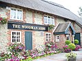
 Woodman's Arms, Hammerpot-Worthing - geograph.org.uk - 4379.jpg 640 × 480; 66 KB


.jpg)


.JPG)


.jpg)


_-_geograph.org.uk_-_739628.jpg)


