Category:Pulverturm (Ehemaliger Landsgemeindeplatz, Schattdorf)
| Object location | | View all coordinates using: OpenStreetMap |
|---|
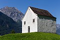
compact tower in Schattdorf in the canton of Uri, Switzerland  | |||||
| Upload media | |||||
| Instance of | |||||
|---|---|---|---|---|---|
| Part of | |||||
| Location | Schattdorf, Uri, Switzerland | ||||
| Street address |
| ||||
| Heritage designation | |||||
 | |||||
Media in category "Pulverturm (Ehemaliger Landsgemeindeplatz, Schattdorf)"
This category contains only the following file.
-
 2017-Schattdorf-Pulverturm.jpg 1,920 × 1,280; 2.86 MB