Category:Quality images by Frankemann
![]()
Media in category "Quality images by Frankemann"
The following 200 files are in this category, out of 202 total.
(previous page) (next page)-
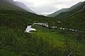
 A place where Svartå river in Svartådalen is at its widest.jpg 4,896 × 3,264; 9.96 MB
-
 Argaladhytta cabin in Junkerdal nasjonal park.jpg 4,896 × 3,264; 9.12 MB
-
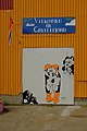 Artistic decoration with two boys at the harbor in Gryllefjord.jpg 3,264 × 4,896; 7.78 MB
-
 Balvaten seen from Skajddebukta.jpg 4,896 × 3,264; 8.02 MB
-
 Beiarelva lower part at Arstadberget.jpg 4,896 × 3,264; 9.39 MB
-
 Beiarfjorden ytre deler seen from the air.jpg 4,163 × 3,028; 5.95 MB
-
 Bergsbotn seen from lookout point at Moltebærhagen by Norwegian County Road 862.jpg 4,896 × 3,264; 13.88 MB
-
 Bjøllånes in Dunderlandsdalen seen from Berglia.jpg 4,896 × 3,264; 9.17 MB
-
 Bjørnsvikfjellet and Sørfolda as seen from Korsviktinden.jpg 4,896 × 3,264; 8.11 MB
-
 Bjørntoppen and Tausafjell seen from Rykkjedalen.jpg 3,161 × 2,245; 2.22 MB
-
 Blåmannsisen with the mountain Blåmannen.jpg 4,498 × 2,992; 7.22 MB
-
 Border point Rr 240 A between Norway and Sweden.jpg 4,896 × 3,264; 8.93 MB
-
 Cove in inner parts of the harbor in Inndyr.jpg 4,896 × 3,264; 8.72 MB
-
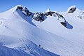 Crowded on the peaks around Bjørnbrean.jpg 4,896 × 3,264; 8.4 MB
-
 Delicate ski trail down Storutladalen.jpg 4,896 × 3,264; 7.07 MB
-
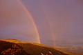
 Double rainbow over Storelvvatnet i Sulitjelma.jpg 4,896 × 3,264; 7.51 MB
-
 Double rainbow over Tverrfjellet in Sulitjelma.jpg 4,896 × 3,264; 7 MB
-
 Drugshøi illuminated by low morning sun in October.jpg 4,896 × 3,264; 11.5 MB
-
 Drugshøi seen from Larseggen.jpg 4,896 × 3,264; 8.73 MB
-
 Elvefjorden seen from the air.jpg 2,965 × 1,992; 3.19 MB
-
 Enclosed pew at the gallery for the governor of Nordland in Gildeskål old church.jpg 4,896 × 3,264; 9.01 MB
-
 Ersfjord and the mountain range on the north side with Okshornan.jpg 4,896 × 3,264; 9.66 MB
-
 Evening light into Kobbskaret in Sørfold.jpg 4,896 × 3,264; 9.3 MB
-
 Evening sun over Balvatnet in Sulitjelma.jpg 4,896 × 3,264; 8.01 MB
-
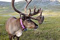 Extraordinary tame reindeer at Saltfjellet.jpg 4,896 × 3,264; 8.84 MB
-
 Faulvatnet lake seen from the northeast.jpg 4,896 × 3,264; 10.31 MB
-
 Fembøring at the port of Bodø.jpg 4,896 × 3,264; 9.49 MB
-
 Flurries of snow above Nevervatnet, Røyrvatnet and Straumvatnet.jpg 4,664 × 3,080; 6.04 MB
-
 Frozen ground in Stroplsjødalen valley in Dovrefjell National Park, Norway.jpg 4,896 × 3,264; 8.65 MB
-
 Gasskatjåhkkå the highest point in Hamarøy municipality.jpg 4,896 × 3,264; 7.7 MB
-
 Gikenelva from above.jpg 4,896 × 3,264; 9.99 MB
-
 Gjerdalen with the mountain Kautulus.jpg 4,896 × 3,264; 9.61 MB
-
 Glen down on to Langvann lake.jpg 4,896 × 3,264; 10.33 MB
-
 Grøvu river i Grøvudalen i Sunndalsfjella.jpg 4,896 × 3,264; 8.87 MB
-
 Heggmovatnet seen from Blombakkfjellet.jpg 4,896 × 3,264; 9.31 MB
-
 Holåbreen eastern part of the glacier.jpg 4,896 × 3,264; 10.23 MB
-
 Husbyviktinden viewed from the lower parts of the Rørstad valley.jpg 4,105 × 2,881; 2.3 MB
-
 Håmmårbukinn at Stroppeltjønna.jpg 4,896 × 3,264; 8.94 MB
-
 Ice cold morning at Langvatnet lake in Dovrefjell National Park, Norway.jpg 4,896 × 3,264; 8.55 MB
-
 Ice water in Kaldvella river.jpg 4,896 × 3,264; 8.89 MB
-
 Inndyr seen from the outer parts of the port area.jpg 4,896 × 3,264; 8.93 MB
-
 Kaldvella river with autumn's first ice.jpg 4,896 × 3,264; 9.48 MB
-
 Karitinden seen from Puttegga.jpg 4,896 × 3,264; 1.66 MB
-
 Kokedaltinden in Sulitjelma seen from ascent against Vardtoppen.jpg 4,896 × 3,264; 8.81 MB
-
 Kråkmotinden seen from Sandnesvatnet.jpg 4,896 × 3,264; 9.13 MB
-
 Kvænfloget and Saltdalsfjorden seen from the air.jpg 3,192 × 2,269; 3.67 MB
-
 Kyrkja and Tverrbytthornet seen from Visdalen in Jotunheimen.jpg 4,896 × 3,264; 7.02 MB
-
 Langvatnet lake seen from Steinfjellet.jpg 4,896 × 3,264; 8.78 MB
-
 Langvatnet with low afternoon light.jpg 4,896 × 3,264; 8.68 MB
-
 Langvatnet with low morning light.jpg 4,896 × 3,264; 9.44 MB
-
 Larstind seen from the ascent to Store Langvasstinden.jpg 4,896 × 3,264; 9.17 MB
-
 Larstind seen from the ridge of Larseggen.jpg 4,896 × 3,264; 9.47 MB
-
 Linnajávrre and Gårttjejávrre seen from Gasskatjåhkkå.jpg 4,896 × 3,264; 9.18 MB
-
 Litlskarhøa in Sunndalsfjella.jpg 4,896 × 3,264; 9.53 MB
-
 Loftet mountain in Jotunheimen National Park.jpg 4,896 × 3,264; 6.8 MB
-
 Look down towards Tverrbekken stream and Hemre rock wall.jpg 4,896 × 3,264; 9.82 MB
-
 Låven summit seen from east.jpg 4,896 × 3,264; 7.67 MB
-
 Many tracks upward and inward Leirbrean.jpg 4,896 × 3,264; 8.38 MB
-
 Middle Hestbreapiggen western peak.jpg 4,896 × 3,264; 6.57 MB
-
 Middle part of Vassliheia quarry field near Saksenvika.jpg 4,896 × 3,264; 10.16 MB
-
 Midtiskartinden summit seen from Midtiskaret gorge.jpg 4,896 × 3,264; 9.48 MB
-
 Midtre Gjevillvasskamben at Gjevillvatnet.jpg 4,896 × 3,264; 7.44 MB
-
 Midtre Hestbreapiggen seen from Nørdre Hestbreapiggen.jpg 4,896 × 3,264; 7.84 MB
-
-
 Multindan seen from southeast with Sagfjord below.jpg 4,896 × 3,264; 8.27 MB
-
 Mørsvikfjorden seen from Kobbskaret.jpg 3,740 × 2,284; 1.72 MB
-
 North Cape seen from Knivskjelvika.jpg 4,896 × 3,264; 10.06 MB
-
 Nyholmsundet in the entrance to Bodø from north.jpg 4,896 × 3,264; 9.09 MB
-
 October morning in Stroplsjødalen valley in Dovrefjell National Park, Norway.jpg 4,896 × 3,264; 8.73 MB
-
 Off-piste skiers ready for takeoff from Storebjørn peak in Jotunheimen.jpg 4,896 × 3,264; 9.41 MB
-
 Offpiste skiers getting ready for descent from Storebjørn.jpg 4,896 × 3,264; 10.3 MB
-
 Olavbunuten seen from Olavsbu in Jotunheimen.jpg 4,896 × 3,264; 10.58 MB
-
 Olavsbu tourist cabin in Rauddalen in Jotunheimen.jpg 4,896 × 3,264; 8.11 MB
-
 Olavsbunuten and Mjølkedalstinden in Jotunheimen.jpg 4,896 × 3,264; 7.52 MB
-
 Old and new log houses at Dindalsvegen.jpg 4,896 × 3,264; 8.98 MB
-
 Old mountain farms in Grøvudalen.jpg 4,896 × 3,264; 10.4 MB
-
 Outer part of the harbor in Inndyr.jpg 4,896 × 3,264; 9.58 MB
-
 Overview of Litle Sokumvatnet and Namnlausvatnet.jpg 4,896 × 3,264; 9.16 MB
-
 Raudalstindane ridge seen from the Rauddalsbandet in Jotunheimen.jpg 4,896 × 3,264; 6.55 MB
-
 Roaldsvatnet seen from Roaldsryggen on Senja.jpg 4,896 × 3,264; 9.39 MB
-
 Rognan with seaside seen from Vikveien.jpg 4,896 × 3,264; 8.1 MB
-
 Ruosvágtjåhkkå peak rows seen from Kuvasstinden in the west.jpg 4,896 × 3,264; 10.26 MB
-
 Rønna and Kvannliaksa seen from the mountain ridge Tjårro with evening light.jpg 4,896 × 3,264; 8.75 MB
-
 Sagfjorden seen from Kuvasstinden in the south.jpg 4,073 × 2,697; 1.96 MB
-
 Sagvassdalen Nature Reserve seen from Kråkmotinden.jpg 4,896 × 3,264; 8.84 MB
-
 Saltdalsfjorden seen from E6.jpg 4,896 × 3,264; 8.64 MB
-
 Saltfjorden seen from Bodøsjøen.jpg 4,896 × 3,264; 8.93 MB
-
 Sandnesvatnet in Hamarøy seen from Kråkmotinden.jpg 4,896 × 3,264; 9.19 MB
-
 Seglfjellet in Beiarn with Leirvika nature reserve (cropped).jpg 3,488 × 2,327; 4.57 MB
-
 Seinesodden nature reserve seen from the air.jpg 3,671 × 2,630; 4.99 MB
-
 Signs warning tourists about the risk associated with going out to Trolltunga.jpg 4,896 × 3,264; 9.6 MB
-
 Sjunkfjorden seen from Sørskarfjellet.jpg 4,896 × 3,264; 8.92 MB
-
 Sjunkhatten and the mountain ridge of Osatinden seen from Sørskarfjellet.jpg 4,896 × 3,264; 8.05 MB
-
 Sjønstå seen from the region of Kvanntotinden.jpg 4,896 × 3,264; 9.5 MB
-
 Skeistinden and Sjunkfjorden as seen from the Korsviktinden.jpg 4,896 × 3,264; 8.32 MB
-
 Skiers following the marks against Fortundalsbreen.jpg 4,896 × 3,264; 6.29 MB
-
 Skiers on their way towards Glittertind in Jotunheimen.jpg 4,896 × 3,264; 6.46 MB
-
 Skjerstad church organ and gallery.jpg 4,896 × 3,264; 7.76 MB
-
 Skogadalsbøen mountain lodge in Jotunheimen National Park.jpg 4,896 × 3,264; 8.06 MB
-
 Slopes down to Gravdalen from Smørstabbreen.jpg 4,896 × 3,264; 8.85 MB
-
 Small rapids in Bjøllåelva and a pale rainbow.jpg 4,896 × 3,264; 10.35 MB
-
 Small waterfall at Bjøllåelva and some rain showers in north of Bjøllådalen.jpg 4,896 × 3,264; 8.7 MB
-
 Smørstabtindan mountains and Smørstabbreen glacier in Jotunheimen Nasjonal Park.jpg 3,197 × 2,258; 3.82 MB
-
 Snota peek seen from Bossvasshøgda.jpg 4,896 × 3,264; 11.78 MB
-
 Snow bridge near Småtindisen.jpg 4,896 × 3,264; 8.86 MB
-
 Snøhetta with Large-, Central and West Summit.jpg 4,896 × 3,264; 8.87 MB
-
 Snøholstinden seen from Olavsbu in violet evening light in Jotunheimen.jpg 4,896 × 3,264; 7.82 MB
-
 Snøholstinden seen from the path in the Rauddalen in Jotunheimen.jpg 4,896 × 3,264; 7.62 MB
-
 Steindalen and Lønstinden in Saltfjellet.jpg 4,896 × 3,264; 8.85 MB
-
 Steinfjellvatnet lake seen from Steinfjellet.jpg 4,896 × 3,264; 8.76 MB
-
 Store Langvastinden med Åmotdalsvatnet i forgrunnen.jpg 4,896 × 3,264; 9.77 MB
-
 Store Rauddalseggje seen from Olavsbu in Jotunheimen.jpg 4,896 × 3,264; 8.42 MB
-
 Store Rauddalseggje seen from the path in the Rauddalen in Jotunheimen.jpg 4,896 × 3,264; 7.7 MB
-
 Store Smørstabbtinden and Kniven mountains in Jotunheimen Nasjonal Park.jpg 4,896 × 3,264; 6.65 MB
-
 Storebjørn mountain in Jotunheimen Nasjonal Park.jpg 4,896 × 3,264; 7.21 MB
-
 Storebjørn seen from Gravdalen.jpg 4,036 × 2,994; 9.99 MB
-
 Storskrymten Litlskrymten and Grytkollen.jpg 4,896 × 3,264; 8.81 MB
-
 Strange stones with lichen below Steinfjellvatnet.jpg 4,896 × 3,264; 9.65 MB
-
 Stream inlet below Steinfjellvatnet.jpg 4,896 × 3,264; 10.19 MB
-
 Stream intake for a river south of Storelvvatnan in Sulitjelma.jpg 4,896 × 3,264; 9.64 MB
-
 Styrkesvik village at the fjord crossing Sørfolda and Leirfjorden.jpg 4,896 × 3,264; 8.64 MB
-
 Sulitjelmaisen seen from Nuortta Sávllo.jpg 4,896 × 3,264; 8.49 MB
-
 Svartå river in Svartådalen valley.jpg 4,896 × 3,264; 9.3 MB
-
 Swamp with prepared path in Ånderdalen National.jpg 4,896 × 3,264; 8.91 MB
-
 Sårjåstjåhkkå peak in Sulitjelma.jpg 4,896 × 3,264; 10.23 MB
-
 Sørfolda and Leirfjord fjords seen from Korsviktinden.jpg 4,896 × 3,264; 8.46 MB
-
 Sørfolda and Leirfjorden fjords seen from european route E6.jpg 4,896 × 3,264; 8.34 MB
-
 Sørfolda seen from Styrkesvik.jpg 4,729 × 3,209; 3.16 MB
-
 The beach at Titterbakken in the Ersfjord.jpg 4,896 × 3,264; 9 MB
-

-
 The beach in the inner part of the harbor of Inndyr.jpg 4,896 × 3,264; 8.69 MB
-
 The industrial area of the former Senjens Nickelworks and Bergsfjorden.jpg 4,896 × 3,264; 8.54 MB
-
 The lighthouse on the promontory of Nyholmen by Bodø harbor.jpg 4,896 × 3,264; 9.78 MB
-
 The skiers following the marks with Tverrådalskyrkja in the background.jpg 4,896 × 3,264; 5.71 MB
-
-
 Thin layer of ice over Åmotsvatnet lake in Dovrefjell National Park, Norway.jpg 4,896 × 3,264; 8.1 MB
-
 Trangstraumen bridge in Berg municipality on Senja.jpg 4,896 × 3,264; 10.05 MB
-
 Trigonometric point mark on Rismålstuva.jpg 4,896 × 3,264; 6.76 MB
-
 Up the last steep piece at the summit of Storebjørn.jpg 4,896 × 3,264; 9.56 MB
-
 Utsyn fra Krukkiladnja mot Semskfjellet Fetterbakk og Kjempåelva.jpg 4,896 × 3,264; 9.18 MB
-
 Vardetoppen in Sulitjelma.jpg 4,896 × 3,264; 8.72 MB
-
 Vesldalstinden seen from Lundadalsvatnet.jpg 4,896 × 3,264; 9.1 MB
-
 Veslebjørn mountain seen from Bjørnungen in Jotunheimen National Park.jpg 4,896 × 3,264; 7.2 MB
-
 View at Satertind and Sjurfjellet peaks in Junkerdal nasjonalpark.jpg 4,896 × 3,264; 9.38 MB
-
 View beyond Bjøllådalen and Krukkimyra.jpg 4,896 × 3,264; 8.7 MB
-
 View from Blåfjell with Grovatnet in the center.jpg 3,073 × 2,273; 1.29 MB
-
 View from Hattvatnan towards Småtindan and Memaurtinden.jpg 4,896 × 3,264; 9.4 MB
-
 View from Hattvatnan towards Småtindan.jpg 4,896 × 3,264; 9.23 MB
-
 View from Hattvatnan towards the upper part of Breivik valley and Memaurtinden summit.jpg 4,896 × 3,264; 8.64 MB
-
 View from Krukkiladnja towards Bjøllådalen with Raudfjellet mountain in the distance.jpg 4,896 × 3,264; 9.4 MB
-
 View from Kråkmo Mountain against Veggfjellan.jpg 3,906 × 2,655; 5.56 MB
-
-
 View from Kråkmotinden Mountain against Tennvatnet.jpg 4,147 × 2,918; 6.61 MB
-
 View from Leirfjord towards Sjunkhatten National Park.jpg 4,896 × 3,264; 7.29 MB
-
 View from Memaurtinden towards Beiarn and Høgtinden.jpg 4,896 × 3,264; 9.13 MB
-
 View from Merraskaret towards Merraskartjønna.jpg 4,896 × 3,264; 8.67 MB
-
 View from north towards Snøhetta mountain peak in Dovrefjell National Park, Norway.jpg 4,896 × 3,264; 8.96 MB
-
 View from Riarskaret towards Fossådalsvatnet and Snota mountain in the distance.jpg 4,896 × 3,264; 8.38 MB
-

-
 View from Riarskaret towards Kamtjønnin lake.jpg 4,896 × 3,264; 10.22 MB
-
 View from Skallen towards Trollhøtta peak.jpg 4,896 × 3,264; 10.1 MB
-
 View from Sokumfjellet towards Memaurtinden.jpg 4,896 × 3,264; 9.47 MB
-
 View from Sokumfjellet towards Morsdalsfjorden.jpg 4,896 × 3,264; 9.85 MB
-
 View from Sokumfjellet towards Småtindan and Memaurtinden.jpg 4,896 × 3,264; 9.76 MB
-
 View from Sokumfjellet towards Sokumvatnet and the mountains in the southwest.jpg 4,896 × 3,264; 9.26 MB
-
 View from Storvassheia towards Kråkmotinden with evening light.jpg 4,896 × 3,264; 9.31 MB
-
 View from the bridge over Rappa river.jpg 4,896 × 3,264; 11.45 MB
-
 View from the cairn at Memaurtinden towards the inner part of the Beiarfjord.jpg 4,896 × 3,264; 9.76 MB
-
 View from the Skull to Snota peak.jpg 4,896 × 3,264; 8.88 MB
-
 View from the south end of Storelvvatnet towards Vardetoppen and Otertinden.jpg 4,093 × 2,961; 3.79 MB
-
 View from the south end of Storelvvatnet towards Vardetoppen.jpg 4,041 × 2,861; 3.39 MB
-
 View from the Storebjørn against Gravdalen.jpg 4,896 × 3,264; 7.66 MB
-
 View from the Storebjørn against Gravdalstinden.jpg 4,896 × 3,264; 6.99 MB
-
 View from the Storebjørn against Hurrungane.jpg 4,896 × 3,264; 8.15 MB
-
 View from the Storebjørn against Simledalen.jpg 4,896 × 3,264; 7.3 MB
-
 View from Veggasætra over Storvatnet lake in Lindalen.jpg 4,896 × 3,264; 10.25 MB
-
 View inward in the Steinbudalen in Jotunheimen.jpg 4,896 × 3,264; 8.55 MB
-
 View inwards Steinbudalen and Ryggjehøe in Jotunheimen.jpg 4,896 × 3,264; 9.18 MB
-
 View of Blekbuvatnet and Romsdalsfjella in the distance from Bollåthøa.jpg 4,896 × 3,264; 9.34 MB
-
 View of Efjorden from Vårset.jpg 4,896 × 3,264; 8.77 MB
-
 View of Fossådalsvatnet lake with the autumn's first snow.jpg 4,896 × 3,264; 10.34 MB
-
 View of Geitådalen from Bollåthøa.jpg 4,896 × 3,264; 8.97 MB
-
 View of Grødalen from Svøulia.jpg 4,896 × 3,264; 8.71 MB
-
 View of Helldalsisen and the peak from Blåfjell.jpg 4,896 × 3,264; 8.24 MB
-
 View of Kamtjønnin and height 1497.jpg 4,896 × 3,264; 9.55 MB
-
 View of Kokedaltinden from Sårjåstjåhkkå.jpg 4,896 × 3,264; 8.74 MB
-
 View of Storskarhøa mountain from Bollåthøa.jpg 4,896 × 3,264; 9.54 MB
-
 View of Svarthamaren from Flya up to Merraskaret.jpg 3,597 × 2,416; 4.5 MB
-
 View of the southern part of Bjøllådalen where Raudfjellelva flows into Bjøllåga.jpg 4,896 × 3,264; 8.7 MB
-
 View of Tverråbrean and Styggehøe in Jotunheimen.jpg 4,896 × 3,264; 8.92 MB
-
 View over Linndalsvatna lake in Linndalen.jpg 4,896 × 3,264; 9.63 MB
-
 View over Mellomfjellet with Trollhøtta peak in the distance.jpg 4,896 × 3,264; 9.92 MB
-
 View over Sulitjelmaisen and Stortoppen from Sårjåstjåhkkå.jpg 4,896 × 3,264; 8.25 MB
-
 View towards Blåfjellet and inner parts of Sørfold.jpg 4,896 × 3,264; 8.47 MB
-
 View towards Langranden from Bollåthøa.jpg 4,896 × 3,264; 10.29 MB
-
 View towards Reinoksfjellet mountain from west.jpg 4,896 × 3,264; 7.82 MB
-

-
 Yellow evening light over the west Mellomfjelltjønnin lake.jpg 4,896 × 3,264; 8.7 MB
-
 Åmotdalshytta tourist cabin under Snøhetta.jpg 4,896 × 3,264; 9.64 MB
-
 Åmotflyin plains in the end of Åmotsdalen.jpg 4,896 × 3,264; 7.25 MB


.jpg)


