Category:Queensbury, West Yorkshire
village in the metropolitan borough of Bradford, West Yorkshire, England .jpg) | |||||
| Upload media | |||||
| Instance of | |||||
|---|---|---|---|---|---|
| Location | Bradford, West Yorkshire, Yorkshire and the Humber, England | ||||
| Different from | |||||
 | |||||
Subcategories
This category has the following 25 subcategories, out of 25 total.
A
- Ambler Thorn (33 F)
B
C
F
- Foxhill Park (5 F)
H
- Henacre Wood (11 F)
L
- Littlemoor Park, Queensbury (12 F)
M
Q
- Queensbury Cricket Club (1 F)
S
- Shibden Head (18 F)
- Sourheads, Queensbury (12 F)
- Sunsets of Queensbury (34 F)
V
W
Media in category "Queensbury, West Yorkshire"
The following 173 files are in this category, out of 173 total.
-
 1970 Volkswagen Beetle seen in Queensbury, Bradford, West Yorkshire (20th June 2013).jpg 2,827 × 2,262; 4.4 MB
-
 Access Track to Raggalds Farm - geograph.org.uk - 5320573.jpg 5,184 × 3,456; 5.83 MB
-
 Alley in Queensbury (2266755247).jpg 2,308 × 1,920; 4.39 MB
-
 Alleyway off Brunswick Street, Queensbury (1919798712).jpg 1,600 × 1,200; 774 KB
-
 April in Yorkshire (26646207791).jpg 3,000 × 3,000; 9.07 MB
-
 Autumn colours, Bare Head Lane, Queensbury (1654471887).jpg 3,743 × 2,305; 3.19 MB
-
 Baldwin Lane - geograph.org.uk - 602897.jpg 640 × 397; 26 KB
-
 Bare Head (2582051938).jpg 2,560 × 1,920; 4.27 MB
-

-

-
 Black horse, blue sky (7699269284).jpg 3,240 × 4,320; 10.99 MB
-
 Blackshaw Beck Lane (2625863490).jpg 1,920 × 2,560; 6.67 MB
-
 Blackshaw Beck Lane towards Giles Hill Lane - geograph.org.uk - 5176595.jpg 1,600 × 1,065; 669 KB
-
 Blackshaw Beck Lane, Queensbury (2226929430).jpg 2,557 × 1,705; 4.21 MB
-
 Blocked gate and stile at Hanging Royd, Queensbury - geograph.org.uk - 4937326.jpg 2,048 × 1,536; 1.29 MB
-
 Branches (2893187760).jpg 1,920 × 2,560; 4.24 MB
-
 Brewery Lane (2867694945).jpg 2,560 × 1,920; 5.8 MB
-
 Buses Stop By Request (2422933211).jpg 2,178 × 1,572; 2.55 MB
-
 Buy a House (4609406128).jpg 1,974 × 1,633; 3.17 MB
-
 Cape of Good Hope (2203838735).jpg 2,217 × 1,920; 3.31 MB
-
 Cemetery - off Chapel Street - geograph.org.uk - 531789.jpg 640 × 395; 53 KB
-
 Chimneys (1814118280).jpg 960 × 888; 208 KB
-
 Chimneys and chimney shadows (8704527765).jpg 1,389 × 2,084; 2.83 MB
-
 Chimneys and Cottages (8979846081).jpg 3,751 × 2,679; 5.51 MB
-
 Clayton Edge Farm (7172226976).jpg 2,953 × 4,134; 8.44 MB
-
 Clayton Edge Farm, Queensbury - geograph.org.uk - 4618470.jpg 1,024 × 768; 191 KB
-
 Clayton Edge, Queensbury - geograph.org.uk - 391899.jpg 640 × 471; 107 KB
-
 Commemorative Stone, Perseverance Road.jpg 480 × 640; 125 KB
-
 Dew pond, Soil Hill, Queensbury, West Yorkshire, UK 01.jpg 4,000 × 3,000; 6.24 MB
-
 Dew pond, Soil Hill, Queensbury, West Yorkshire, UK 02.jpg 4,000 × 3,000; 6.23 MB
-
 Doorway in Foster Park (9077747245).jpg 2,729 × 3,898; 9.53 MB
-
 Down the Hill (7172208154).jpg 3,051 × 3,051; 6.04 MB
-
 Du côté de chez moi (2967859376).jpg 1,786 × 1,788; 2.96 MB
-
 Dunkirk Brow from Corporal Lane - geograph.org.uk - 40062.jpg 640 × 427; 103 KB
-

-

-

-

-
 Evening in Queensbury (6173082088).jpg 3,785 × 2,959; 5.02 MB
-
 Evening tree (5474360468).jpg 3,000 × 4,000; 6.7 MB
-
 Flowers at no. 8 (14853220422).jpg 2,180 × 2,846; 6.66 MB
-
 Football Pitch - Moor Close Avenue - geograph.org.uk - 1496492.jpg 640 × 480; 201 KB
-

-
-
 Foxcroft Place - Roper Lane - geograph.org.uk - 1496244.jpg 640 × 480; 215 KB
-
 Free House (9096028394).jpg 1,981 × 2,772; 4.06 MB
-
 Gate (2204649714).jpg 2,560 × 1,920; 3.36 MB
-
 Gateway (2051353384).jpg 3,225 × 2,483; 4.37 MB
-

-
 Grazing at Queensbury (8960894003).jpg 1,835 × 2,781; 4.28 MB
-
 Greenland (4733229715).jpg 2,184 × 1,456; 4 MB
-
 Greenland (4783452195).jpg 2,392 × 1,595; 2.82 MB
-
 Greenland (7190481556).jpg 3,935 × 2,806; 9.72 MB
-
 Hang 'em High (12640257675).jpg 3,113 × 3,113; 8.52 MB
-
 Harrowins (2935589390).jpg 2,584 × 3,623; 11.27 MB
-
 Harrowins (4625161668).jpg 1,920 × 2,560; 6.62 MB
-
 Harrowins (8740979999).jpg 2,885 × 3,817; 12.37 MB
-
 Haydn Place (1555234533).jpg 955 × 215; 83 KB
-
 Hazelhurst, Queensbury (5229389807).jpg 1,869 × 2,438; 2.98 MB
-
 Here comes the sun 1 (2213031378).jpg 2,387 × 1,303; 1.72 MB
-
 Here comes the sun 2 (2212236557).jpg 2,560 × 1,454; 3.15 MB
-
 Here comes the sun 3 (2212232913).jpg 2,496 × 1,920; 5.07 MB
-
 Holgate Place - West End - geograph.org.uk - 1093274.jpg 640 × 450; 228 KB
-
 Horse and pony at Queensbury.jpg 3,829 × 2,042; 6.94 MB
-
 Horses at Queensbury.jpg 3,516 × 2,726; 6.74 MB
-
 Icicles, Brunswick Street, Queensbury (5227181806).jpg 1,440 × 2,450; 3.56 MB
-
 In Shibden Dale (2300667896).jpg 1,371 × 2,048; 6.89 MB
-
 In the bleak midwinter (2239062260).jpg 2,560 × 1,920; 3.15 MB
-
 Into the Light (9093809727).jpg 2,579 × 3,869; 6.31 MB
-
 Keep it clean (7495893266).jpg 2,963 × 2,335; 4.7 MB
-
 Kitchen sink drama (8189776113).jpg 1,414 × 2,206; 2.66 MB
-
 Lamp (2676954437).jpg 1,518 × 2,277; 4.85 MB
-
 Lane to Shibden (3263643627).jpg 3,834 × 2,937; 12.98 MB
-
 Lanes Farm, Bridle Stile Farm and Yews Farm (14873422763).jpg 4,411 × 3,225; 12.61 MB
-
 Leopard loose in Halifax? (5447733708).jpg 1,860 × 2,599; 1.2 MB
-
 Light behind the trees (6281140212).jpg 3,971 × 2,963; 7.39 MB
-
 Lion's Head Rainwater Head (8441691724).jpg 2,395 × 2,395; 3.52 MB
-
 Littlemoor - Highgate Road - geograph.org.uk - 3165982.jpg 640 × 480; 118 KB
-

-
 Looking down Crooked Lane - geograph.org.uk - 91583.jpg 640 × 480; 101 KB
-
 Lower North Royd (3494736372).jpg 2,143 × 1,587; 2.61 MB
-
 M (8183203564).jpg 2,930 × 1,953; 2.27 MB
-
 Metalwork (2203844961).jpg 1,583 × 1,269; 864 KB
-
 Mist and Snow in Queensbury 10.02.2013 (8461497817).jpg 3,324 × 2,917; 5.86 MB
-
 Mist in the valley 1 (3068423945).jpg 2,516 × 1,866; 4.92 MB
-
 Mist in the Valley 2 (3068337617).jpg 2,534 × 1,434; 3.05 MB
-
 Mist in the Valley 3 (3068334499).jpg 2,519 × 1,507; 3.08 MB
-
 Nasturtiums by the Gate (2859756657).jpg 1,920 × 2,389; 4.04 MB
-
 New Bungalow, Knowle Farm - geograph.org.uk - 3009846.jpg 640 × 450; 53 KB
-
 NQ1889 (2436628447).jpg 2,420 × 1,713; 5.1 MB
-

-
 Old bridge, by Queensbury Station (2302011803).jpg 2,523 × 1,682; 3.29 MB
-
 Old Footbridge at Queensbury Station (2719785833).jpg 2,560 × 1,706; 3.84 MB
-
 Old Harrowins (2527874963).jpg 1,920 × 2,560; 5.09 MB
-
 Old Harrowins, Queensbury - geograph.org.uk - 338932.jpg 464 × 640; 163 KB
-
 Old Time (9911774365).jpg 2,849 × 2,849; 5.11 MB
-
 Old Waymarker Stone in Shibden Dale (geograph 6035286).jpg 450 × 600; 333 KB
-
 One of the pools at Oats Royd - geograph.org.uk - 3950009.jpg 1,600 × 1,200; 521 KB
-
 One swallow does not make a summer (7172217472).jpg 2,750 × 4,131; 8.36 MB
-
 Path (2859723735).jpg 1,920 × 2,560; 5.47 MB
-
 Path at Hanging Royd (3264428902).jpg 1,782 × 2,291; 3.28 MB
-
 Path between Cambridge Street and Station Road (2717562962).jpg 1,583 × 2,376; 4.32 MB
-
 Path from Park Lane to Littlemoor (2986782095).jpg 1,920 × 2,560; 5.44 MB
-
 Pennine Close - Brewery Lane - geograph.org.uk - 1496225.jpg 640 × 480; 227 KB
-
 Playground - Osbourne Drive - geograph.org.uk - 1094692.jpg 640 × 480; 238 KB
-
 Pond in Shibden Dale, Queensbury - geograph.org.uk - 4937329.jpg 2,048 × 1,536; 1.09 MB
-
 Pylon (1809224013).jpg 2,388 × 3,681; 1.96 MB
-
 Pylon from Baldwin Lane - geograph.org.uk - 1729391.jpg 640 × 480; 44 KB
-
 Pylon, Queensbury - geograph.org.uk - 850335.jpg 640 × 468; 40 KB
-
 Pylons, Windy Bank Lane - geograph.org.uk - 3260582.jpg 640 × 480; 65 KB
-
 Queen's Head (former) (9159644213).jpg 1,970 × 1,407; 1.74 MB
-
 Queen's Head (former), Queensbury (7638589798).jpg 2,260 × 1,808; 2.35 MB
-
 Queensbury 2 February 2008 (2236550274).jpg 2,560 × 1,920; 3.01 MB
-
 Queensbury 2 February 2008 (2238189665).jpg 2,560 × 1,920; 3.03 MB
-
 Queensbury Bridleway 33 approaching Bridleway 35 - geograph.org.uk - 5278445.jpg 2,019 × 1,494; 873 KB
-
 Queensbury Chimneypots (14816373883).jpg 2,880 × 2,032; 4.94 MB
-
 Queensbury crossroads - geograph.org.uk - 39948.jpg 640 × 480; 94 KB
-
 Queensbury Flickr 25 June 2023.jpg 3,953 × 2,618; 6.57 MB
-
 Queensbury FP 34 - geograph.org.uk - 5278426.jpg 2,048 × 1,536; 992 KB
-
 Queensbury Health Centre - Russell Road - geograph.org.uk - 1093151.jpg 640 × 480; 169 KB
-
 Queensbury in the mist (10059585493).jpg 2,322 × 3,779; 3.52 MB
-
 Queensbury Rooftops (9284564737).jpg 2,180 × 2,303; 5.16 MB
-
 Queensbury rooftops (9311026846).jpg 2,721 × 2,721; 6.67 MB
-
 Queensbury Trees 1- Harrowins (5794693204).jpg 3,000 × 4,000; 10.26 MB
-
 Queensbury Trees 2- Littlemoor (5794682782).jpg 2,627 × 4,000; 10.69 MB
-
 Road to Farsides Farm - geograph.org.uk - 1270277.jpg 640 × 480; 104 KB
-
 Roper Farm, north of Ambler Thorn - geograph.org.uk - 3950034.jpg 1,600 × 1,200; 460 KB
-
 Round the corner (2859736535).jpg 2,560 × 1,920; 6.86 MB
-
 Sandbeds.jpg 2,147 × 2,147; 3.33 MB
-
 Set Fair.jpg 1,894 × 1,894; 1.21 MB
-

-
 Spring is here (2438829740).jpg 1,699 × 2,386; 4.49 MB
-
 Square Park, Boothtown - geograph.org.uk - 349921.jpg 640 × 480; 98 KB
-
 Station House, Queensbury (2717568742).jpg 1,920 × 2,560; 5.86 MB
-
 Stop Flickr 20 October 2022.jpg 2,358 × 2,429; 1.24 MB
-
 Straight Wall (2473965641).jpg 2,502 × 1,932; 3.56 MB
-
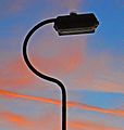 Streetlight at sunset (2463635407).jpg 1,833 × 1,926; 3.62 MB
-
 Sunset (2315726378).jpg 2,560 × 1,712; 2.8 MB
-
 Syke Lane, Queensbury (5464672147).jpg 1,920 × 2,560; 1.96 MB
-
 Symmetry (2257746957).jpg 2,560 × 1,920; 3.18 MB
-
 Tall stone at junction of paths, Queensbury - geograph.org.uk - 4937438.jpg 2,048 × 1,536; 1.33 MB
-
 Telecomms mast at Royd Hill - geograph.org.uk - 3950017.jpg 1,600 × 1,200; 392 KB
-
 The circus comes to Queensbury (7403597054).jpg 2,671 × 3,339; 4.61 MB
-
 The circus comes to Queensbury (7403599438).jpg 2,470 × 1,764; 2.31 MB
-
 The grass is greener ... (7172057338).jpg 3,114 × 2,491; 5.52 MB
-
 The Joys of Queensbury in Bygone Days (8204691847).jpg 3,327 × 2,137; 6.31 MB
-
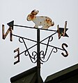 The North wind doth blow, and the bunny gets rusty (7139623723).jpg 2,129 × 2,286; 2.41 MB
-
 Top of the path up from the footbridge over Shibden Brook - geograph.org.uk - 4937296.jpg 2,048 × 1,536; 1.42 MB
-
 Tunnel 1 (1655291448).jpg 2,592 × 3,872; 3.58 MB
-
 Tunnel 2 (1654394691).jpg 2,592 × 3,872; 2.42 MB
-
 Up the Lane (7172201210).jpg 3,108 × 3,100; 5.17 MB
-
 View from Low Lane, without horse (4710082946).jpg 2,560 × 1,707; 4.42 MB
-
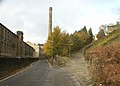
 Wall near the Black Dyke Mill - geograph.org.uk - 5321729.jpg 5,184 × 3,456; 4.95 MB
-
 Watch out for Horses (23817740874).jpg 3,589 × 2,406; 6.93 MB
-
 Way Out (26805416076).jpg 2,375 × 3,707; 8.08 MB
-
 Waymark on Queensbury Bridleway 35 - geograph.org.uk - 5278436.jpg 2,048 × 1,536; 1.03 MB
-
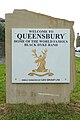 Welcome (5733835065).jpg 2,347 × 3,520; 5.02 MB
-
 Weston Avenue - Fleet Lane - geograph.org.uk - 1093261.jpg 640 × 430; 211 KB
-
 Weston Avenue - Fleet Lane - geograph.org.uk - 1496589.jpg 640 × 480; 248 KB
-
 Weston Vale Road - Weston Avenue - geograph.org.uk - 1093271.jpg 640 × 440; 189 KB
-
 White horse on a steep slope (4961313538).jpg 2,609 × 2,609; 5.69 MB
-
 Wibble.jpg 2,194 × 2,861; 3.45 MB
-
 Winter (3251670548).jpg 1,915 × 2,287; 3.67 MB
-
 Winter Extras (8124511714).jpg 1,830 × 2,745; 4.35 MB
-
 Winter trees (16320267465).jpg 1,920 × 2,560; 4.43 MB
-
 Wizard Wood Works (7537658856).jpg 2,333 × 2,068; 2.71 MB
-
 Yard behind the High Street, Queensbury (14926207821).jpg 2,788 × 2,788; 5.36 MB
-
 Yews Green (24441152226).jpg 2,517 × 2,517; 5.77 MB
-
 Z (1810073328).jpg 2,492 × 1,716; 1.84 MB
-

-
 Donkey Hill - geograph.org.uk - 352153.jpg 640 × 460; 71 KB
-
 Shetland pony a long way from home^ - geograph.org.uk - 614641.jpg 640 × 505; 44 KB
-
 Transmitter, Royd Hill - geograph.org.uk - 39455.jpg 427 × 640; 58 KB
.jpg)

.jpg)
.jpg)
.jpg)
.jpg)

.jpg)


.jpg)
.jpg)

.jpg)

.jpg)
.jpg)
.jpg)
.jpg)
.jpg)

.jpg)
.jpg)
.jpg)
.jpg)


.jpg)
.jpg)
.jpg)


.jpg)
.jpg)
.jpg)


.jpg)
.jpg)
.jpg)

.jpg)
.jpg)
.jpg)
.jpg)
.jpg)
.jpg)
.jpg)
.jpg)
.jpg)
.jpg)
.jpg)
.jpg)


.jpg)
.jpg)
.jpg)
.jpg)
.jpg)
.jpg)
.jpg)
.jpg)
.jpg)
.jpg)
.jpg)
.jpg)


.jpg)
.jpg)
.jpg)
.jpg)
.jpg)
.jpg)
.jpg)
.jpg)

.jpg)

.jpg)
.jpg)
.jpg)

.jpg)
.jpg)

.jpg)
.jpg)
.jpg)
.jpg)
.jpg)


.jpg)


_(9159644213).jpg)
,_Queensbury_(7638589798).jpg)
.jpg)
.jpg)

.jpg)


.jpg)
.jpg)
.jpg)
.jpg)
.jpg)


.jpg)


.jpg)

.jpg)

.jpg)
.jpg)
.jpg)
.jpg)
.jpg)


.jpg)
.jpg)
.jpg)
.jpg)
.jpg)

.jpg)
.jpg)
.jpg)
.jpg)

.jpg)
.jpg)

.jpg)


.jpg)

.jpg)
.jpg)
.jpg)
.jpg)
.jpg)
.jpg)
.jpg)


.jpg)