Category:RAF Syerston
| Object location | | View all coordinates using: OpenStreetMap |
|---|
Royal Air Force training station in Nottinghamshire, England  | |||||
| Upload media | |||||
| Instance of |
| ||||
|---|---|---|---|---|---|
| Location | Flintham, Rushcliffe, Nottinghamshire, East Midlands, England | ||||
| Owned by | |||||
| Operator | |||||
| ICAO airport code |
| ||||
| official website | |||||
 | |||||
Subcategories
This category has the following 2 subcategories, out of 2 total.
A
Media in category "RAF Syerston"
The following 10 files are in this category, out of 10 total.
-
 A step into fresh air - geograph.org.uk - 1612884.jpg 640 × 484; 118 KB
-
 Demolition at RAF Syerston - geograph.org.uk - 1612889.jpg 640 × 479; 84 KB
-
 Former RAF Syerston - geograph.org.uk - 414232.jpg 640 × 427; 70 KB
-
 Former RAF Syerston buildings - geograph.org.uk - 414208.jpg 640 × 427; 71 KB
-
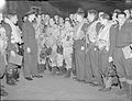 Royal Air Force Bomber Command, 1942-1945. CH7127.jpg 800 × 612; 72 KB
-
 Syerston Airfield - geograph.org.uk - 102249.jpg 640 × 480; 98 KB
-
 Syerston parkland - geograph.org.uk - 414256.jpg 640 × 427; 76 KB
-
 SyerstonTower-203.jpg 2,816 × 2,112; 1.33 MB
-
 The entrance to RAF Syerston - geograph.org.uk - 1612888.jpg 640 × 479; 78 KB
-
 Disused school - geograph.org.uk - 414221.jpg 640 × 427; 84 KB


