Category:RAF Weston-super-Mare
| Object location | | View all coordinates using: OpenStreetMap |
|---|
defunct British airfield  | |||||
| Upload media | |||||
| Instance of |
| ||||
|---|---|---|---|---|---|
| Location |
| ||||
| Operator | |||||
| Inception |
| ||||
| Dissolved, abolished or demolished date |
| ||||
 | |||||
Subcategories
This category has only the following subcategory.
H
Media in category "RAF Weston-super-Mare"
The following 11 files are in this category, out of 11 total.
-
 RAF Weston-super-Mare aerial photograph WWII IWM MH 26560.jpg 800 × 607; 76 KB
-
 Control Tower Weston Airfield.jpg 640 × 480; 79 KB
-
 Entrance at Weston airport - geograph.org.uk - 1371889.jpg 640 × 427; 42 KB
-
 Flowerdown Bridge Plaque.jpg 3,197 × 1,800; 2.17 MB
-
 Old aircraft hangar - geograph.org.uk - 1718156.jpg 1,600 × 1,200; 347 KB
-
 Royal Air Force Airbus A400M ZM400 in flight over west of England (45158518).jpg 3,000 × 2,082; 829 KB
-
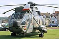 Seaking - Weston Super Mare 2007 (2409904330).jpg 1,024 × 683; 199 KB
-
 Seaking - Weston Super Mare 2007 (2409905088).jpg 1,024 × 683; 249 KB
-
 Site of the old Weston Airport - geograph.org.uk - 1371928.jpg 640 × 427; 75 KB
-
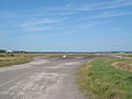 The main runway at Weston Airport.jpg 640 × 480; 63 KB
-
 UH1 Huey - Weston Super Mare 2007 (2409872160).jpg 1,024 × 683; 211 KB


.jpg)
.jpg)
.jpg)

.jpg)