Category:Raadhuis Etten-Leur
| Object location | | View all coordinates using: OpenStreetMap |
|---|
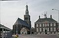
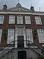
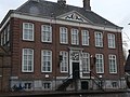
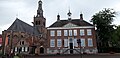
Nederlands: Afbeeldingen van het oude Raadhuis, Markt 1, 4875 CB in Etten-Leur in de provincie Noord-Brabant in het zuiden van Nederland. Nabij de Catharinakerk
|
This is a category about rijksmonument number 15388
|
 | |||||
| Upload media | |||||
| Instance of | |||||
|---|---|---|---|---|---|
| Location | Etten-Leur, North Brabant, Netherlands | ||||
| Street address |
| ||||
| Located on street | |||||
| Heritage designation |
| ||||
 | |||||
Media in category "Raadhuis Etten-Leur"
The following 25 files are in this category, out of 25 total.
-
 Detail P1490889.jpg 4,000 × 2,672; 5.63 MB
-
 En omstreken, reproductie D.Th.Verryck - Etten - 20072504 - RCE.jpg 1,200 × 955; 270 KB
-
 Etten-leur 005.jpg 1,600 × 1,200; 903 KB
-
 Etten-leur 006.jpg 1,600 × 1,200; 690 KB
-
 Etten-Leur Stadhuis.jpg 2,048 × 1,536; 1.26 MB
-
-

-
 Markt 1, Etten-Leur.jpg 4,000 × 3,000; 3.78 MB
-
 Markt, Etten-Leur P1490899.jpg 4,000 × 2,672; 5.87 MB
-
 Markt, Etten-Leur P1490907.jpg 4,000 × 2,672; 5.19 MB
-
 Oude Raadhuis Etten-Leur P1490887.jpg 4,000 × 2,672; 5.76 MB
-
 Oude Raadhuis Etten-Leur P1490888.jpg 2,672 × 4,000; 5.88 MB
-
 Oude Raadhuis Etten-Leur P1490905.jpg 4,000 × 2,672; 5.94 MB
-

-
 Overzicht met Raadhuis en Hervormde kerk - Etten - 20110372 - RCE.jpg 1,200 × 960; 234 KB
-

-

-
 Overzicht naar het westen met kerkgebouw - Etten-Leur - 20396961 - RCE.jpg 1,200 × 798; 154 KB
-
 P1030479Raadhuis Etten-Leur.JPG 2,448 × 3,264; 3.69 MB
-
 P1030480Detaille voorgevel Raadhuis.JPG 3,264 × 2,448; 3.72 MB
-
 P1040744Gemeentehuis Etten-Leur.JPG 3,264 × 2,448; 3.72 MB
-
 Raadhuis Etten-Leur P1490956.jpg 4,000 × 2,672; 6.01 MB
-
 Raadhuisplein, Etten-Leur P1490911.jpg 4,000 × 2,672; 5.69 MB
-

-
 Vincent van Gogh Monuments.jpg 4,608 × 2,240; 4.91 MB


,_OVERZICHT_ZUIDOOST_ZIJDE_(NEDERLANDS_HERVORMDE_KERK)_-_Etten-Leur_-_20262136_-_RCE.jpg)


